You are using an out of date browser. It may not display this or other websites correctly.
You should upgrade or use an alternative browser.
You should upgrade or use an alternative browser.
Sussing Sudan
- Thread starter JohnM
- Start date
- Status
- Not open for further replies.
juddles
Suspended
- Joined
- Aug 2, 2011
- Posts
- 5,283
- Qantas
- Platinum 1
JohnM
Enthusiast
- Joined
- Jun 7, 2006
- Posts
- 11,828
- Qantas
- LT Gold
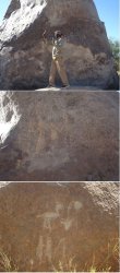
Beats me - but it does look like a gloriously wind and sand blasted patina on ferricrete and truly fab-o petroglyphs. Who/when?
I knew I wouldn't like this trip if i went on it.
I can't recall that there was any specific explanation for the origin of the petroglyphs. They were only about 4-5 kms from the old fort, so I'm guessing there was a fairly extensive settlement in the area and that they were done then.
JohnM
Enthusiast
- Joined
- Jun 7, 2006
- Posts
- 11,828
- Qantas
- LT Gold
The bogging exercises were generally quite easily overcome. Mud would be far worse.
Onto wrapping up Day 3.
And we press on, going for a burn in the process - getting up to about 90kph.
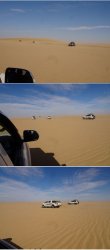
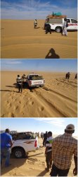
Until the Formation Bogging Team puts on another rousing performance.
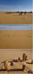
Then a petrified ‘forest’ – in reality, pieces of scattered petrified wood that had pretty obviously mostly been placed upright. Nevertheless, indicative of ancient substantial plant life in the area.
And on to camp. Some cloud in the sky this day enhanced sunset.
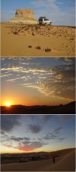
Onto wrapping up Day 3.
And we press on, going for a burn in the process - getting up to about 90kph.

Until the Formation Bogging Team puts on another rousing performance.

Then a petrified ‘forest’ – in reality, pieces of scattered petrified wood that had pretty obviously mostly been placed upright. Nevertheless, indicative of ancient substantial plant life in the area.

And on to camp. Some cloud in the sky this day enhanced sunset.

JohnM
Enthusiast
- Joined
- Jun 7, 2006
- Posts
- 11,828
- Qantas
- LT Gold
Day 4.
Today it was out of the desert to Dongola to re-provision before returning to the desert to camp for the night.
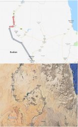
The day 3 camp site was near the biggest dunes we encountered and our post-breakfast walk took in some.
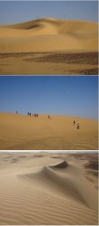
Our millennial took on the leader in a race down, and back up. Some sandboards, or large cardboard cartons would have been fun!
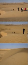
And in comes the shuttle service.
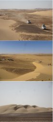
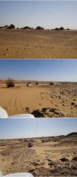
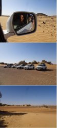
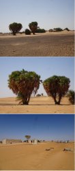
Heading E towards the Nile and encountering some ‘islands’ of well-established vegetation. Sand dunes diminishing and rockier terrain.
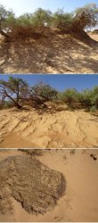
Matted roots bind the sand.
And then the ‘Door to the desert’ oasis. Apparently there is one person, an experienced desert tracker, who still occasionally stays here. Otherwise it was abandoned.
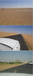
Pebble surface and then onto the bitumen for the run into Dongola
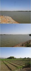
Lunch on the bank of the Nile, while the drivers fuelled and re-provisioned and then it was back into the desert to camp for the night, arriving just on sunset.
Today it was out of the desert to Dongola to re-provision before returning to the desert to camp for the night.

The day 3 camp site was near the biggest dunes we encountered and our post-breakfast walk took in some.

Our millennial took on the leader in a race down, and back up. Some sandboards, or large cardboard cartons would have been fun!

And in comes the shuttle service.

Heading E towards the Nile and encountering some ‘islands’ of well-established vegetation. Sand dunes diminishing and rockier terrain.


Matted roots bind the sand.

And then the ‘Door to the desert’ oasis. Apparently there is one person, an experienced desert tracker, who still occasionally stays here. Otherwise it was abandoned.

Pebble surface and then onto the bitumen for the run into Dongola

Lunch on the bank of the Nile, while the drivers fuelled and re-provisioned and then it was back into the desert to camp for the night, arriving just on sunset.

RooFlyer
Veteran Member
- Joined
- Nov 12, 2012
- Posts
- 31,569
- Qantas
- Platinum
- Virgin
- Platinum
- Star Alliance
- Gold
Pebble surface and then onto the bitumen for the run into Dongola
We call them 'lags' here in Oz and we sample them as very broad scale geochemical sensors. Must check out the mineral potential of the place before I go
Side story, hope you don't mind JM. I went to Egypt in the 1990s for work, seeing if the company should invest there. We were taken out into the desert south of Luxor, and saw that the gold-workings in the ridges were untouched since the day Nasser nationalised the mining industry in the 1950s! < Our eyes: $$$$$
JohnM
Enthusiast
- Joined
- Jun 7, 2006
- Posts
- 11,828
- Qantas
- LT Gold
Day 5.
A little further N to visit the first major historical site, then a back-track S on the sealed road until heading E to cross the Nile and get more into the historical aspects of the trip that predominate on the E side – and will dominate the rest of this TR.
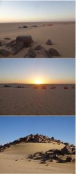
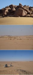
Firstly, though, camp amongst the rocks NW of Dongola at dawn and the chauffer drive coming to collect us after our morning stroll into the desert.
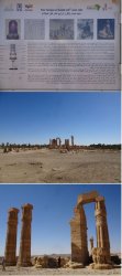
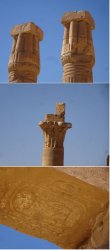
Then to the pharaonic Temple of Soleb on the Nile floodplain. The first of a few historical scraps to come…
Those who have been to Egypt will recognise a few familiar characters.
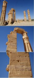
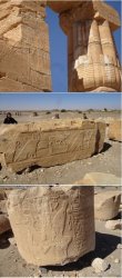
The closed, and open lotus, depending on how deep you are into the sanctums of the temple. Cartouche on the underside of the lintel.
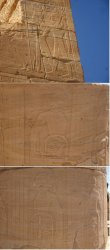
Notice the African features of the woman in the second pic of bracket 2.
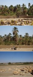
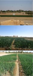
The surrounding area. The temple is only a few hundred metres from the Nile. The crop is onions. To maximise the efficiency of the flood irrigation, the filed is divided into gridded ‘cells’. Rather than flood the whole field from end to end (and end up with waterlogging at one end and insufficient water at the other), the cell arrangement allows successive flooding/blanking off down the chain. I managed to convey to the friendly farmer my opinion that he had a very good onion crop.
A little further N to visit the first major historical site, then a back-track S on the sealed road until heading E to cross the Nile and get more into the historical aspects of the trip that predominate on the E side – and will dominate the rest of this TR.

Firstly, though, camp amongst the rocks NW of Dongola at dawn and the chauffer drive coming to collect us after our morning stroll into the desert.


Then to the pharaonic Temple of Soleb on the Nile floodplain. The first of a few historical scraps to come…
Those who have been to Egypt will recognise a few familiar characters.


The closed, and open lotus, depending on how deep you are into the sanctums of the temple. Cartouche on the underside of the lintel.
Notice the African features of the woman in the second pic of bracket 2.


The surrounding area. The temple is only a few hundred metres from the Nile. The crop is onions. To maximise the efficiency of the flood irrigation, the filed is divided into gridded ‘cells’. Rather than flood the whole field from end to end (and end up with waterlogging at one end and insufficient water at the other), the cell arrangement allows successive flooding/blanking off down the chain. I managed to convey to the friendly farmer my opinion that he had a very good onion crop.


JohnM
Enthusiast
- Joined
- Jun 7, 2006
- Posts
- 11,828
- Qantas
- LT Gold
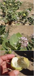
Apple of Sodom (Calotropus procera) (a Solanaceae, so related to potato, tomato) is common near the Nile in Sudan and native to the region. It’s a noxious weed in inland Australia. Also known as milkweed.
We then spent some time and had lunch in the nearby Nubian village.
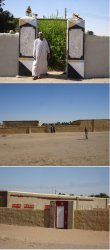
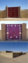
Typically, Sudanese houses are within a walled compound with usually very elaborate and colourful gates.
Being welcomed into a home and the view directly across the street. The Nile alligator skulls on the pillars are to ward off evil.
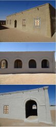
Traditional storage vessels. The Sudanese seem to prefer a dried form of date. Some construction going on.
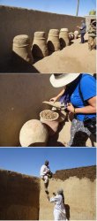
Throughout Sudan it is common to see earthenware (unglazed, to act as what we in WA call a ‘Coolgardie safe’ for evaporative cooling) water containers in racks on the street. These are community drinking water sources. If in front of a house or business, the owner or proprietor is responsible for keeping them filled. The provide free drinking water to passers-by.
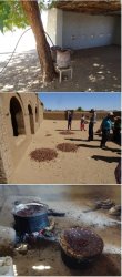
Drying dates and stewing them to make a brew that just may have a touch of alcohol by the time they had finished with it.

We then spent some time and had lunch in the nearby Nubian village.
Typically, Sudanese houses are within a walled compound with usually very elaborate and colourful gates.
Being welcomed into a home and the view directly across the street. The Nile alligator skulls on the pillars are to ward off evil.


Traditional storage vessels. The Sudanese seem to prefer a dried form of date. Some construction going on.


Throughout Sudan it is common to see earthenware (unglazed, to act as what we in WA call a ‘Coolgardie safe’ for evaporative cooling) water containers in racks on the street. These are community drinking water sources. If in front of a house or business, the owner or proprietor is responsible for keeping them filled. The provide free drinking water to passers-by.
Drying dates and stewing them to make a brew that just may have a touch of alcohol by the time they had finished with it.

JohnM
Enthusiast
- Joined
- Jun 7, 2006
- Posts
- 11,828
- Qantas
- LT Gold
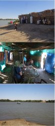
Leaving the Nubian village and the friendly residents behind, we headed for our Nile crossing point.
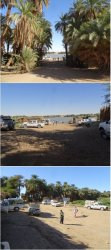
The F lounge. Note the water ‘bar’ at centre right rear. Ferry coming.
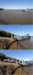
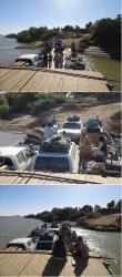
Loading us and an on-time takeoff.
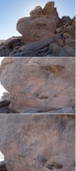
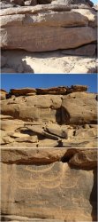
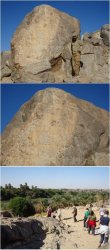
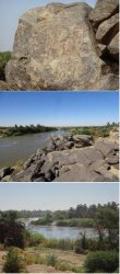
Then a visit to a nearby petroglyph site. Dated to c. 3500 y BCE IIRC.

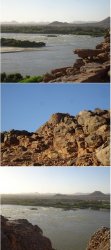
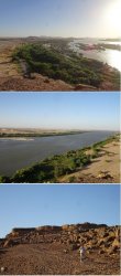
Then the Third Cataract (rapids) on the Nile and an Ottoman fort, also close by our river crossing point.
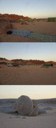
That night we had a fixed camp nearby set amongst picturesque rocks.

The F lounge. Note the water ‘bar’ at centre right rear. Ferry coming.


Loading us and an on-time takeoff.

Then a visit to a nearby petroglyph site. Dated to c. 3500 y BCE IIRC.


Then the Third Cataract (rapids) on the Nile and an Ottoman fort, also close by our river crossing point.


That night we had a fixed camp nearby set amongst picturesque rocks.

RooFlyer
Veteran Member
- Joined
- Nov 12, 2012
- Posts
- 31,569
- Qantas
- Platinum
- Virgin
- Platinum
- Star Alliance
- Gold
Phwoar! Have you read the relevant Wilbur Smith books?
Edit: What were the toilet facilities: fixed long drops at camps or take-a-shovel-behind-a-dune?
Washing: bucket of water? Ablution tent? Or a happy but mutually odoriferous crew?
Important considerations for those of delicate constitutions who are being tempted to reconsider their reluctance to go on this tour!!
Last edited:
Read our AFF credit card guides and start earning more points now.
AFF Supporters can remove this and all advertisements
JohnM
Enthusiast
- Joined
- Jun 7, 2006
- Posts
- 11,828
- Qantas
- LT Gold
Phwoar! Have you read the relevant Wilbur Smith books?
Edit: What were the toilet facilities: fixed long drops at camps or take-a-shovel-behind-a-dune?
Washing: bucket of water? Ablution tent? Or a happy but mutually odoriferous crew?
Important considerations for those of delicate constitutions who are being tempted to reconsider their reluctance to go on this tour!!
Wild camping was find a rock or sand dune for toilet. Washing was a bowl of water. It was not very hot, the heat was very dry and the levels of exertion not very high, so it was pretty easy to stay clean and not malodorous.
The fixed camp had camp showers and drop toilets.
To come is the Nubian Rest House, which was sensational and another permanent-tented type of place with ablution blocks (flushing toilets and normal showers).
It really wasn't bad at all.
juddles
Suspended
- Joined
- Aug 2, 2011
- Posts
- 5,283
- Qantas
- Platinum 1
... fixed long drops.... or take-a-shovel-behind-a-dune?...
is that the sedimentary versus metamorphic thing?
JohnM
Enthusiast
- Joined
- Jun 7, 2006
- Posts
- 11,828
- Qantas
- LT Gold
Day 6.
A wander around the fixed camp after breakfast as the crew packed the vehicles.
Interesting large boulders, some of which had split cleanly in two.
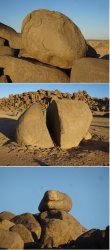
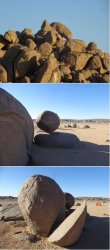
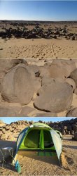
Then it was a slight retrace of steps back to the Nile near the Third Cataract and ancient granite quarries and archaeological sites near the village of Tombos. (I should mention that the petroglyph site visited the previous afternoon was Sabu, for anyone keen to follow along on Wikipedia or similar). A 3000 year old statue of King Taharqa lies in the quarry where it was carved. The face is broken and the guess is that it broke in late construction and the statue was abandoned.
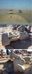
Evidence remains of the techniques used to cleave the granite.
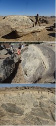
A wander around the fixed camp after breakfast as the crew packed the vehicles.
Interesting large boulders, some of which had split cleanly in two.


Then it was a slight retrace of steps back to the Nile near the Third Cataract and ancient granite quarries and archaeological sites near the village of Tombos. (I should mention that the petroglyph site visited the previous afternoon was Sabu, for anyone keen to follow along on Wikipedia or similar). A 3000 year old statue of King Taharqa lies in the quarry where it was carved. The face is broken and the guess is that it broke in late construction and the statue was abandoned.

Evidence remains of the techniques used to cleave the granite.

JohnM
Enthusiast
- Joined
- Jun 7, 2006
- Posts
- 11,828
- Qantas
- LT Gold
The village abuts the quarry. Nearby, walking closer to the Nile, there is a rich array of archaeological sites scattered about.
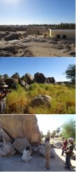
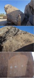
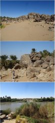
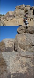
Closer to the river, the petroglyphs represented a sort of border or customs stop where boats had to discharge and portage cargo to the next section (although this was not one of the six main cataracts downstream of Khartoum).
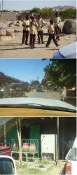
Nearby school mid-morning recess as we returned to the vehicles for a re-provisioning detour to a nearby larger town before heading E for a long drive into the desert towards the late 19th C British-constructed railway from Wadi Halfa on the Egyptian border to Khartoum.
Schooling is compulsory and the teaching of English is common. It was Sunday, the first day of the new week, and town was busy. More clay-pot water coolers (called zeer).
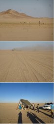
And E we go. Part of a large herd of camels in a pan that had a good growth of plants over an extensive area. Very dusty soil in this area. And then first evidence of gold mining that widely occurs in this area.
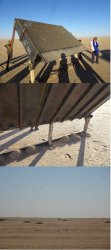
This sieve device was set up well away from the active mining area. There were shallow front-end loader scoop marks scattered about and evidence that material had been passed across the sieve. The base of the bin had channels with shutters at the bottom. I figured it may have been a sampling method. Looking to @RooFlyer to explain.


Closer to the river, the petroglyphs represented a sort of border or customs stop where boats had to discharge and portage cargo to the next section (although this was not one of the six main cataracts downstream of Khartoum).


Nearby school mid-morning recess as we returned to the vehicles for a re-provisioning detour to a nearby larger town before heading E for a long drive into the desert towards the late 19th C British-constructed railway from Wadi Halfa on the Egyptian border to Khartoum.
Schooling is compulsory and the teaching of English is common. It was Sunday, the first day of the new week, and town was busy. More clay-pot water coolers (called zeer).

And E we go. Part of a large herd of camels in a pan that had a good growth of plants over an extensive area. Very dusty soil in this area. And then first evidence of gold mining that widely occurs in this area.

This sieve device was set up well away from the active mining area. There were shallow front-end loader scoop marks scattered about and evidence that material had been passed across the sieve. The base of the bin had channels with shutters at the bottom. I figured it may have been a sampling method. Looking to @RooFlyer to explain.

JohnM
Enthusiast
- Joined
- Jun 7, 2006
- Posts
- 11,828
- Qantas
- LT Gold
Shortly after, we drove alongside a lengthy active mining area. Travelling at speed, bumping about and not getting very close made it hard to capture what was going on. It appeared to me that there was a series of contiguous mining spots where front-end loaders were passing soil over the same or similar sieve devices. A lot of dust suggested dry-blowing was the separation method. There was no indication of large processing plants.
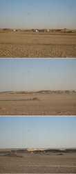
Followed by a fairly late arrival to our camping spot for that night.

Followed by a fairly late arrival to our camping spot for that night.
RooFlyer
Veteran Member
- Joined
- Nov 12, 2012
- Posts
- 31,569
- Qantas
- Platinum
- Virgin
- Platinum
- Star Alliance
- Gold
Hmmmmm and hmmmmm.
i don't know how that box thing works other than it looks pretty much like a standard 'grizzly' used as a coarse/fine size discriminator for gravels.
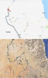
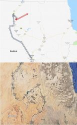
As for gold. Did you see anything like a sign/company name that said 'gold mining' ? Or was it just per the tour guides who may have just assumed it? All the rocks in your pics are granite and whilst its not unknown, gold in granite is very rare. The map below indicates that you were not in a gold mining area, compared to your daily map. The heaps of spoil indicates that the workings are not very deep.
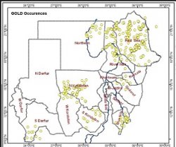
My conclusion - probably gravel pits, although what they are doing out there, goodness knows!
Of course, a good geo covers his backside; it could be an old alluvial gold deposit in which case your thoughts about dry-blowing would be spot on. The sieve thing would be to get rid of the boulders allowing the gold-containing fines to be separated out and trucked to a water source for processing.
i don't know how that box thing works other than it looks pretty much like a standard 'grizzly' used as a coarse/fine size discriminator for gravels.
As for gold. Did you see anything like a sign/company name that said 'gold mining' ? Or was it just per the tour guides who may have just assumed it? All the rocks in your pics are granite and whilst its not unknown, gold in granite is very rare. The map below indicates that you were not in a gold mining area, compared to your daily map. The heaps of spoil indicates that the workings are not very deep.

My conclusion - probably gravel pits, although what they are doing out there, goodness knows!
Of course, a good geo covers his backside; it could be an old alluvial gold deposit in which case your thoughts about dry-blowing would be spot on. The sieve thing would be to get rid of the boulders allowing the gold-containing fines to be separated out and trucked to a water source for processing.
JohnM
Enthusiast
- Joined
- Jun 7, 2006
- Posts
- 11,828
- Qantas
- LT Gold
We were told that it was gold mining and I took that at face value. Our leader was very experienced with many years of travelling throughout Sudan leading all sorts of people - NGO's, aid organisations, journalists, tourists. He didn't mention mineral exploration that I can recall but I'd have faith that his account is accurate. There was a great amount of the shallow extensive scooping going on scattered throughout the area - both systematically digging a whole area and as many scattered scoops seemingly radiating either side of the long line of intensive workings, as though to indicate sampling to define deposit extent.
It seems unlikely to be gravel pits as they were very numerous along quite a few kms of that shallow valley. And similar activities were observed further east the next day. Besides, there's nothing out there to truck gravel to (eg. road building is non-existent). It's a very remote and underpopulated area. Also, strangely, there seemed no evidence of systematic mass trucking of anything out of the area.
And I was relying on you to have the instant answer because it was quite bizarre to me at the time and now remains a gnawing puzzle .
.
It seems unlikely to be gravel pits as they were very numerous along quite a few kms of that shallow valley. And similar activities were observed further east the next day. Besides, there's nothing out there to truck gravel to (eg. road building is non-existent). It's a very remote and underpopulated area. Also, strangely, there seemed no evidence of systematic mass trucking of anything out of the area.
And I was relying on you to have the instant answer because it was quite bizarre to me at the time and now remains a gnawing puzzle
- Status
- Not open for further replies.
Become an AFF member!
Join Australian Frequent Flyer (AFF) for free and unlock insider tips, exclusive deals, and global meetups with 65,000+ frequent flyers.AFF members can also access our Frequent Flyer Training courses, and upgrade to Fast-track your way to expert traveller status and unlock even more exclusive discounts!

AFF forum abbreviations
Wondering about Y, J or any of the other abbreviations used on our forum?Check out our guide to common AFF acronyms & abbreviations.
Currently Active Users
- JimmyJ
- ox power
- acha
- jase05
- adsta
- Aeryn
- CMA222
- tassiemark
- Bill Bosworth
- kookaburra75
- butters_1313
- TEM321
- LiamR
- Hawk529
- Pete98765432
- hachoo
- StayGoldPonyboy
- http_x92
- Harrison_133
- Daver6
- Willpanzer
- Solid
- esquire
- doctorstrangelove
- leesionn
- larry40
- DejaBrew
- Aussie_flyer
- Vekor
- aus_flyer
- jc123
- bluecoconut
- Viridis
- SydneySwan
- cjd600
- fletty
- tgh
- MooTime
- vbap
- Lat34
- drron
- Jungking
- MH_fan
- dairyfloss
- redbigot
- lychees
- TheMoose
- Mutilla2
- _TheTraveller_
- donkeykong
Total: 1,938 (members: 66, guests: 1,872)


