Brushing Broome to points further N

JohnM

Enthusiast
Joined
Jun 7, 2006
Posts
11,089
Qantas
LT Gold
It’s getting a bit cold in the SW, so I had started itching for a trip N. My Initial plan was to head to Cape Leveque, north of Broome, as I had not been up that cape before and I hear good things.

Coinciding with the general time I was considering going, my elder son wanted to scope a business opportunity at Kununurra, so Kununurra went into my plans. He’ll fly into KNX from PER for a couple of days and fly back out. I’ll join him and his consultant as a bit of a sounding board.

So, I’m hitting the road tomorrow morning and will aim to be back home by about Thursday 8 July. I have Covid-vax #2 on Monday 12 July.

Here’s the general likely route and a few of the potential stops. It’s flexible except for the need to be in Kununurra by 27 June until 1 July.
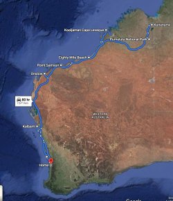
Kununurra.JPG

There has been quite a lot of publicity that Kalbarri is open for business after being smashed by Cyclone Seroja in April. People are being encouraged to visit and help get the town back on its feet, so I’ll make there the first night’s stop.

I’ll see how I’m going as to whether I’ll go into Purnululu (the Bungle Bungle Range – aka The Bungles). I’ve been there briefly before and flown over in a light aircraft and a helo, so it’s not a must-do. The two campgrounds within the park are likely to be full and off-the-grid camping will be a no-go in the park, I’m sure. I’ll play it by ear.

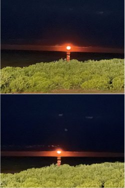
Fortuitously, The Staircase to the Moon is on at Broome next weekend. It’s at about 1900h on Saturday, so I’ll target that as I have not seen it before. You can brush up on it here: Staircase to the Moon Dates.

There will be little or no posting along the way; I’ll complete the TR on return.
 
OK, I’m back in cold, wet PER after an 8k+ km drive through warmth and dryness. Better get this TR done before I shoot through back N in a week and a bit.

I drove through Kalbarri on the first day. There is still a lot of cyclone damage evident, but the town has worked hard to get back into operation for the major winter business season. I’m not into taking pics of others’ misfortune, but it was clear that TC Seroja hit right at the centre of town.
I was pleased to see that the B&B S of town where PJM and I stayed last year (A Kalbarri kaleidoscope) was intact. I held fears for them as they were very exposed high on a hill and facing NW. It appeared they had sustained some minor damage to sheds and garage.

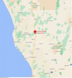
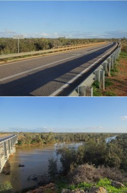
First night out was spent camped at Galena Bridge at the Murchison River. WA Main Roads provides good 24h stop sites at plenty of places along NW Coastal Highway.

Snip 1.JPGSnip 2.JPG

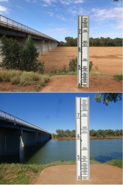
Next day’s lunch stop at the Gascoyne River crossing just north of Carnarvon was one day shy of a year since a lunch stop on my way to Exmouth and Coral Bay last year (Escape to the Coral Coast).

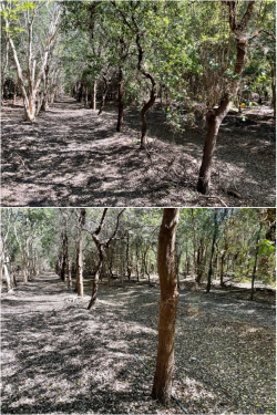
Very good rains this year in the Gascoyne. Pics from 23 June 2020 and 22 June 2021.

Although the dry riverbed is deceptive; there is a very substantial shallow aquifer under it that drives intensive agriculture around Carnarvon. It’s a major winter-producing area for vegetables, much as similar-latitude Bundaberg is on the E coast.

Snip 3.JPG

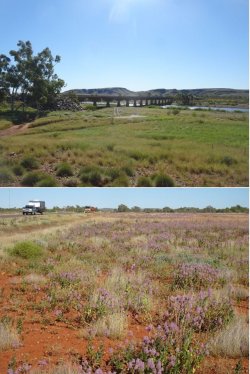
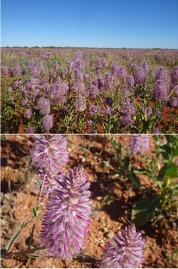
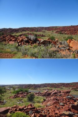
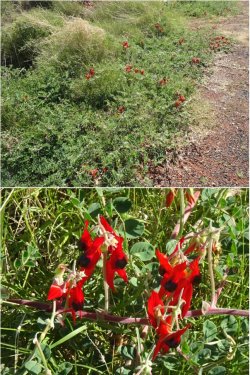
Getting into the Pilbara and the Fortescue River crossing. Good displays of mulla mulla, and at peak bloom.

Snip 4.JPGSnip 5.JPG

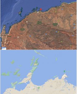
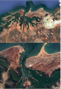
Next stop for two nights was Point Samson, E of Karratha, and really getting into the mind-boggling action of the Pilbara for iron ore and natural gas. The Google Maps image almost seems to show the iron ore mass.

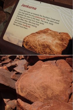
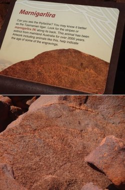
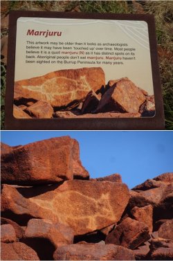
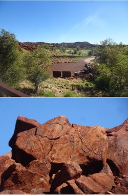
Cape Lambert is a Rio iron ore loading port, as is Dampier, and the Burrup Peninsula is home to the major Woodside LNG facility, while being famous for extensive rock art.

Snip 6.JPG

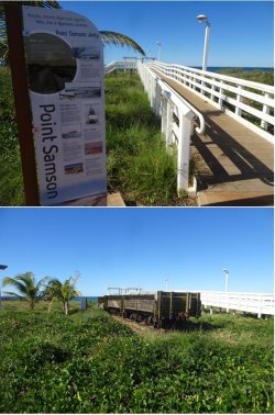
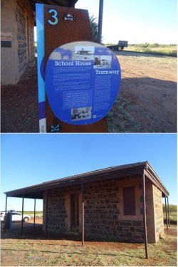
Point Samson township is a small, mainly recreational and historical, spot.

Snip 7.JPG

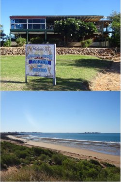
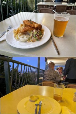
The Samson Beach tavern is a bit of an institution. PJM lived in Karratha about 30 years ago and tells me that it was the place to take the kids for fish & chips of a weekend. They still do very good pub meals and the beer is spot-on.

Snip 8.JPGSnip 9.JPGSnip 10.JPG
 
Your B&B was safe because it was to the south of the landfall.Due to the circulation of winds around the eye in WA maximum damage will be to the north of the landfall.In QLD the maximum damage will be to the south of the landfall.
A little bit of Trivia.
 
Next day was exploring around the area.

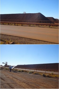
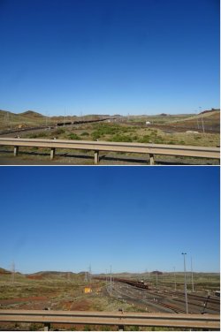
First, Wickam, the town established in 1970 by the Robe River (now Rio) mining operation (some may remember the vicious Robe industrial dispute of the mid-1980s that ended up having far-reaching consequences.)

Snip 11.JPGSnip 12.JPGSnip 13.JPGSnip 14.JPG

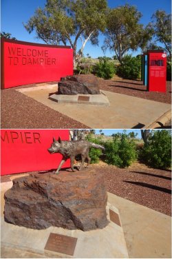
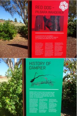
Entry point to Dampier and a famous local.

Snip 15.JPGSnip 16.JPG
 
The Frequent Flyer Concierge team takes the hard work out of finding reward seat availability. Using their expert knowledge and specialised tools, they'll help you book a great trip that maximises the value for your points.

AFF Supporters can remove this and all advertisements

OK, I’m back in cold, wet PER after an 8k+ km drive through warmth and dryness. Better get this TR done before I shoot through back N in a week and a bit.

I drove through Kalbarri on the first day. There is still a lot of cyclone damage evident, but the town has worked hard to get back into operation for the major winter business season. I’m not into taking pics of others’ misfortune, but it was clear that TC Seroja hit right at the centre of town.

I was pleased to see that the B&B S of town where PJM and I stayed last year (A Kalbarri kaleidoscope) was intact. I held fears for them as they were very exposed high on a hill and facing NW. It appeared they had sustained some minor damage to sheds and garage.

First night out was spent camped at Galena Bridge at the Murchison River. WA Main Roads provides good 24h stop sites at plenty of places along NW Coastal Highway.

View attachment 252432View attachment 252433

Next day’s lunch stop at the Gascoyne River crossing just north of Carnarvon was one day shy of a year since a lunch stop on my way to Exmouth and Coral Bay last year (Escape to the Coral Coast).

Very good rains this year in the Gascoyne. Pics from 23 June 2020 and 22 June 2021.

Although the dry riverbed is deceptive; there is a very substantial shallow aquifer under it that drives intensive agriculture around Carnarvon. It’s a major winter-producing area for vegetables, much as similar-latitude Bundaberg is on the E coast.

View attachment 252434

Getting into the Pilbara and the Fortescue River crossing. Good displays of mulla mulla, and at peak bloom.

View attachment 252435View attachment 252436

Next stop for two nights was Point Samson, E of Karratha, and really getting into the mind-boggling action of the Pilbara for iron ore and natural gas. The Google Maps image almost seems to show the iron ore mass.

Cape Lambert is a Rio iron ore loading port, as is Dampier, and the Burrup Peninsula is home to the major Woodside LNG facility, while being famous for extensive rock art.

View attachment 252437

Point Samson township is a small, mainly recreational and historical, spot.

View attachment 252438

The Samson Beach tavern is a bit of an institution. PJM lived in Karratha about 30 years ago and tells me that it was the place to take the kids for fish & chips of a weekend. They still do very good pub meals and the beer is spot-on.

View attachment 252439View attachment 252440View attachment 252441
Lots of familiar sights so far. The Samson Beach Tavern looks exactly the same as the last time I had Fish & Chips there in about 1993.
 
Ignoring the impertinent and disrespectful rabble and moving on.

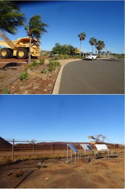
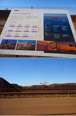
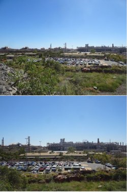
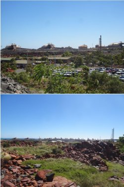
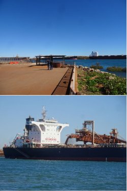
I called into Port Hedland. Not sure why, as there are no redeeming features from a tourist perspective, unless into ship-spotting.

The original town has become surrounded and swamped by ore-loading berths and the salt evaporation ponds (the latter also common at other NW centres such as Onslow). The scale is enormous. Best captured from way above. It’s a deep-water port, so there are no long jetties protruding from shore.

Snip 61.JPG

A snippet from the old town (from where it says ‘Port Hedland’ on the Google Earth image above):

Snip 62.JPG

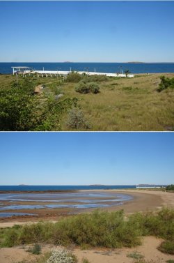
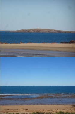
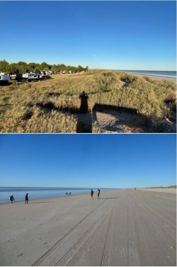
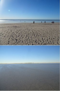
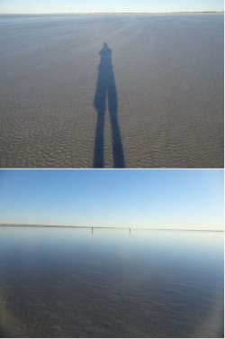
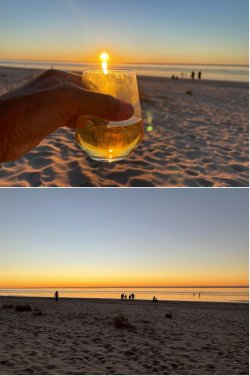
That night was spent at Eighty Mile Beach, where there is a good caravan park situated immediately behind some low coastal dunes from the tidal beach.

Snip 63.JPGSnip 64.JPGSnip 65.JPGSnip 66.JPG

On to Broome the next day. I had intended to brush past Broome and continue to Kununurra. However, it turned out that the Staircase to the Moon phenomenon was occurring over the weekend. The Staircase happens between March and early November when a full moon rises over the exposed tidal flats of Roebuck Bay.

So, I went into Broome and waited for sunset, watching as cloud gradually spread from the west during the afternoon. It hadn’t quite reached the E horizon by the time of the Staircase, but the phenomenon was brief because of the cloud.

As I sat on the tiered grass at the Town Beach park, I was taking photos with both my camera and my phone, some alternately. Unfortunately, as I was to suddenly realise a couple of days later when I was in Kununurra, I had placed my camera on the grass next to me and not in my pocket. In my haste to get going to make a few hundred km towards Kununurra that night, I got up and walked away without it.

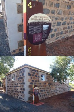
A phone call to Broome Police revealed that it had been handed in, so I collected it later in the week. Looking more closely at the contents of the SD card today, whoever picked it up had been playing with it and all my Staircase photos were deleted (but no previous photos), some random movies added and, as I was to find out later, settings changed to produce pics with artistic effects. Rather bizarre that they did that then handed it in, but it could have been worse.

So, the only pics of the Staircase that I have are from my phone, and none of the more zoomed-in pics that I had taken on my camera.

Snip 67.JPG

Nothing to report from Kununurra. I met my son at KNX and we spent a couple of days looking at the extensive sandalwood plantations there that are now approaching harvest.

The sandalwood grown commercially is Indian sandalwood (Santalum album); the native Australian sandalwood is Santalum spicatum. As sandalwood is a parasite, it is planted alternating with hosts that have no commercial value.

I think that the original promoters of these schemes severely underestimated the logistics of the harvesting 15 years down the track.

1625978802237.png
 
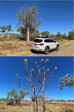
Dropped my son back at KNX and then it was time to head S. Boab (aka baobab) trees are characteristic of the Kimberley. Predominantly native to Madagascar, with fewer species native to Australia and parts of Africa. I don’t know what the yellow-flowered trees are, but they are common around Kununurra.

Snip 69.JPG

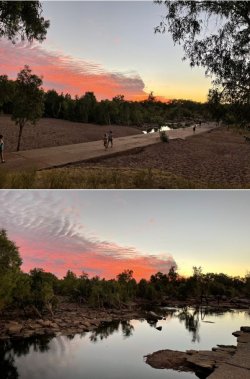
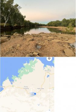
Nice 24h rest stop at Mary Pool between Halls Creek and Fitzroy Crossing.

Snip 70.JPGSnip 71.JPG

I get back to Broome, collect my camera from the police station and overnight there before heading N to Cape Leveque. As noted above, the person who picked up my camera had a good play with it before deciding it wasn’t worth keeping. At least they didn’t just ditch it and did take the trouble to hand it in.

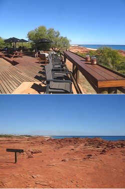
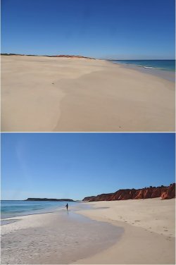
I get to Kooljaman at the tip of Cape Leveque and it’s a glorious spot. Off I go on a long walk around from the W to the E of the cape, taking photos furiously but not noticing the camera was set on some weird special effects setting.

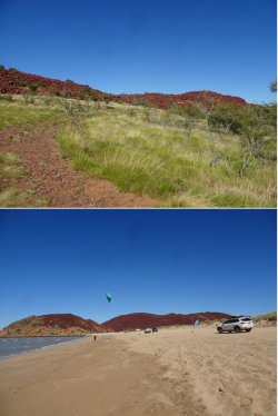
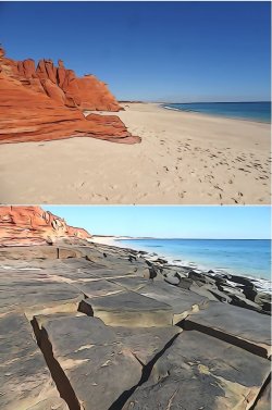
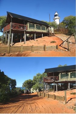
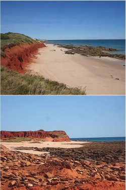
The ‘resort’, which includes some glamping tents, fixed tents and camping is situated above the western red cliffs that are of significance to TOs, so out of bounds. There is a path down to the W beach and it’s a nice walk around the cape to the E (swimming) beach.

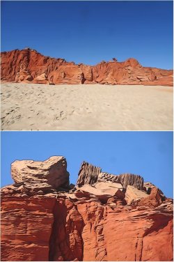
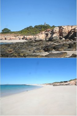
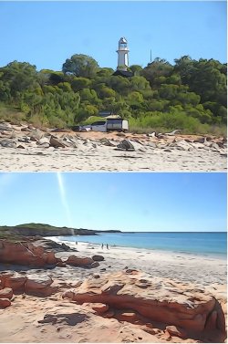
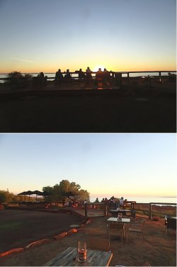
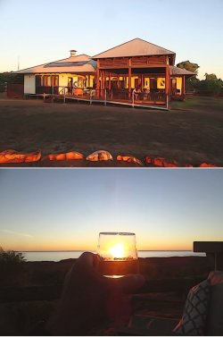
The pics may look strange, but they give the idea.

Snip 72.JPGSnip 73.JPGSnip 74.JPG

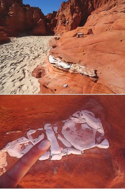
There were interesting seemingly pure chalk sporadic inclusions in the sandstone.

Snip 75.JPG

And some cracked basalt near the point.

Snip 76.JPG

Around the point and the lighthouse in view.

Snip 77.JPG
 
Snip 78.JPGSnip 79.JPG

Delightful spot for sunset.

Snip 80.JPGSnip 81.JPG

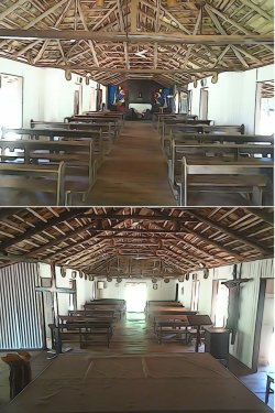
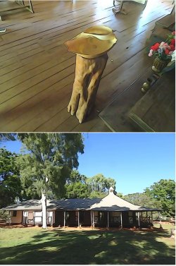
The TO communities at Beagle Bay and One Arm Point are closed because of Covid. Unfortunate, because the church at Beagle Bay is famous (https://www.westernaustralia.com/us/Attraction/Beagle_Bay/56b266ebd5f1565045daa0e1).

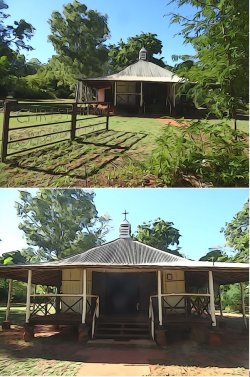
Lombadina, just S of Cape Leveque is partly a TO community and part a standard settlement. The TO part is closed, but the conventional part is open. The mission church there is of historic interest, but not to the level of the one at Beagle Bay.

Snip 82.JPGSnip 83.JPGSnip 84.JPG

A detour into James Price Point, with its notable red cliffs, not far N of Broome. Controversial a few years ago for being promoted as a site for an onshore LNG facility.

Snip 85.JPG

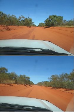
The road in to James Price Point is red sand and over the years has become almost like a trench with its base sitting below the level of the surrounding country.

Snip 86.JPG

I brushed off Broome and immediately headed S after coming off the Cape Leveque road. My aim of camping at Eighty Mile Beach caravan park again was thwarted when it had a ‘Full’ sign up. It was the Saturday after school holidays had started. I thought the lockdown in Perth/Peel might have slowed the northward migration, but seemingly not.

I just camped off the grid in the bush that night.
 

Enhance your AFF viewing experience!!

From just $6 we'll remove all advertisements so that you can enjoy a cleaner and uninterupted viewing experience.

And you'll be supporting us so that we can continue to provide this valuable resource :)


Sample AFF with no advertisements? More..

Recent Posts

Back
Top