NUIGINI ------- BUNA ... KOKODA TRAIL ... GOROKA SHOW

  • Thread starter Deleted member 29185
  • Start date
Status
Not open for further replies.
We had brought educational packs for the school, birthing kits and medical supplies for the haus sic and obviously, we just wanted to experience Buna.

We did however, have the privilege of meeting the hard working school staff and were able to present the principle and teaching staff with sporting equipment and educational packs.

The Buna medical centre is small and poorly funded. We got the feeling the doctor probably does not get paid and just does what he can, so the birthing packs and medical supplies we donated appeared to be greatly appreciated.

Lovely to see you thinking of the locals with practical items - @straitman instructed me on the same thing in Fiji and it has been great to see my children giving the education packs to the local teachers and (trying to) chat to the kids.

You had me welling up...:eek:
 
Yes, sounds like you have the correct airfield and more than likely the wreck was of "Career Girl". Have you thought of forwarding your photos to the Pacific Wrecks website for uploading - I'm sure they would love to see people are still interested in them and to have updated photos.

I'll do that. I'll straighten the images and try to find more between all the group and it may prove to be of an assistance to someone.

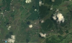
I've done a Google map search and the parallel runways are pretty clear in the pic. Directly between Dobuduru (Dobudura) and Girua.

103 - Google map of runway.jpg

Lovely to see you thinking of the locals with practical items - @straitman instructed me on the same thing in Fiji and it has been great to see my children giving the education packs to the local teachers and (trying to) chat to the kids.

A tip for anyone contemplating doing the track, weight is a real issue. We had lots of stuff of a practical kind and Buna and Dobuduru gained mostly from that as it just weighted too much to carry to the communities on the track. We did take light things like balloons, but they were not a good idea as it turned out, as as they are short lived (dropped on the grass and they pop) and then the village is left with commercial plastic waste. I personally think the best thing for the villages is simply to bring lots of small denomination notes and buy stuff from them! A K2 can of drink sells in the villages to tourists for K7 (mind you, they carry them in). Bananas are exceptionally tasty (compared to the genetically engineered by-product we seem to have masquerading as bananas) and along with pineapples and avocados are good solid cash crops for the villages. We even had an Efogi Villager set up a little stall at 4am to sell freshly made donuts (and they were great for breakfast :D). Buying those items provides good money into the villages, helps very weary trekkers recover and doesn't generate waste ... even the cans are recycled by the villagers selling the scrap aluminium!

Forget the sweets, the balloons and the toys, just bring cash! (although we also brought packets and packets of different stickers ... fairy stickers, motor bike stickers, even aborigines hunting stickers, which turned out to pretty well received as the kids wore them like temporary tattoos, so they lasted at least a bit longer than the balloons and weighed next to nothing, but was still something nice for the kids to receive!
 
Since we were in the antiquity mood, following on from the airfield and aircraft gun, Roy suggested we catch up with a man I had met earlier this year, who also played a role in rescuing this trek when the Kokoda Track Authority (KTA) brought in the rule that all treks must be through a KTA licenced tour operator. Peter stepped in and allowed us to use his company licence to proceed with this trek, whilst we organised Roy's company registration and licence. He also owns a quaint museum in old Buna, so down the beach we went, to visit his museum and catch up again.

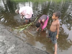
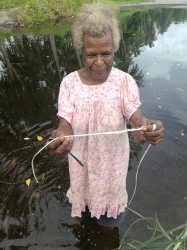
Along the way, we bumped into a lady, shin deep in the river, in the process of making billum rope ... with a spoon!

135 - Making bilum rope.jpg


135 - Showing us the rope.jpg

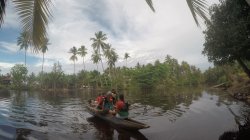
Upon arrival in old Buna, we were pretty wrapped to discover that accessing the museum is not just by walking through a door! We first had to cross the river, which was a real treat aboard two traditional canoes across a near perfect lagoon setting!

131 - Canoe to museum.jpg

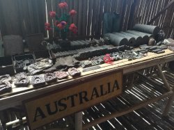
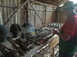
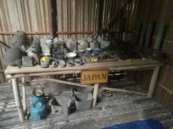
Once ashore, in the older section of old Buna, we were greeted with freshly cut coconut drinks and stories aplenty. The museum was grand, by Buna standards, being housed in a purpose built building with a breezy veranda for socialising and story telling and was set up in three distinct sections, being Australian, American and Japanese relics.

131 - Buna museum 2.jpg

131 - Buna museum 1.jpg

133 - Buna museum 3.jpg

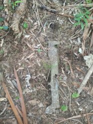
Of course, everywhere around Buna are war items. You don't have to look too hard to find them. At one point on a track (where Dick Whittington was found), I looked down and what looked like parts of a rifle of some sorts was semi-buried in the grass and sand. I didn't touch it, as it is part of a war grave as far as I'm concerned, but perhaps someone may like to elaborate on what it actually is (pic below).

131 - Unknown relic.jpg

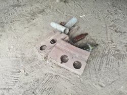
Even when the boys dug the holes for our gest haus posts they uncovered this assortment! It's currently residing under the gest haus ... what else do you do with it??

131 - Gest Haus relics.jpg
 
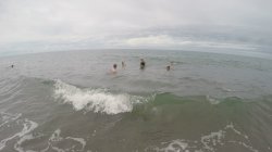
Anyway, the afternoon was drawing to a close and although the museum was fascinating and well worth seeing, it is a sombre reminder of the atrocities which occurred in such an idyllic place and we decided a little cheering up was in order so we decided for a swim before heading back to repack our gear ready for the start of the big trek in the morning.

135 - Afternoon swim.jpg

The next day dawned before too long and it was time to muster the troops, say goodbye to every man (well boy) and his dog, and head off on the trek!

134 - Boy and his dog.jpg

Remembering that PNG is the land of the unexpected, it really didn't come as too much of a surprise to learn our much needed troopy had gone bagarup overnight, so our Kokoda mission started early, with a 5km trek from Buna, through the swamps to where the truck would meet us to whisk us away to a week+ of torment and pain!

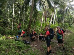
136 - Packs on ready to depart Buna.jpg


So we're off, hitting the main road out of Buna with the destination of a palm oil plantation plotted in the GPS ... well, not really, no coverage at all here!

137 - We're off. Main road out of Buna.jpg

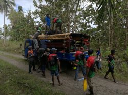
The trek was enjoyable (hot and muggy, yes but enjoyable) and after an hour or so, we reached the palm oil plantation track and following a fairly brief break in the shade under the trees, our trusty truck came roaring into view! Luggage packed everyone piles in (well, almost everyone, a few of our porters got to ride in the upstairs carriage, up on the tarpaulin roof)!

138 - 2.5 hours of trekking out of Buna, we meet up with the truck.jpg

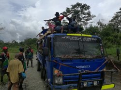
After a short break in Popondetta for some final supplies and lunch, we were off on adventure! Of course, Popondetta was not the only stop, we had one when the seat support fell through the rusted floor, oh and another when the bull bar fell off, but Mike, in true bushman form, repaired the truck and before long, we were playing tourist at Kokoda! (and in defence of the poor truck, we were loaded to the hilt and the road was particularly rough)

139 - Road to Kokoda. Marjin Sam and Siprian prefer the top and the bullbar had just fallen off.jpg


140 - Father and son porters - Gary and Peter.jpg

Father and son team ... Gary, (my work mate) and his son Peter! Both first timers on the track and both did exceptionally well.
 
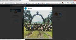
You didn't happen to come across this group on your trek - they have just finished it as well (I knew a couple of participants).

upload_2017-9-22_10-53-44.png
 
You didn't happen to come across this group on your trek - they have just finished it as well (I knew a couple of participants)

Yes we did, I believe! The image is fairly blurred, but some of those look like the group which was walking the same direction (Kokoda to Owers Cnr) and our paths crossed from time to time. Let them know we were the group with the guitar playing porters that did the war cry each morning and see if it was them! If my memory serves me, we both stayed at Templetons Crossing No.1 camp (on Thurs 7/9) and I have the feeling we may have met them again at the end (at Owers Cnr on the morning of the 13/9).

If it is them, I wouldn't mind getting in contact with them, as the group I'm thinking of were a fun group as well!

Checking with one of them now
 
Oops, I seem to have skipped forward a way, so had best go back to the beginning of the trail!

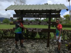
We arrived at Kokoda at about 3pm so decided we'd do the short trek up to Hoi village (rather than the planned overnight at Deniki Village). After all, it was just our first day! ;)

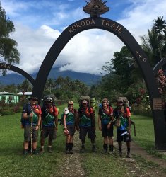
140 - Ian - Kiplin- Lisa- Clark- Debby - David.jpg

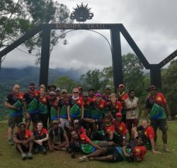
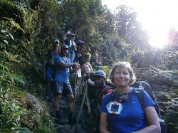
From the beginning. Me, Lisa and my sister Debby with Kiplin, Clark and David, our personal porters and great blokes

Kokoda map (002).jpg

Kokoda Trail map.

We started at the very right of this map ... Kokoda Village. There is actually a funny story about the name of the trail. Some argue "trail" is the correct term and others argue "track" is more Aussie than the Yankee "trail" (The American path was actually 50km or so to the east of the Kokoda Trail and is known as the Kapa Kapa Track or trail which funny enough is also not correct as it is actually the Gabba Gabba Track or colloquially the Ghost Mountain Track and is said to be the Kokoda Trail on steroi_s, so I really doubt I'll ever be doing that one)!

Officially, the name is Kokoda Trail but I often use either, so if I inadvertently use track rather than trail, please forgive me! :(

When this trek was first planned, it was decided we'd do the trek in the "easy" direction as when you look at the elevation map above, from Kokoda up to Mt Bellamy is a lovely casual uphill gradient (mostly) designed perfectly to ease us into the walk, whereas the reverse direction has many more shorter, but far steeper pinches. The truth is, there is no "easy" direction. It's fair to say the direction we chose was easier, but easy ... it wasn't!

The lik lik walk up to Hoi Village certainly gave us the idea this was to be no stroll in the park, however upon arrival in Hoi, we were greeted with a lovely quaint village in a very peaceful setting with a beautiful stream flowing through the middle. I immediately hit the stream to soak my feet and just rest on the bank and then went to discover our accommodation for the night!
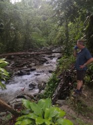
142 - Greg having a coffee break.jpg

Greg having a coffee beside the stream in Hoi.
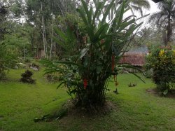
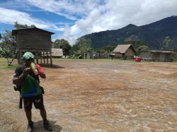
144 - Hoi Village.jpg

Hoi Village

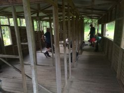
143 - Gest Haus - Hoi.jpg

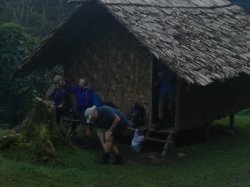
Our Hoi gest haus ... 5 rooms, complete privacy! Oh, except wall sheeting must have been an optional extra!

We had a great evening meal and as per Buna meals, our trek kitchen team washed all our dishes and cutlery before the meal and after the meal. We often offered to do this ourselves, but they wouldn't have a bar of it. It was a little embarrassing actually, to be pampered like royalty when those lads worked as hard as us (actually harder) on the track! Even more amazing was that our kitchen team chopped wood, made the fires morning, lunch and dinner, prepared the meals, washed up all utensils before and after each meal, packed them and carried them along with their own gear over the same gruelling tracks as we walked, wouldn't eat themselves until after we had finished, cleaned up the camp site and then basically ran to the next one to do it all again and they were all late teens or early twenties! o_O I struggle to get my kids of a similar vintage, out of bed in the morning!

The next day, following a nice breakfast, we headed off about 7am for the first full day's walk ... all uphill! :eek: I very quickly learned I hate uphill. I found muscles I never knew existed ... in the most painful of ways. I'd never really given my bum much thought, but I did within the first few hours of walking 'cause I found muscles that were threatening to go out on strike. Happily, my muscles were thoughtful and they'd take turns, one minute my bum would be caning, next my calves then around the back of my shins, then behind my knees, oh I forgot my back and ... seemed all my high altitude highlands training counted for little!
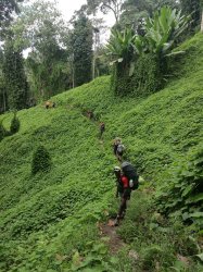
145 - Hoi to Deniki.jpg

Hoi to Deniki Village.
 
I did the "track" in 2006, with my son, from PM to Kokoda and you are right in saying there is no easy way !!!....endless ups and downs but we made it just fine with no real dramas....your trip report and photos bring back wonderful memories....Looking forward to the next installment
 
We were all pretty glad we stayed at Hoi the previous night, as finally, after 5 hours of an uphill slog, we arrived for lunch into Deniki Village.
145 - Deniki Village.jpg


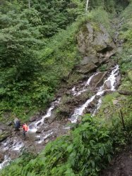
To start with, the many creek and river crossing were quite fun and always very picturesque, if not sometimes a bit rugged, but I also quickly learned to quite dislike water crossings as every crossing meant a bloody great uphill climb on the other side and some of the exits were near vertical, which seemed to go on forever!

146 - Lisa at a crossing.jpg


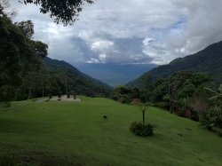
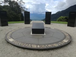
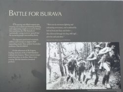
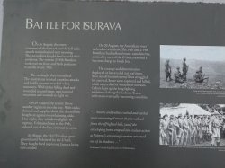
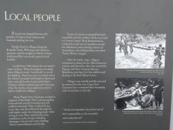
After Lunch at Deniki, we continued onto what would have to be one of the most attractive jungle memorial sites ever, the Isurava Memorial. A very beautiful yet sad and emotionally moving site. The views from here were simply spectacular, yet we drifted from story board to story board reading in silence, of the terrible torment that must have beset all those involved, be they Australian, Papua New Guineans or Japanese. The conditions were hard in ideal conditions, we had already learned some of that, but in torrential rain, no shelter to speak of, mud, soaking clothes, dysentery, heavy packs and with people trying to kill them, the experience must have been nightmarish.
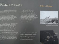
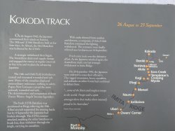
147 - Isurava Memorial.jpg

148 - Isurava Memorial.jpg
 
Last edited by a moderator:
Wow, that was a sombre read of the story boards. Gives some appreciation to what the soldiers lived through and their connection with the locals. Doesn't bear to think what would have happened had the Japanese offensive been successful.
 
Moving on from Isurava, a visit was paid to the gun site which pinned down the Aussies and then, with the afternoon drawing closer to evening, we pushed on for our nightly stopover at Alola Village ... over more creek crossings and a horrendously steep uphill once again!

149 - Gun site.jpg

148 - Continue to Alola.jpg

149 - More creek crossings.jpg

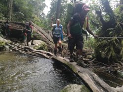
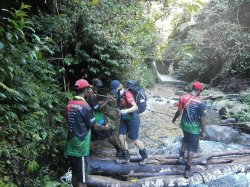
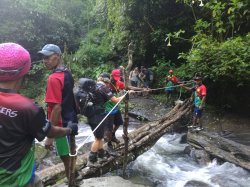
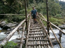
150 - Log bridge.jpg

Trust me, those logs rock and roll!

149 - There is a treck there - somewhere.jpg

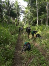
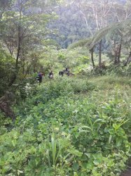
Photo's really fail to tell the full story, but I hope these at least go someway to show just how steep and dense the jungle actually can be. Not all the time, but at times, it was really thick and at other times exceptionally steep and yes, in the above pic, there is actually a track there!
 
That day 2 was a real hammering. The map made it look so easy, but it was in fact 9 hours of over a 2500 feet (780m) vertical climb and much of it was damn steep. My muscles ached and I felt absolutely stuffed ... but a good meal, a rub of Deep Heat, a good nights sleep and 4am the next day saw us all leaping out of bed (not really, crawling out of bed attempting to get the legs to work was more the reality) and we were ready to go again! We decided a 6am start would be better as we're starting off just at daybreak, it's cooler and the views always seem far better, crystal clear air and mist and cloud hanging around us making for some spectacular sights. The sad part though, first up was , umm let me try to remember ... oh yes, a bloody steep uphill! My favourite, not!

154 - Daybreak.jpg

Daybreak in camp! Best time of day!

After struggling up that hill, I hit my peak, yea ... a downhill :). The really odd thing here that I just cannot fathom, was that the rest of our team preferred uphills and disliked the downhills with a passion. Me ... I was 350% opposite. I could trek the downhills without a problem and was often out in front, by up to 1/2 hour. On the uphills though, I was ALWAYS last but usually by only about 10-15 minutes. Uphills kill the muscles (well killed mine at least) whereas the downhills put a lot of pressure on the toes as the downhills are just as steep as the uphills, just in the opposite direction, and it's impossible not to have your feet slip forward and press on the boots. To compound this, we had a lot of wet conditions early on (we passed the owner of Kokoda Spirit, Wayne, and he stated it was monsoonal conditions and we were "lucky" as we were getting the full Kokoda experience! :rolleyes:). The outcome was that we were all about 3" taller due to the mud stuck to the bottom of our boots and to really add some fun into the mix, most of the mud was damn slippery clay! I sort of put my downhill preference down to me learning to ski on ice. I still prefer hard snow over powder and I reckon that set me up OK for dealing with the "skating" down these tracks. Of course there is another alternative ... pure luck!

Anyway, at the bottom of my lifesaving downhill was Eora Creek. I saw the ominous warning of yet another river crossing and it wasn't the rickety bridge, it was what I saw on the other side .... a massive uphill! We had a great lunch at Eora! 1.5 hours for lunch, which was unreal. We were able to wash and drape all our wet clothes over the rocks and got them dried and collapse (in my case) to have a nanna nap! Eora Creek is one of those naturally beautiful spots that make you glad you're alive (and I felt like I very nearly wasn't)!

151 - Arriving at Eora Creek.jpg

Greg crossing.

151 - My porter Kiplin @ Eora Creek.jpg

My porter Kiplin, with Marjin, one of our amazing kitchen hands behind tending to the lunch fire.

152 - Track master - Roy.jpg

Track master Roy.


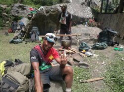
153 - Rest time - Clark, Roy 2 and Sippy.jpg

Rest time for Clark, Roy 2 and Sippy!

151 - At times I thought I was dead.jpg

Me ... at my peak level of fitness! I'm obviously not an "Energizer Bunny" (although I think at that point, I was probably believing I was some kind of bunny for even being there)!

151 - The hill behind Eora Crk.jpg

The reason for my feeling of foreboding is pictured above. The building on the
left is our Eora Creek lunch spot. The hill above those buildings, is our post-lunch climb. Easily the steepest looking uphill to date! :mad:

151 - Same hill.jpg

My worst nightmare comes true. It's near vertical, the steps, when existent, are high (kills my butt muscles) and it's vertically up for 1600 feet (485m). Part of this climb is up a waterfall. You may be thinking a dry waterfall ... nope, water was cascading down as we were climbing up! No pics I'm afraid as at that point, I was too busy hanging on with my fingernails!

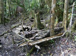
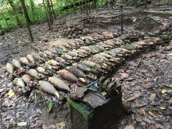
A Japanese ammo stack was passed on the way.

153 - Japanese ammo stack.jpg

Don't touch, some of the grenades still have their pins intact!

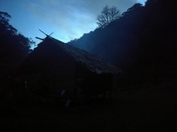
Finally we reach our digs for the evening after another 9 hour trekking day. The Templeton's Crossing camp.

153 - Night time.jpg
 
Last edited by a moderator:
Great photos. I certainly couldn't do that walk now, in my 60's, but it would have been a struggle at any time.

My father was in that fight for Isurava with the 2/16. This is giving me a good idea of what he faced - and he was 38 when he did it.
 
The Frequent Flyer Concierge team takes the hard work out of finding reward seat availability. Using their expert knowledge and specialised tools, they'll help you book a great trip that maximises the value for your points.

AFF Supporters can remove this and all advertisements

Sponsored Post

Struggling to use your Frequent Flyer Points?

Frequent Flyer Concierge takes the hard work out of finding award availability and redeeming your frequent flyer or credit card points for flights.

Using their expert knowledge and specialised tools, the Frequent Flyer Concierge team at Frequent Flyer Concierge will help you book a great trip that maximises the value for your points.

Well we have one thing in common-I am also absolutely no good uphill but still can run downhill.Some passing me on the uphills make snide remarks as they pass.they get double back on the downhills.
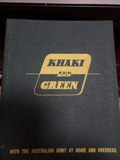
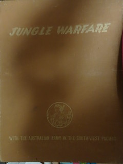
But this TR made me remember my Dad's old books printed by the War Museum during the war.These are the 42 and 43 editions that cover Kokoda including men's own stories.
36532210784_368d9a339e_n.jpg
.
36986639210_9322ef7b9a_n.jpg
.
Hard not to have a tear in the eye with some of the stories especially those involving the Papuans.On reaching a village often the elderly were bayonetted,the young men who had not run into the bush press ganged as porters and young women taken off.The porters often got their own back when the Japanese were running out of food pointing out the poisonous berries and leaves as good food supplies.
Really enjoying this TR.
 
Status
Not open for further replies.

Enhance your AFF viewing experience!!

From just $6 we'll remove all advertisements so that you can enjoy a cleaner and uninterupted viewing experience.

And you'll be supporting us so that we can continue to provide this valuable resource :)


Sample AFF with no advertisements? More..
Back
Top