




A swing through South America

LPB-UYU OB304
B737-700
CP-2923

On time
IMG_6059.jpeg
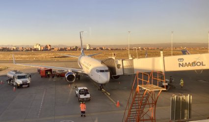
B737-700 being loaded at LPB ready for the journey to Uyuni.

I'd drunk the first coffee because I didn't know if it would be allowed through security for the domestic flight (liquids are allowed domestic in Bolivia the same as Aus), so had enough time to get a second coffee in my travel mug for the flight. There was an unannounced gate change (5 to 3, so no big deal) then boarding was called. I was listed as Grupo 3 on the boarding pass but there seemed to just be a single queue that everyone joined, rather than an ordered by group process. With the very egalitarian all-Y layout, maybe they don't need to consider status pax. (though there was a 'Business' check in lane earlier so who knows?)

There was a short delay whilst bags were finalised, then doors closed and the aircraft was pushed back. It was then that a member of the crew announced that due to weight limitations some bags had been left behind. As there is currently only a single flight a day, this caused a bit of murmuring, especially amongst the clearly identified tourist pax which were probably 60-70% of the mix. Moreso because some may have been starting tours that day (the reason the flight is early AM into UYU) which would have been a major inconvenience without necessary baggage.
IMG_6062.jpeg
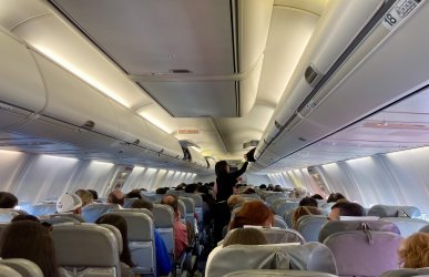
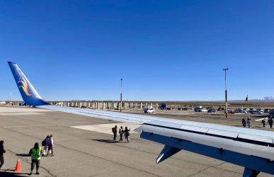
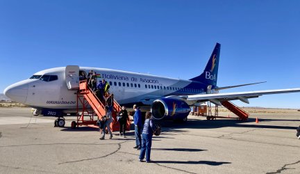
Arrival at UYU was met with a request to remain seated and alight by called rows. 1-10 first, then to 20 etc. As it was they opened the rear door and everyone near the back just headed out that way. I had checked FindMy whilst waiting and AirTags confirmed both my bags were at UYU.
IMG_6063.jpeg
IMG_6064.jpeg

No service of any kind was offered during the 50-minute flight.
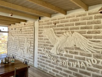
 
I had chosen not to immediately start my tour of the Salar de Uyuni that day and instead booked the night at Casa de Sal, a salt hotel, that is, constructed of salt bricks. As I'd arrived at the hotel about 0900 they completely understandably didn't have my room ready. They estimated only an hour, so checked me in and then I paid the $10 or so for breakfast and went up to the dining room on the top floor.

IMG_6065.jpeg
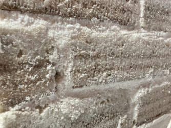
Salt bricks!

IMG_6068.jpeg
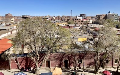
View across Uyuni from the breakfast area

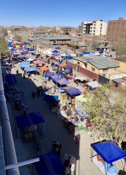
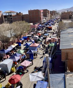
Going on outside was a pretty extensive street market. I couldn't see where the stalls ended in either direction.
IMG_6066.jpeg
IMG_6067.jpeg

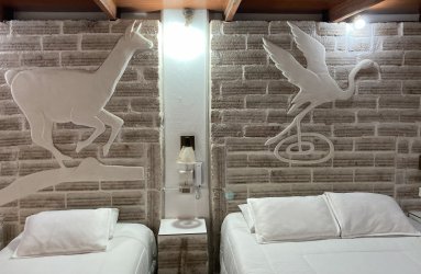
Salt art in my allocated room. The beside table was a stack of salt bricks and the bed mattress was raised up on some too.
IMG_6069.jpeg
IMG_6070.jpeg

I spent the day updating part of this TR, doing some other work which was nearly due and trying to organise photos from Peru. Then went for a walk around the markets but didn't need anything. Final task was to repack into a smaller bag I'd be taking with me for the Salar de Uyuni 3-day tour, and then have the hotel store my suitcase and golf clubs whilst I was away for three days.

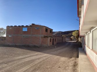
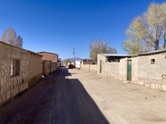
Uyuni as a town is sprawling, dusty, filled with numerous street dogs and from the parts I saw, mostly devoid of charm.
 
During the day I'd received a WhatsApp message from the tour company for the following day. Due to the state of emergency (SOE) and the decision by the Government to drop much of the subsidy on fuels the cost of gasoline had risen significantly. They wanted all the people on the tour to come to the office at 0930 on the morning of the tour to decide which course of action the group wanted to take. They suggested that maybe only a 2-day tour might be offered, as they were resorting to buying their fuel from the black market at further inflated rates.

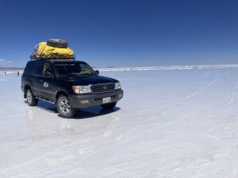
To give you an idea, in their storefront they had a comparison that previously the price of gasoline was BOB3.something per litre. Officially it was now BOB7.something (about AUD1). At the meeting they advised they'd bought sufficient fuel for the 3-day tour but at BOB22 per litre. Each Landcruiser carried three large jerry cans on the roof for the 3-day tour.

The tour group I was with was 9 people (tourists) in two Landcruiser's. (plus two drivers and an English-speaking guide - each Cruiser had a back row of seats so could accommodate six pax) We all agreed to pay USD50 extra each to continue with the 3-day tour. I can neither confirm nor deny the fuel situation story, but we did see long lines at many petrol stations.

As additional background, Bolivia is in an SOE due to significant blockade activity earlier in the year, especially around La Paz. They had elected a new right-wing government late last year after the former socialists were pretty thoroughly trounced. One measure the new government had introduced was to wind back the heavy subsidies on fuels. Formerly, Bolivia exported significant quantities of gas and was able to afford the subsidies, but the budget situation had deteriorated markedly, with declining petro exports and something needed to change. Bolivia's credit rating was also poor and they couldn't access international financing. The blockades were mostly union movement organised as a form of civil disobedience and to try to bring down the new government and have their own socialists returned to power.

With the SOE life seemed pretty normal in La Paz and in Uyuni, except for the fuel situation and most businesses preferring cash. Many businesses accepted card no issues, but they preferred to be paid in Bolivianos cash. (USD was also indicated as accepted but generally with a pretty poor exchange rate) My Bankwest Zero Plat credit card worked fine everywhere with BOB expenses, although most terminals offered a dynamic currency conversion option for AUD or BOB and always noted to the merchant that I wanted to pay in BOB.
 
On the morning after the tour meeting, I did find some little bits of charm in the town. The meeting finished at 0945 and we'd be starting the tour at 1030, so I went for a walk to fill up my coffee mug (go to Llama Cafe - good coffee) and buy another bottle of water, as well as some toilet paper. I bought a two roll pack which was never opened during the tour as, subsequently I found out each Bano cost a couple of BOB to enter and that got you a small toilet paper bundle, plus the night stop accommodation also supplied toilet paper.

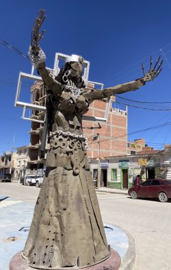
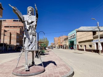
The tour company I used, Andes Salt Expeditions, has their office in the background of this street art statue.
IMG_6074.jpeg

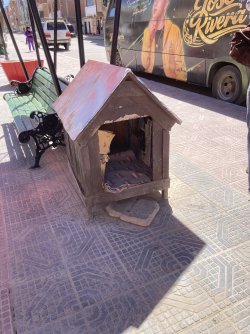
Even the street dogs get looked after in Uyuni! There were a number of these kennels dotted all around the streets.
IMG_6075.jpeg

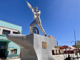
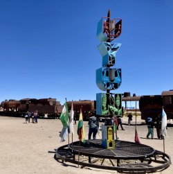
More street art. Heavily mining influenced.
IMG_6076.jpeg
IMG_6077.jpeg

I lucked in as I'd be sharing a car with three other tourists as well as the driver and guide sitting in the front. The other car had five tourists and their Spanish speaking driver. At each stop the cars always pulled up together and the guide spoke to the whole group.
 
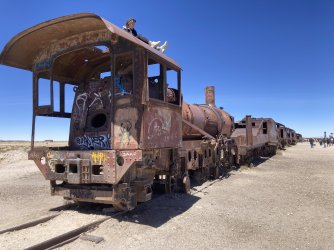
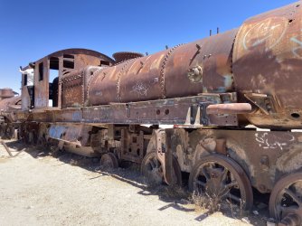
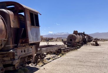
First stop: the train graveyard.
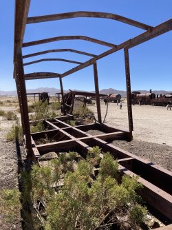
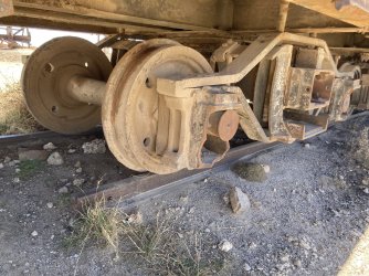
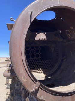
As newer models were delivered over the years, older trains were just left here in the desert to rust. Additionally, when the mining companies (some nationalised) went bust, they left the trains here. There must have been 30-40 different engines and carriages which now serve as props for tourists for climbing on or selfies.

IMG_6088.jpeg

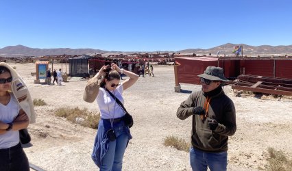
Our guide Juan doing his intro explanation to the group. Everywhere on this tour sunscreen, hats etc were vital.
IMG_6078.jpeg

Various trainy bits. 🚂
IMG_6081.jpeg
IMG_6082.jpeg
IMG_6084.jpeg
IMG_6085.jpeg
IMG_6086.jpeg
IMG_6089.jpeg

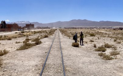
A single track that is still in use.
IMG_6080.jpeg

Our group consisted of:
A Polish couple who kept mostly to themselves. 🇵🇱
A Brazilian couple who were initially reserved (not great with English) but became a fun part of the group. 🇧🇷
An Austrian couple. 🇦🇹
Then one each from Australia (me), UK, and the Philippines. 🇦🇺🇬🇧🇵🇭
Our Filipina was definitely the extrovert of the group and she was the glue which linked the two cars' groups together.

All the others were in their 20's or early 30's (Brazilian couple), which left a significant age gap to me in my early 50's. (would you like me to take that photo of you... no I don't need one taken of me... the scenery is the attraction not me standing in front of it... no I'm not on Insta or... etc) Certainly no issues keeping up with them as I was probably fitter than about half and I know the value of being on time! Interesting were discussions about travel of course: I didn't mention I was doing much of this trip flying J whilst they were swapping stories about other tours, hostels and night buses. 😱
I did get the feeling with the group and our conversations that my generation really has had the absolute best opportunities in life and that we may well have got those by screwing over future generations.

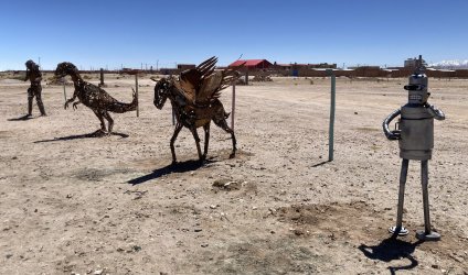
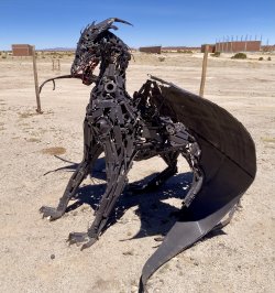
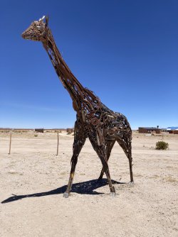
Next to the trains was a small chained off metalwork art installation area.
IMG_6090.jpeg
IMG_6091.jpeg
IMG_6093.jpeg
 
Last edited:
Then it was 20 minutes north to Colchani for a quick salt workings tour whilst the drivers and the stopping point hosts set up lunch for us.

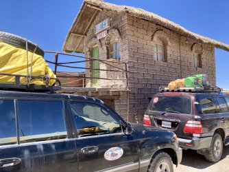
A much older salt building with our Cruiser (black) and another tours (maroon) in front.
IMG_6094.jpeg

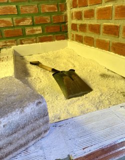
Drying salt for crushing, plus an example brick.
IMG_6095.jpeg

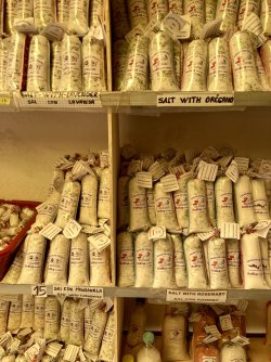
Some of the products created.
IMG_6096.jpeg

After lunch it was time to get out onto the salt flats!
IMG_6098.jpeg
IMG_6099.jpeg
 
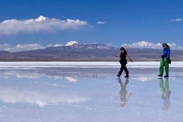
What this tour taught me was that there are some places on earth where it is impossible to take a bad photo! Wow, what an amazing landscape.

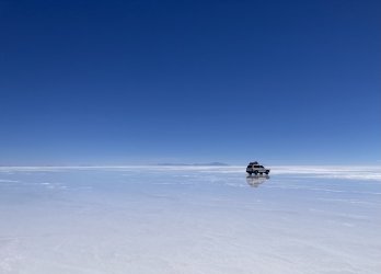
First the Salar de Uyuni. I can’t do justice to all the basic info, so here’s the Wiki Salar de Uyuni - Wikipedia. Suffice to say, really big, really flat, (and really deep) salt flats.

IMG_6102.jpeg

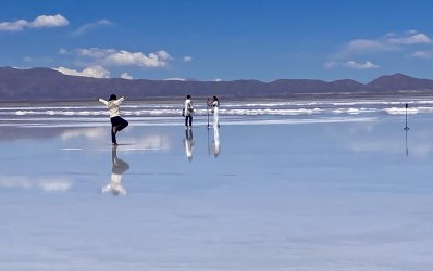
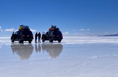
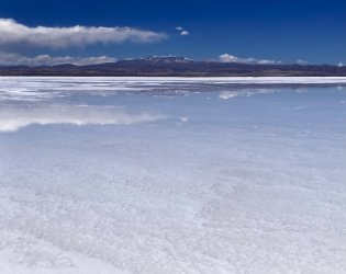
I had thought it was only wet from the sort of Nov-Feb period, but we first headed for an area that still had surface water. Not a great amount, but still sufficient for some reflection style photos. I’d guess the area was a couple of hundred metres by another couple of hundred. The water was about 2-3 cm deep.

IMG_6101.jpeg

IMG_6104.jpeg

IMG_6105.jpeg

IMG_6107.jpeg

The timeline of my photo roll suggests we spent 40 minutes at this first stop. Pretty amazing site, but the Andes hadn’t begun to feature properly yet.

IMG_6108.jpeg

IMG_6109.jpeg
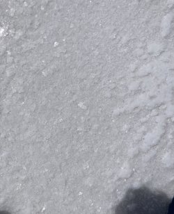
Definitely salt.
No, I didn’t taste the water.

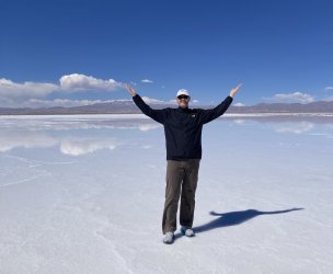
And I did get in front of the camera occasionally when Juan suggested it. Ahh, maybe it is possible to ruin a photo around here. 😛
IMG_6113.jpeg
 
Last edited:
The image just can’t do justice to the sheer slope and scale of the rock looming over the place. The hotel is on a small flat point but those apartments next door are built on an at least 45 degree slope. (maybe more precipitous 😮) I really hope they have some sort of horizontal anchoring into the rock.
(Sorry, a bit behind.) I'd be very worried about an earthquake - the Sth American west coast has some really big ones. The rockfall would be pretty bad on those upper apartments, maybe the whole lot.
 
(Sorry, a bit behind.) I'd be very worried about an earthquake - the Sth American west coast has some really big ones. The rockfall would be pretty bad on those upper apartments, maybe the whole lot.
I thought about that in the hotel I was in. They had a small rock wall upslope that might stop something smaller than a bowling ball, but jeez it seemed really risky!

Actually had an earthquake in the hotel I was in during my time in Cusco, Peru. Apparently just over magnitude 4 but there was no doubting what it was as the hotel shook for about ten seconds.
And of course it was about 8pm and I’d just got out of the shower so could either flee in a towel (from the third floor!), or do what I did which was get very quickly dressed with the first things at hand as the shaking had stopped by then.
 
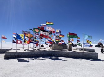
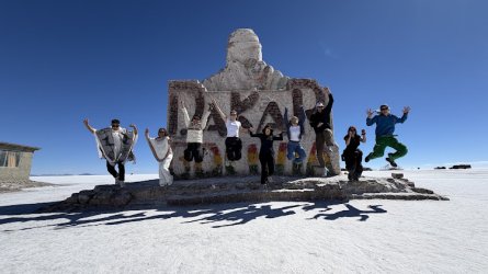
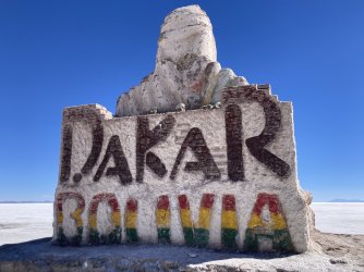
Past the monument to the Dakar rally which was held in Bolivia for a couple of years in the mid-teens (along with other Sth American countries during the period 2009-2019). Also nearby is the hill of flags which apparently was started by some of those rally teams.
IMG_6125.jpeg
IMG_6127.jpeg

The group
IMG_6280.jpeg

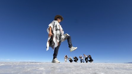
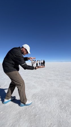
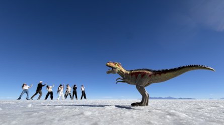
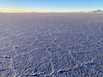
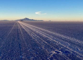
We then got out onto the drier part of the salt flats and did some of the perspective manipulation style photos.
IMG_6287.jpeg
IMG_6289.jpeg
IMG_6290.jpeg

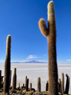
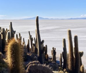
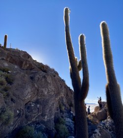
Then on to Incahuasi island in the middle of the salt flats. Interesting coral formations and cacti everywhere on this natural break in the flat white expanse.
IMG_6137.jpeg
IMG_6138.jpeg
IMG_6139.jpeg

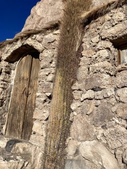
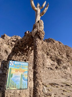
There was even a small building on the island (near the entry point) where the doors were made of cactus plant and it looks like they built the stone around one.
IMG_6134.jpeg

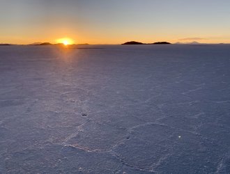
The final act on the salt flats was to pull up for sunset. On the tailgate of one of the 'Cruisers the local crew cracked open the pringles, some cheese, some crackers and a couple of bottles of red to toast the first day.
IMG_6142.jpeg
IMG_6145.jpeg
IMG_6144.jpeg
IMG_6147.jpeg
 
We then drove for another 45 minutes to get off the salt flats to a small village where our rudimentary accommodation was waiting. Our tour group had all selected the ‘medium’ tour which meant individual rooms with bathroom facilities. The rooms were still VERY sparse, with basically just a bed (no heating).

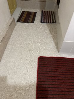
The floor of my room came as a bit of shock but I shouldn’t have been surprised.
IMG_6151.jpeg
Yes, crushed salt flooring.

There was a single GPO in the room so the phone (camera) could be recharged, but no mobile signal.

Fortunately the water was hot for a (also very basic) shower and dinner was simple but filling. Our guide ran through the timings for the next day (breakfast at 0645, then into the vehicles at 0715) and I think most people went off to sleep very quickly.

Village view the next morning:
IMG_6152.jpeg
IMG_6153.jpeg
 
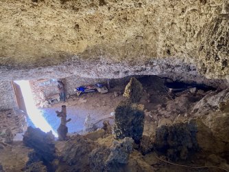
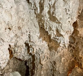
Short stop at a small cave system about 15 minutes from the village. This was a dry cave and inside it was all coral rock. No water dripping to create cave formations here.
IMG_6155.jpeg
IMG_6156.jpeg
IMG_6157.jpeg

After another hour a chance to stretch the legs (and toilet break - usually about 5Bs to enter - they were always clean and functional and your entry cost got you a small wad of toilet paper if needed) at another village.

IMG_6161.jpeg

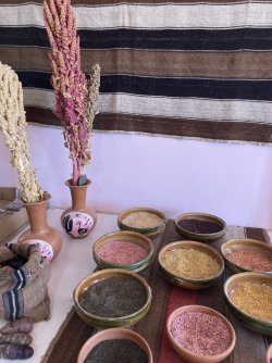
We’d passed by what were clearly basic fields but it hardly looked like anything would grow in the dry and dusty ‘soil’. Apparently it was quinoa and who knew there were different varieties including some that were pink?
IMG_6162.jpeg

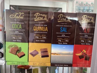
You can even put it in chocolate!
IMG_6163.jpeg

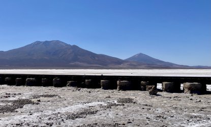
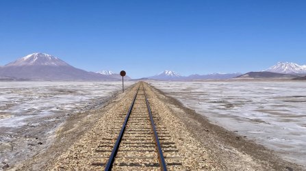
Then another hour of travel to a valley heading south. The train line from Uyuni heading south to Antofagasta in Chile was once used to export minerals to the coast but now apparently only supports a single freight carrying train a day.

IMG_6164.jpeg
IMG_6167.jpeg

Driving across the salt pan and this valley allowed much faster movement. For most of the tour the roads were rudimentary rocky tracks and we bumped and bounced along them quite slowly.

IMG_6165.jpeg

IMG_6168.jpeg
 
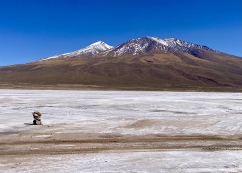
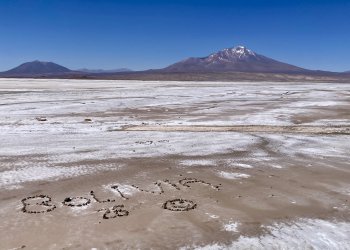
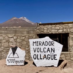
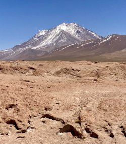
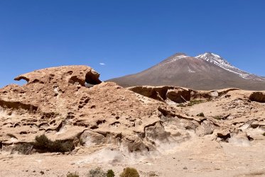
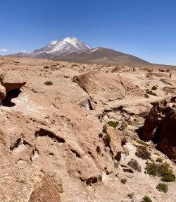
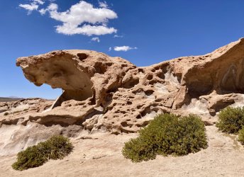
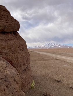
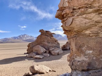
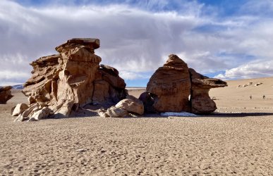
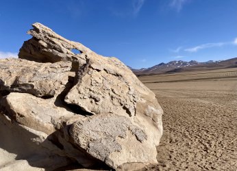
The route now really started to get up into the Andes. We climbed past 4000m altitude to reach what was described as very old volcanic flows and a view to an active volcano Ollagüe. The rock formations were interesting but we were quite a long way from the active mountain and could barely see a wisp of steam activity from a vent near its top.

IMG_6169.jpeg
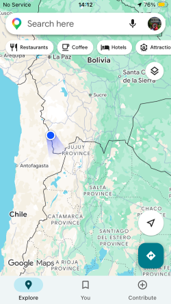
That mountain in the background isn’t Ollagüe; it’s likely Cañapa.
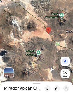
Ollagüe is a huge stratovolcano that sits on the border of Bolivia and Chile and can be easily seen from G maps satellite view.
IMG_6298.jpeg
We were at the red pin viewpoint so we’re looking WNW towards the volcano.

IMG_6172.jpeg
A small wisp of steam can be seen from the upper left.

We had about 30 minutes to scramble around on the rock formations , take photos etc.
As with almost all stops there were basic bathroom facilities available for a token cost.

IMG_6170.jpeg

IMG_6173.jpeg

IMG_6174.jpeg
This was described as a snakes head.
 
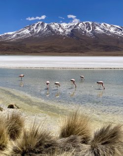
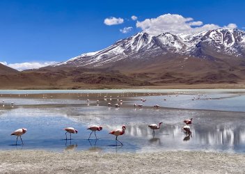
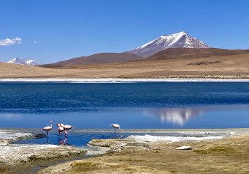
Next we headed to some lagoons and flamingos!

Laguna Cañapa
IMG_6176.jpeg

Laguna Hedionda
IMG_6179.jpeg

IMG_6183.jpeg

It genuinely was just one stunning landscape after the next. We stopped at this one and had lunch looking out a window over this lagoon.

After lunch and another 30 minutes driving was Laguna Honda.
IMG_6185.jpeg
The winding dirt roads were followed by about 6-8 different groups that we saw at various times during the day.

IMG_6292.jpeg
Too small to be seen in this image but there were a couple of Flamingos down in the water and some Vicuñas grazing nearby.

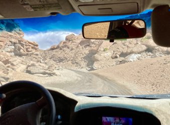
We continued south basically tracking the border on the Bolivian side. Next up was some unscheduled adventure.
IMG_6186.png
 
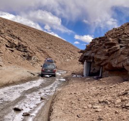
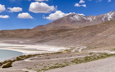
So we started following this little valley uphill to get to the next stop.
IMG_6187.jpeg

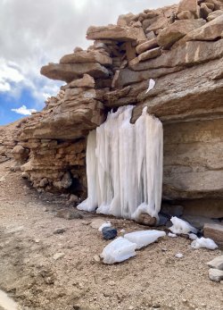
There were snow patches around and a small trickle of snow melt water as we wound our way through.

We were following the other car along the track. Even drove past a frozen trickle of water, or maybe just left over snow dragged by gravity.
IMG_6188.jpeg

IMG_6189.jpeg

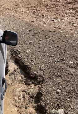
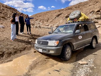
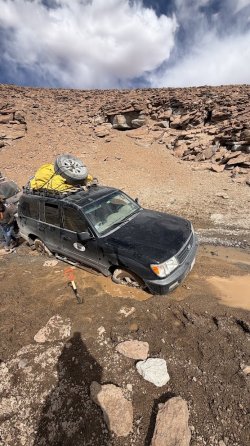
Our driver found a patch of mud and got the rear right tyre bogged. He reversed a little and then got the front right properly bogged!
IMG_6190.jpeg

I took the first shot out the window as he was trying to get going early on. Soon realised that wasn’t happening so jumped out.
IMG_6191.jpeg

What then followed for the next 40 minutes really needed Benny Hill music accompanying it.

IMG_6293.jpeg

First we tried throwing big rocks into the mud to get the tyre something to get traction on.
Next the little shovel came out to try and dig the mud away but new stuff just oozed and flowed in to keep the tyre surrounded.

IMG_6295.jpeg

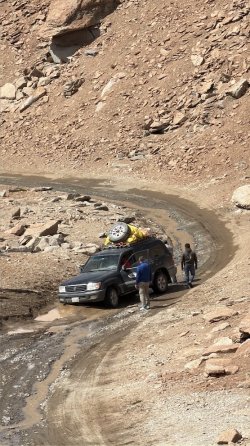
Eventually the other vehicle must have realised we weren’t following them any more and came back to find us. They positioned it behind our vehicle to give us a tow out backwards. Except they didn’t have a tow rope… What they decided to have a go with was twisting up a couple of tarps that were on the roof racks covering the fuel drums. Much knotting and tying off later they gave it a go. As soon as the other vehicle took up the slack the tarps ripped. So they tried again, about four times, and every time the tarps ripped. No surprises at all as they probably have a weight bearing capacity of about 200Kg, not the 1.5 tonne needed for a Landcruiser. 😆

I’m not sure what our driver was doing with his attempts but eventually the other (more experienced) driver, with everyone pushing and pulling, managed to get the vehicle out. I have a suspicion that our driver may not have even had it in low range…

We saw none of the other tour groups using this pass up the mountain. So an hour, two destroyed tarps, and some muddy staff later we were on our way.
 
Last edited:
Next stop was another rock formation but the rocks weren’t the attraction here.
IMG_6193.jpeg

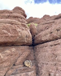
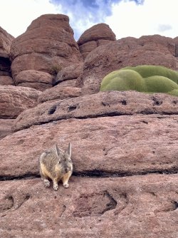
Instead it was a member of the chinchilla family, the viscacha.
IMG_6194.jpeg

IMG_6195.jpeg

Highly likely these were southern viscacha. Southern viscacha - Wikipedia

There was even a little mouse scurrying around the rocks, probably surviving on scraps of food tourists were feeding the viscacha with. (despite the sign saying not to feed them)
IMG_6196.jpeg

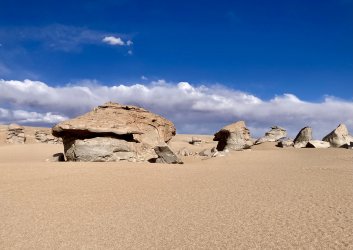
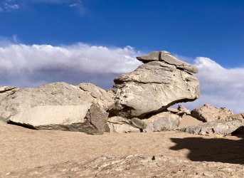
Back in the vehicles for half an hour then it was the volcanic rock as the attraction once again. Some formations were named.
IMG_6197.jpeg
African hut. I reckon yurt would be more appropriate.

IMG_6198.jpeg
Tortoise

IMG_6200.jpeg

IMG_6202.jpeg
The camel

IMG_6203.jpeg
The dragon
 
Read our AFF credit card guides and start earning more points now.

AFF Supporters can remove this and all advertisements

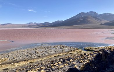
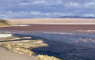
Final stop for the day was at the entry to the National Park to pay the entry fees and then see more flamingos in Laguna Colorada, a shallow red-coloured lake.
IMG_6204.jpeg

IMG_6206.jpeg

The lake, as I believe all we had seen on the tour, was fed by springs from the mountain ranges. In the image above there was a clear delineation of the fresher water entering the lake and the salty red-coloured, algae rich water.

Then with sunset and plunging temps we headed for the next accommodation stop. Again there was hot water and electricity but these were only available for three hours after our arrival 1900-2200. Plan for the next morning was 0445 breakfast and 0515 departure for geysers and hot water springs bathing opportunity.

When they say electricity off, what they really meant was that lights would still work but the power outlets (gpo’s) were switched off. I got my phone charged to 83% which would be fine.
 
Day three.
Dark, cold and some real off-road terrain for the first hour.

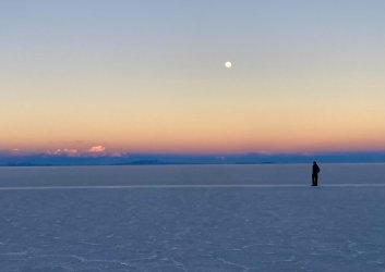
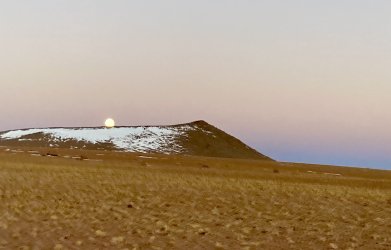
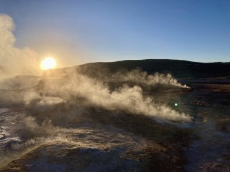
Moon was setting as the sun started to make itself known.
IMG_6211.jpeg

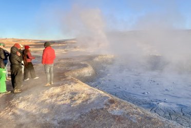
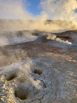
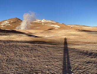
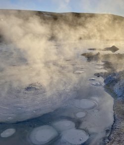
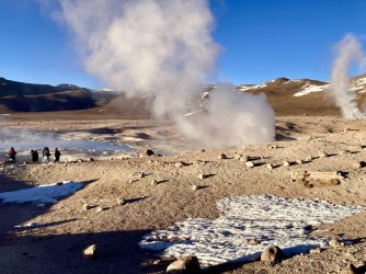
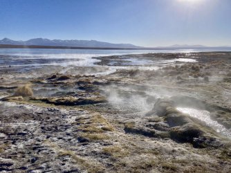
The geysers were really just an active geothermal region with boiling mud, steam vents etc. Anyone who has seen similar elsewhere in the world (especially around Rotorua and Taupo) will recognise the type of thing.

IMG_6212.jpeg

Interestingly for me, there were only a couple of vents that had the typical sulphurous smell: most were not unpleasant.
IMG_6213.jpeg

No designated pathways, just wander where you liked, which seemed a little reckless.

IMG_6214.jpeg

IMG_6219.jpeg

IMG_6218.jpeg

One of the vents did have steam coming out with some volume and force: sounded like a jet engine but maybe with a slightly deeper pitch.

IMG_6223.jpeg

There was apparently a joint Russian/Bolivian company up there with a geothermal power plant, but the site is quite some way from major population centres, so I do wonder about the utility.

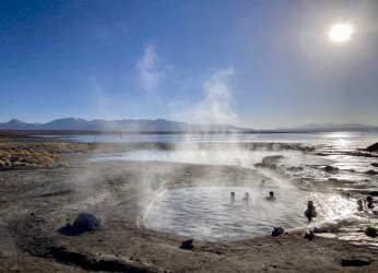
We then descended a couple of hundred metres down to a hot spring where a couple of the other tour group members braved the 1-2 deg C air temp to go and spend 30 minutes soaking in some hot water.

IMG_6225.jpeg

They had two pools (35 and 40 degrees C apparently) and it seemed like a pretty decent setup. I didn’t pack anything for swimming on this trip so walked around the site. Plenty of smaller warm water springs all in the same area.

IMG_6226.jpeg

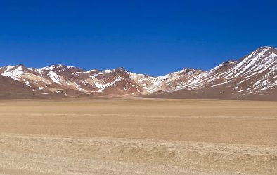
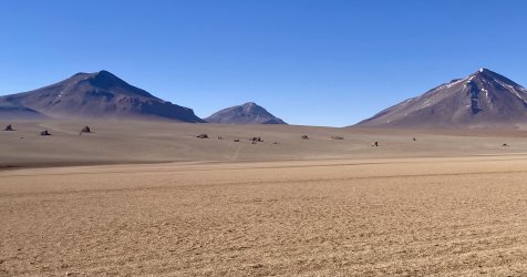
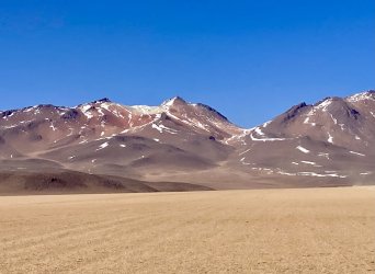
We then continued on to what was described as the Salvador Dali desert landscape. There certainly was some colour in the hills but I wouldn’t really describe it as ‘surrealist’.
IMG_6227.jpeg

IMG_6229.jpeg

IMG_6230.jpeg

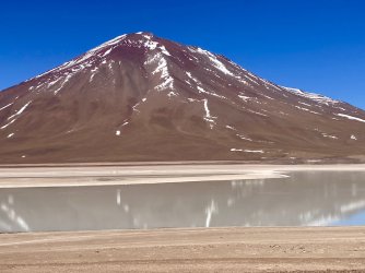
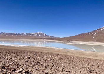
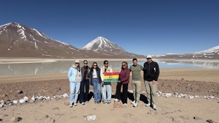
The final stop as a full group was at the adjacent green and white lakes. The green lake didn’t have any noticeable colour tinge due to the calm conditions, but the white lake certainly appeared more as described.
IMG_6233.jpeg

IMG_6232.jpeg

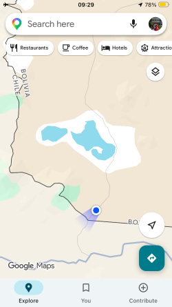
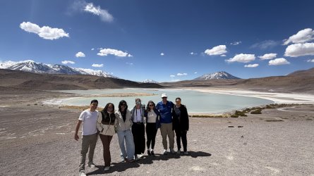
Over the water in the distance was the Bolivian border check point. Our cars would be splitting here as our car needed to drop the two Austrians over to the Chilean border as they’d be continuing on via transfer to San Pedro de Atacama. The rest of us would be heading back to Uyuni.

IMG_6296.jpeg

It was sort of weird that the two Poles mostly didn’t join in the group photos.

This was interesting: we were transferring two people to the Chilean border point where the company had organised a driver to take them onwards from there. As we got to the Bolivian border point the two leaving jumped out briefly for outwards immigration and our driver was given two tickets. I fully expected to be getting out at this point to remain in Bolivia, but nope, the whole car drove onwards a couple of Km over to the Chilean border point.

IMG_6234.png

We parked up there for a short while, transferred over luggage, said farewells and then drove back. I guess the Bolivians either don’t care about this happening (probably multiple transfers by tour groups each day), or figure that we’re all doing the right thing in a really remote place. Maybe it’s because we were technically still in Bolivia the whole time, but just seemed weird that no one accounted for four of us (two tourists and two tour group staff) driving past the Bolivian border point and then returning through.
Also unusual was that neither the Bolivian nor Chilean points had any flags flying.
 

Become an AFF member!

Join Australian Frequent Flyer (AFF) for free and unlock insider tips, exclusive deals, and global meetups with 65,000+ frequent flyers.

AFF members can also access our Frequent Flyer Training courses, and upgrade to Fast-track your way to expert traveller status and unlock even more exclusive discounts!

AFF forum abbreviations

Wondering about Y, J or any of the other abbreviations used on our forum?

Check out our guide to common AFF acronyms & abbreviations.
Back
Top