USA Reloaded - Vegas, Hiking, NYC - QF/SQ (F & Suite)

Status
Not open for further replies.
Sponsored Post

Struggling to use your Frequent Flyer Points?

Frequent Flyer Concierge takes the hard work out of finding award availability and redeeming your frequent flyer or credit card points for flights.

Using their expert knowledge and specialised tools, the Frequent Flyer Concierge team at Frequent Flyer Concierge will help you book a great trip that maximises the value for your points.

Las Vegas - Day 2 Continued.....


Having completed the east side of the Strip we jumped in a cab to pick up the rental car for the next several days. Rental pickup for all the major companies is located in a large complex a few miles from the airport. AVIS provided us with a standard SUV (sorry specifics evade me) for 7 days with required insurances included for A$898. On pickup my overcautiousness saw us add in a GPS unit for an additional A$246. The GPS unit turned out to be both largely useless and largely unneeded. It was not your typical Garmin or the like but was a cell phone which had been configured to only run some navigation app. Long story short, having been assured it would still fully operate in areas with no cell phone coverage, it didn’t. The outcome of this can be seen in the linked discussion.


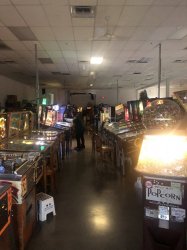
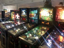
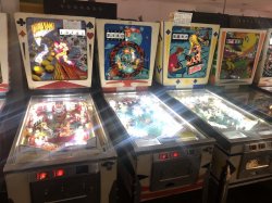
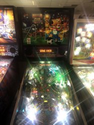
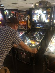
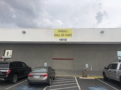
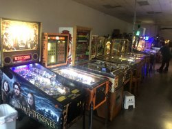
BroName & I both grew up enjoying pinball machines so the Pinball Hall Of Fame was an obvious must see for us. I had been here in 2010 but since he had not, I was more than happy to visit again. Its located at 1610 E Tropicana which is a few miles east of the Strip and quite close to the airport. The hall of fame is basically a large warehouse type room containing over 200 machines (mainly pinball but also arcade games) from all eras. There’s plenty of old machines from the very early days of pinball right up to the modern day. For anyone who likes this kind of thing its definitely worth a visit however a bit of a negative is that with so many machines the operators struggle to keep them all in perfect order.
F1E00A26-A48E-43CB-A9FF-9F3958A2C392.jpeg

10ACFBF7-05BB-4148-8DAF-6E01F0D2DB1D.jpeg

B420CAD1-FC8F-4A70-B588-636B4942B92B.jpeg

363A6444-F44D-448E-BD43-AAA0C85F4032.jpeg

4EBF33A5-6DB0-40FE-92C0-C5D6DAFEAC7B.jpeg

B73E7B2B-4D75-4423-BFA8-65F69B1BA039.jpeg

BroName plying his trade:
8D40EA76-F189-4721-B369-3BB7756B0AAE.jpeg

We played some of the machines for an hour or so before jumping back in the car to our hotel for another afternoon swim and short rest.


Drive along the Strip:


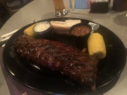
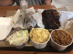
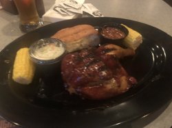
Refrehsed, we jumped in a cab to another place that I had visited in 2016 – Ellis Island. This is located one block back from the strip behind Bally’s and was recommended to me by another forum member last time as a must do for their BBQ restaurant. It was great then and it was great again this time. We arrived and wandered through the small casino straight to the restaurant. Our order was a no-brainer: full rack of ribs and a half bbq chicken for us both to share. I had missed out of the chicken last time and was keen to try it. The verdict was it was pretty good but the star of the show was again the ribs. The slot club card gives a few dollars off the price and with this discount we ended up paying US$24.98 plus tax. A bargain for what was a sensational meal.

The Chicken:
201172B1-42F7-4EB2-86A7-97A77A32819B.jpeg

The Ribs:
1FB69E2F-EFD0-42B8-AA88-B1D590276455.jpeg


After dinner we played a few of the games (unsuccessfully) while sampling a few of the microbrews on offer (the IPA was fantastic). This is a great smaller venue away from the hustle and bustle of the strip. Its definitely in my list of must dos. Fully satisfied we walked back towards the hotel, stopping off at a few places to play a little or just take a look. Eventually we found ourselves back in our room. The brief Vegas adventure was over and were ready and excited to embark upon the main reason for the trip…….
 
The Frequent Flyer Concierge team takes the hard work out of finding reward seat availability. Using their expert knowledge and specialised tools, they'll help you book a great trip that maximises the value for your points.

AFF Supporters can remove this and all advertisements

Las Vegas to Lone Pine


While Vegas was good fun as always, the brief 2 day stop was really only a sideshow to the real purpose of our trip. It had allowed us to recharge the batteries somewhat before we set off for a week of hiking in the southern Sierras and Yosemite. We checked out and were on the road by 5:30am. This gave us enough time to make the approx. 4hr drive to Lone Pine plus stops at various locations in Death Valley and be there in time to pick up some hiking permits.

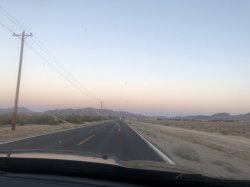
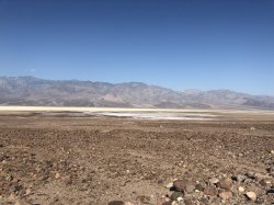
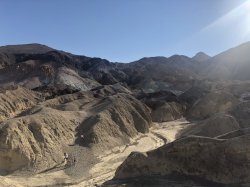
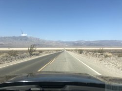
Off we went and about 45 minutes later we were passing through Pahrump. I had made a brief stop here last time for a cheap casino buffet breakfast. No stop this time, we went straight through town and on to Death Valley. Another hour and we passing through the national park entrance. I won’t thoroughly review our time here as I did this LAST TIME, however I will provide some commentary for a few places that weren’t on the previous itinerary. I will also say that this remains an amazing place with some spectacular scenery. If anyone has the opportunity to be in the area I highly recommend it.

18C45826-3527-4E14-B58A-7F278CE6FF19.jpeg


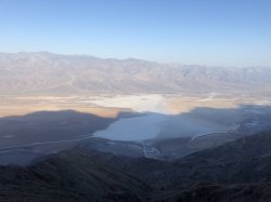
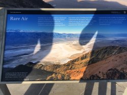
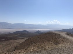
First up was Dantes View. Hands up Star Wars nerds! Some may recognise this view as looking down on Mos Eisley. I’m not a huge fan of the films (don’t dislike them) but still felt I should prepare a relevant quote to see what BroName’s reaction would be. He had no idea what I was talking about until I explained the link. Apart from being a Star Wars location, Dantes View is basically a lookout at the top of a mountain range overlooking Badwater Basin below. Badwater Basin is a major point of interest as well which will be explained shortly. The view up here was simply stunning. Well worth the visit.

D5E376D0-F054-4AB6-B0F5-D72A915ED50B.jpeg


43184636-4520-4357-A44A-1330EF226747.jpeg


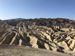
Zabriskie Point (reviewed last time):
7485C1C2-9AD5-42C0-BD1E-96966F522EE7.jpeg


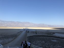
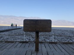
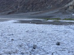
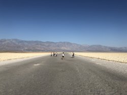
Next up was Badwater Basin which is significant in that it is the lowest point in North America sitting at 86 metres BELOW sea level. There was quite a crowd already gathered here at about 8am which probably wasn’t surprising since it would soon become prohibitively hot. It was interesting to walk out onto the flats and see the salt accumulation everywhere. Again, this is a major tourist spot in the park and basically a must see.

A62E3512-5384-43C2-8938-32AA3D195231.jpeg

789EDE31-C8C7-4C2A-B396-32BAD9B53938.jpeg

A41ED558-0CD6-4074-A58B-A8543AF3F15F.jpeg

A151CFB9-C8AE-42F1-918B-F948B61838C7.jpeg

CA2E6D5A-DBAB-480A-9D4B-BFE9BB87828B.jpeg
 
Las Vegas to Lone Pine Continued......


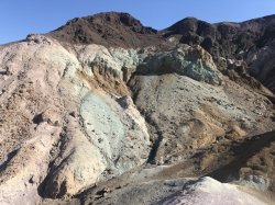
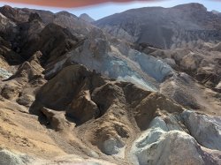
Back up the road was Artist’s Pallet which is a rock formation on the side of the mountains noted for its variety of different colours. Think greens, purples, pinks, oranges etc. The different colours are caused by the oxidization of the different metals contained in the rock. The photos here don’t really do it justice due to the time of day and my less than perfect photography skills, however it’s definitely another must see.

4ADCBFE8-F32E-487F-A7E6-5F7689997647.jpeg

299D6A05-EBD7-4B63-A07D-E5CBD1CA027B.jpeg

D9876268-0C24-4949-B0B4-E1D3F604F39D.jpeg


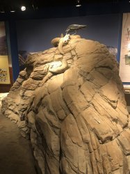
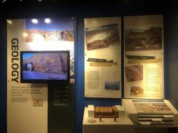
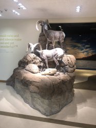
Stopped in at the Furnace Creek Visitor Centerfor a look around and to grab a bite to eat. It’s the main visitor centre in the park however is still quite small. It contains a couple of interesting exhibits though and the thermometer outside is worth taking a photo next to even if it does occasionally malfunction.

CF643DEC-81BC-467D-BC06-F9D032710747.jpeg

8415650F-71F6-4CC0-9EA8-541A8456FCB2.jpeg

21617B93-24DE-4989-8AC0-98567D8F6415.jpeg

From here we were off towards the west side of the park but before exiting we stopped at another place that I visited last time – Father Crowley Point. Its basically a scenic vista with great views. Last time I didn’t leave the parking lot but this time I was interested in driving the half mile down a dirt road to the real view spot. It was very bumpy and rocky and it possibly wasn’t the best idea to go down in a rental car but in the end we made it with the car still intact.

BDF6EBE6-3B3D-4A55-BEAF-02BEB4395241.jpeg

C1D56272-88B5-4E59-827A-D1C341FCE01B.jpeg
 
Las Vegas to Lone Pine - Finding What We Were Looking For........


We continued on and were soon leaving Death Valley National Park behind and were on towards Lone Pine. We did have one more spot to stop before we got there though. BroName had been smart enough to download some relevant maps onto an app on his phone so when our “GPS” carked it we were still able to find points of interest. I asked him to put a coordinate in to his phone:


36.33088, -117.74527


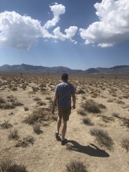
Just over 14 miles after leaving Father Crowley Point we pulled over, hopped out of the car and made the approx. 400m walk through the desert trying to avoid what appeared to be many rattlesnake nests.

0BDC7C5A-0891-4BD2-BC76-3ACE6269DFDF.jpeg

Before too long we could see the sunlight reflecting off what looked like a metal object and we knew we were close. A couple of minutes later we had found what we were looking for.

B4BCFD41-833E-498C-AA47-4DAA639ABB0C.jpeg

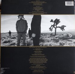
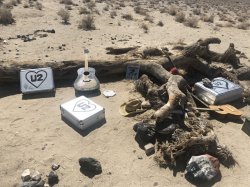
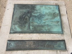
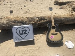
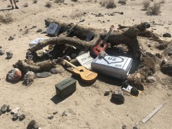
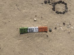
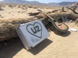
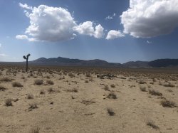
Many people think that the Joshua tree seen in the artwork of the famous U2 album of the same name is in Joshua Tree National Park but in actual fact it is located just outside the west entrance of Death Valley National park. There are many Joshua trees in the area, an entire grove if you could call it that in fact, all along CA190 for a few miles at least. The tree from the album however is basically by itself with no others close by. The tree has since died around 15 years ago but fans of U2 have made a kind of shrine to the band, leaving memorabilia, guitars, photos etc around it. THE Joshua Tree was worth the stop. If you are a U2 fan or just a music fan in general, this is a cool place to visit.


Instructions for finding it (other than plugging in the GPS coordinates above):


-Route 190, 14 miles West of Father Crowley Lookout near the West entrance to Death Valley National Park, or, 13 miles southeast of Keeler on Route 190. The tree is found on the South side of 190, about one quarter mile in from the road.

590FFF98-CA59-4800-81B2-551A2B53C6D8.jpeg

0A76BC8D-D2A7-45F0-81BC-9385FC79B346.jpeg

20EF1F35-4AAB-4C96-93E8-34444BB387AA.jpeg

873F1C6D-3BB4-48E7-9B1A-B3A3A9B40429.jpeg

4DF37DC0-34ED-40B6-BD39-55300E03CC5D.jpeg

12845741-CE2B-4FA8-A187-4E39BBAC9A2D.jpeg

305CA4B6-25C4-408C-A925-71F742DADFF9.jpeg


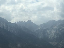
From here is was a simple drive of around an hour to Lone Pine. As we got closer the Sierras came in to view and wow they look impressively imposing. They got bigger and bigger as we drove and before long we were on the home stretch and pulling into the motel parking lot…….
 
Lone Pine – Day 1


It was around midday when we hopped out of the car in the parking lot of the Comfort Inn Lone Pine. We had chosen this place basically by default as I had been a little slack with booking something here. About two 2 weeks prior to departure I had finally gotten around to searching for somewhere to stay in Lone Pine and had discovered very little available. To be honest I should have realised that accommodation in a small town like this would be in high demand during the summer months so the fact that we were forced to pay A$679 for a 2 night stay in a typical motor inn style room was my own fault. Still, it was in a reasonably good location on Main St about a mile from the small centre of town and the room was perfectly acceptable for what we needed. Nothing exciting at all about the room so no photos here.
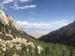
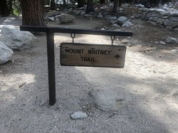
The reason for visiting Lone Pine was that it is the town closest to the trailhead for those wanting to summit Mt Whitney and yes, that’s exactly what we were going to attempt to do. For those who are not aware (probably almost everyone), Mt Whitney is the highest mountain in the lower 48 states. It tops out at just over 4,400m above sea level. The hike itself requires no mountaineering experience, just the ability to follow the approx. 17.5km trail from Whitney Portal (2,550m above sea level) to the summit. My last trip had involved hiking to the top of Half Dome in Yosemite. This was a fantastic experience and having achieved that goal was extremely satisfying. However, I now knew that I could do Half Dome, so I was looking for a bigger challenge and this seemed like a good option.


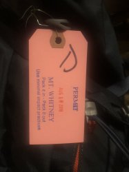
As with many/most of the wilderness areas in the Sierras, climbing Mt Whitney requires a permit. Each year in February & March entries are taken for the Mt Whitney lottery with results advised in early April. Options are for day permits (hike to be completed in 1 calendar day) or overnight permits (hike to be completed in 2 or more days). With only 100 day permits & 60 overnight permits issued each day, the popularity of the lottery means that chance of success are low. And this was proven when both myself & BroName were unsuccessful in our entries. A month or so after the lottery I was scanning the permit website and came across a single cancelled permit on the exact date we had been looking for. Only 1 though, we needed 2. I snapped it up of course with the plan to turn up the day before and hope for a no-show. If we were unsuccessful in obtaining a permit for BroName we would do a different hike in the same area.

Having joined a Mt Whitney facebook group and read a couple of internet forums dedicated to the mountain I came to be more confident that we would indeed get the extra permit. Consensus was that there would be several no-shows each day and that the chances of picking one up as a walk-in the day before were very good. Additionally I found that simply asking the facebook group if anyone had a spare permit in their group yielded almost instant results. So if anyone happens to want to try this hike do not worry, you should not have much trouble obtaining a permit.

So, BroName’s walk-in permit: we had to go to the Eastern Sierra Interagency Visitor Centre (across the road from our hotel actually), firstly to pick up my permit but also to put BroName’s name down for the daily lottery. When we heard they had at least 10 no-shows and only 6 people registered for the daily lottery we were in! We were hiking up the Mt Whitney Trail the next day – Saturday 18 August. We were given the mandatory spiel about the wildlife in the area, pack out all your rubbish before being given a lovely little plastic pack containing bag and some kind of air freshener pounder for doing you *cough* business in. Yes, they do mean pack out ALL your rubbish.

The lucky ticket!:
IMG_8772.JPG


With permits secured we decided to drive up to the trailhead and have a look around so that we knew where to go the following morning. Did I mention we needed to be on the trail just after 2am? So yes, knowing where to go would be helpful in the dark. It was about a 20 minute drive up to Whitney Portal where we asked where the best spot to park the next morning would be before hopping out to hike the first part of the trail. It really was beautiful around here and despite it being obvious from the outset that the hike would be very difficult, we were glad to be there. We hiked about a mile up the trail before returning to the portal.

IMG_8760.JPG

IMG_8770.JPG

IMG_8762.JPG

IMG_8764.JPG

IMG_8765.JPG


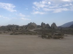
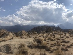
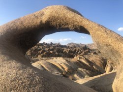
Next we headed back down towards town with a stop on the way in the Alabama Hills. This is an area of hills and rock formations just outside Lone Pine. They are a huge contrast to the surrounding area with very few trees and lots of red dirt and rocks. We stopped off to find Mobius Arch which, as the name suggests is a rock arch that looks like a mobius strip. Additionally when looking through the arch is forms a perfect picture frame with Mt Whitney in the background. There is a short loop which begins and ends at the carpark and wanders through some of the rock formations.

IMG_8794.JPG

IMG_8771.JPG

IMG_8801.JPG


Dinner time came and we headed up the road to the Mt Whitney Restaurant (original name right?) which was basically a road house filled with photos and other paraphernalia related to Mt Whitney and the surrounding area. Grabbed a quick burger (Not the Mt Whitney burger) to fill up before heading back to our motel for a very early night. As I said, we were going to be on the trail just after 2am so that meant a 1:30am alarm call. Not something we were looking forward to but given the length of the hike we were going to be attempting, it was unavoidable………
 
Lone Pine – Day 2


Alarm went off at 1:30am and we were up in a flash! In truth I don’t think either of us slept particularly well as we had been filled with anticipation. The adrenalin was pumping. A quick shower and change into the hiking clothes, grabbed our already packed bags and we were in the car and off to the portal. 20 minutes later we were pulling into a parking space about 50m from the trailhead. Perfect! If nothing else, being this close would be a huge positive come the end of a VERY long day!


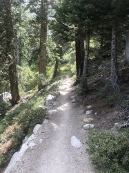
And off we went – up and up and up! The spot about a mile in where we turned around the day before came and went.

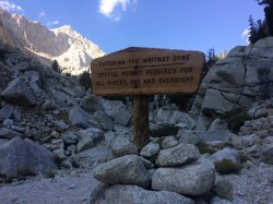
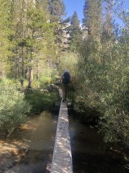
We crossed Line Pine Creek over a series of log bridges and before long we were entering the Mt Whitney Zone. This is the point where can hike to without a permit. After this, if you’re caught without one you risk a fairly large fine. We had bashed out about 2.5 miles in the first hour and had a short rest.

Continuing on ever upwards we reached Outpost Camp after about 2hrs. Outpost Camp is just under 4 miles into the hike and is one of the two camping spots permitted along the hike. We stopped for a bit of a rest and a bite to eat. At around 10,300ft above sea level, I was starting to get a bit of a mild headache. This was consistent with the symptoms I had had on previous hikes around this elevation. We sat for a while and then continued on.

IMG_0756.JPG

IMG_0759.JPG

4dd3ac0e-b66a-4fc9-96d7-0566ccaa35fa.jpg

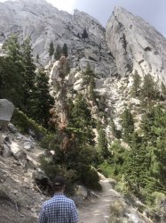
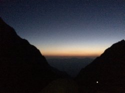
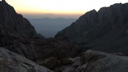
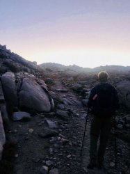
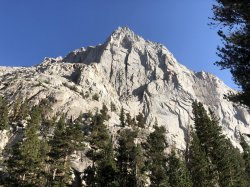
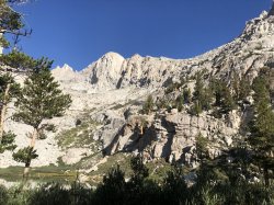
Up and up some more and the morning sun began to poke its head above the horizon revealing some amazing scenery. We had made decent progress but it was obvious that we were slowing. The going seemed to get tougher and we had to make a few more stops. My headache was getting worse and at times I was beginning to feel a little sick. This was altitude sickness, not a lack of food. We stopped for a while to give my body the chance to regroup and after about 20 minutes I was feeling good enough to kick on again. Unfortunately it was short lived. 15 or 20 minutes later the nausea returned. We spotted the sign for Trail Camp up ahead and that’s when I called it. I touched the sign in a sort of proof to myself that I made it this far before half stumbling to the rock about 10 metres off the trail and vomiting several times. While very disappointing to have to turn around, there was simply no way I would be able to safely make it to the top. I tried to make BroName (who was feeling fine) continue on but being the good great hiking partner that he is, he insisted on heading back down the mountain with me.


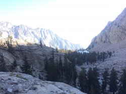
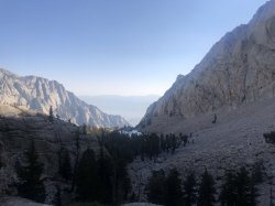
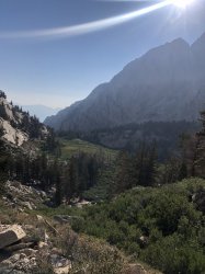
The story of the hike down isn’t anywhere near as interesting other than by now it was daylight which meant that we actually got to appreciate the fantastic views around us. The symptoms subsided pretty quickly which was good and made the trip down a lot easier. It seemed like every group was passed asked us if we made it to the summit. No guys, not today we didn’t ☹. Down we went making good progress. The knees began to hurt a little as we went but that always happens on the way down. On and on we went before eventually maybe 3hrs later we reached the trailhead again. Safe and sound.

IMG_0757.JPG

IMG_8788.JPG

IMG_8781.JPG
IMG_8782.JPG

IMG_8785.JPG

IMG_0758.JPG
IMG_8789.JPG


So why didn’t we make it to the top? I had only given us a 50% chance of making it before we started anyway, but why were we unsuccessful? Well yes, obviously altitude sickness was the reason but why did I get it and what could be done next time to give me a better chance of summitting?

  1. Lack of time spent at altitude prior. Unfortunately timing meant that we really weren’t able to schedule in any time to acclimatize at all. Sure we could have skipped Vegas but it was part of the itinerary and we were both keen to have a short visit. Ideally we would reach Lone Pine a day early and perhaps camp the first night at much higher altitude.
  2. In the two weeks before departure both BroName and I had been struck down with a cold. I don’t put nearly as much weight on this as the previous reason but it definitely played a part.
  3. Next time we will attempt Mt Whitney as an overnight hike. This will aid in the acclimatisation as well as break up the hike into much more manageable portions. I would probably begin right on midnight and hike to Outpost Camp for several hours sleep. In the afternoon I would hike up to Trail Camp and spend the night there. Wake up early for a pre-dawn summit attempt. Sounds simple? We will see!


We jumped in the car and headed back down to town. Straight to the hotel for a shower and a sleep. It was still only around 10:30am but we were definitely up for several hours of rest.
 
Last edited:
Lone Pine - Day 2 Continued.......


We got up mid-afternoon and pottered around the room for a bit before heading out. Asked the guy at the front desk for a dinner recommendation and he pointed us to the BBQ place down the street. Done!

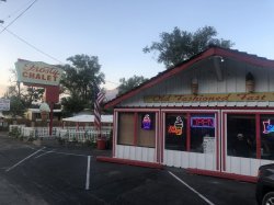
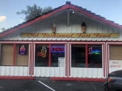
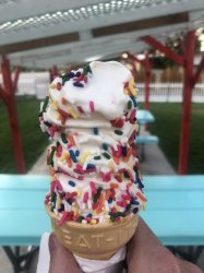
Headed down the road to a place we had seen the previous day – Frosty Chalet! Just your typical small town burger and dessert joint. Not much in the way of top quality but had what we wanted:

IMG_8807.JPG
IMG_8805.JPG
IMG_8806.JPG

From there it was back up the road to the Lone Pine Smokehouse for some BBQ. I can’t recall the menu deal we purchased and it doesn’t appear to be on the menu but it was 2 decent servings of the meats plus 3 sides for US$32 plus tax. The guy at the Comfort Inn had told us this place was expensive and maybe it was for this part of the world but for us it seemed more than reasonable.

IMG_8808.JPG

IMG_8804.JPG

We were now totally full. Since it was now getting to be twilight and since we were still quite sore, we called it a day and went back to the room. BroName decided to jump in the outside pool which was nice enough but not nice enough to get me in. In any event, he was back in the room soon as well and we were heading off to bed.
 
Stopping overnight at a camp spot will lessen the chance of altitude sickness.
But also a good idea to consider taking some diamox for prevention.
The fact that you had a headache previously at a similiar altitude means you are one of the unlucky ones to be prone to altitude sickness.
You did the right thing coming back down.


We both took Diamox in the week leading up but no help unfortunately. We are already planning a return with a hiking itinerary that will give us the best possible chance of summiting. Probably 2021.
 
Lone Pine to Lee Vining


We weren’t in a huge rush and so took the time to have the complimentary breakfast provided by the hotel. Nothing flash, just unappetising cereal, some bacon, powdered eggs, waffles. I just had a waffle and some bacon and left the rest for others.

We loaded up the car, checked out and then we were on our way up the highway. Final destination for the day was Lee Vining which is a small town on Mono Lake that serves as a kind of gateway to the eastern entrance of Yosemite National Park.

Originally we weren’t going to be staying in Lee Vining. I had booked 5 nights in Yosemite and were had planned to go straight there from Lone Pine. However, about 6 weeks before we were due to arrive I started coming across stories of wildfires in the area to the west of Yosemite. I didn’t think anything of it for a couple of weeks until the size of the fire began to grow and grow with masses of smoke causing significant visibility issues in the area as well as posing health risks. The conditions at that time would have made it unsafe for us to hike in the Yosemite Valley area. I found myself monitoring containment and smoke reports multiple times a day. With 3 weeks to go before our departure I discussed the issue with BroName and we agreed to book a backup room in the event that the fire was not contained. Closer we got to our arrival date and still no full containment, and infact for a period of about a week Yosemite Valley was closed. Now I was really worried. Finally, firefighters seemed to get the better of the fire, Yosemite re-opened, smoke conditions improved and we were satisfied that we would be able to continue our visit almost entirely as planned. We made one small change – instead of 5 nights in Yosemite we decided to spend the 1st night in Lee Vining before moving on to the park.

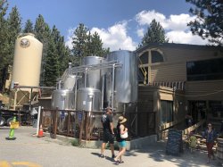
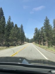
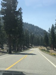
We set off from Lee Vining up US395 to the east of the Sierras, through the small towns. Filled up gas in Bishop as I wasn’t making the same mistake as last time and leaving the fill up till later where the price would have been 25%+ higher. We continued on until we reached the turnoff to Mammoth Lakes. While the town is primarily a tourist town with the Mammoth Mountain ski fields used in the winter and many hiking trails in the summer, we were there to visit the Mammoth Brewery.

IMG_8822.JPG

IMG_8821.JPG


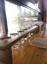
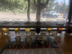
We wandered in to find your typical microbrewery type setup with a small tasting room for drinks as well as another smaller section taking food orders. They do a wide variety of different beers which change from time to time. Many are named after different places in the surrounding area as you would probably expect. Our eyes were immediately drawn to a couple of different tasting paddles and as we both felt that we would like to try all the beers on offer, we decided to get one of each paddle and share. 12 different beers plus a non-alcoholic root beer. As I said they do a wide variety and the paddles included browns, Kolsch, Vienna lager, IPAs and much more. For me the clear winner was the Epic IPA though followed by the IPA 395 – hey I like my IPAs.

IMG_0761.JPG

IMG_8818.JPG


We continued on up the highway via a short detour through the Mammoth Scenic Loop. Yep, it was scenic.

IMG_8825.JPG

IMG_8826.JPG


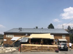
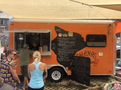
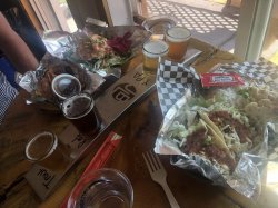
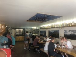
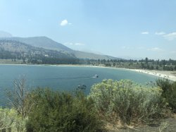
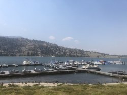
Another 25 min or so up the 395 and we came to June Lake Loop which as the name would suggest is an approx. 18 mile loop rood around a few beautiful lakes – June Lake, Gull Lake, Silver Lake & Grant Lake. The only real “town” on the loop is June Lake and there’s a popular beach, boat ramp etc as well as another small ski area. Again, we were not coming for these activities but instead for lunch and another microbrewery. June Lake Brewing is located in the middle of town just under 3 miles from the turn off of CA395. The town is really quite small so its easy to find. In the brewery carpark is Ohanas 395 which is simply a food truck serving Hawaiian food. Its very popular and there was a pretty decent line when we arrived. Even so, it moved quick and in a few minutes we were putting in our order – Hawaiian tacos for me & the Poke Bowl for BroName. As they work closely with the brewery they have waiters to bring your order inside for you. We took the opportunity to go and grab a table and another small tasting paddle of beer while we waited.

IMG_8835.JPG

IMG_8836.JPG

IMG_8837.JPG

IMG_8839.JPG


The tacos were great. Plenty of filling with a side of rice also. The definitely hit the spot. I didn’t try BroName’s poke as its not really my thing but he seemed to enjoy it as well. Would not hesitate to eat this again. The beer was not quite as good I have to say. Maybe it was the venue being much smaller/more crowded or that I had already had the tasting paddles an hour earlier but I didn’t enjoy it as much as Mammoth. Still, definitely worth a lunch stop in an area that it certainly worth a detour for.
 
Last edited:
Stopping overnight at a camp spot will lessen the chance of altitude sickness.
But also a good idea to consider taking some diamox for prevention.
The fact that you had a headache previously at a similiar altitude means you are one of the unlucky ones to be prone to altitude sickness.
You did the right thing coming back down.
Would heaps of beer help with prevention @drron ?
Asking for a friend.
 
Lone Pine To Lee Vining Continued.....


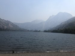
We continued on around June Lake Loop passing the other lakes one by one:

June Lake:
IMG_8832.JPG

IMG_8841.JPG

IMG_8844.JPG

Silver Lake:
IMG_8848.JPG

IMG_8853.JPG


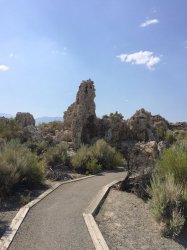
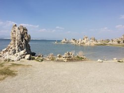
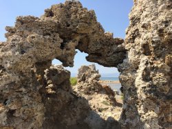
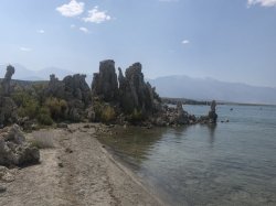
We reached the end of the loop and the junction with US395, turn south for about 400m before turning off and heading about 5 minutes down the road to the shores of Mono Lake. Ok so big lake, what’s the big deal? Well, there are several things to do here including walking, looking at the wildlife etc, however probably the most well known feature of the lake are the Tufa formations. Tufa are just limestone towers which look kind of like stalagmites in caves. I won’t try to explain the geologic process that sees them form but that kind of information is easily found if you are interested. The Tufas at the southern end of the lake are the most visited and we took a walk around the South Tufa loop which is about a mile long. Mrs NoName and I had been here in 2010 and I was interested to see it again.

IMG_0762.JPG

IMG_0763.JPG

IMG_0764.JPG

IMG_0765.JPG

IMG_8864.JPG


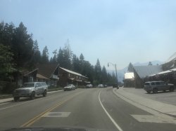
Back in the car for a short ride into town to our hotel – Lakeview Lodge in Lee Vining. One night here was just under A$250, not too bad given the prices in the area. It is pretty much one of those motor lodges where you park your car outside your room. Similar to our place in Lone Pine actually. Two beds in separate rooms, a bathroom and that was about it. Perfectly adequate though and would stay here again.
 
Lee Vining - One Night Only!


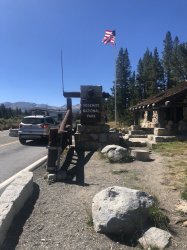
Being so close to Yosemite I was itching to show BroName why I love it so much so after a short rest, at about 3pm we jumped back in the car and made our way up to the eastern entrance at Tioga Pass.

Always an uplifting sight:
64C8A53A-2E1A-44F0-BB77-76B5DDEF7809.jpeg

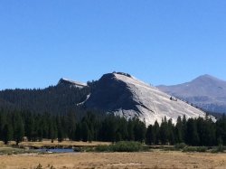
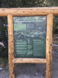
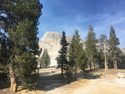
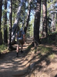
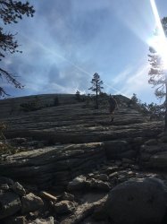
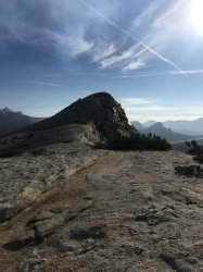
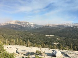
We made our way along Tioga Rd towards Tuolumne Meadows where pulled over and found a park at the Lembert Dome trailhead. Lembert Dome is a prominent granite dome just to the east of Tuolomne Meadows. While it well and truly stands out in the surrounding area, it isn’t in the same scale as some bigger domes and mountains in the park. It was however a good way to stretch the legs after the previous day’s escapades. We set off along the trail and were looking at a around a 4.5km round trip with about 300m elevation gain. The trail basically makes its way around one side to the back of the dome where you then make your way up to the top via any route you like. The first part of the hike to the back was harder than expected as it was reasonably steep and relentless. Once we got to the actual climb up the dome however it was a short simple scramble to the top for some fantastic views out over the meadows below.

72200C3F-E6AE-407F-BC36-AB51CF6C9F35.jpeg

CF24D8B2-D19B-4D56-B023-10E879D70C46.jpeg

AF5889A9-8132-46B2-ACEE-C6206E445953.jpeg

C4D250DA-1A01-4A5D-9DED-DE815009A6A5.jpeg

4AC7FF0E-DD54-422B-B896-E6050A636773.jpeg

87B62599-E7CE-40DF-B2DB-3FA19737D63A.jpeg

FACE014D-FEA4-48D3-AD68-B2BC42E75E01.jpeg


We were back in the car about 6pm and headed back down to our hotel in Lee Vining.


Great views on the way down:
6BCF1E3E-522B-43E2-A89C-AFB52295C4E3.jpeg

29EEB12D-D478-48A3-AA6C-C1DAE4B09185.jpeg


Parked the car, went and got changed and then wandered around the corner to look for something to eat. We came across what looked like the only place of note in town, Bodie Mike’s (Im sure there were other decent offerings). This was another BBQ place and the menu consisted of the usual variety of ribs, steaks etc. We grabbed a table out on the outside deck which offered good views out across the highway and towards Mono Lake. Definitely the place to sit on a nice warm summers night. We decided to order something a bit smaller tonight and both went for one of the pulled pork BBQ sandwich which also came with chips and cole slaw. Another big meal but hey that is par for the course in this part of the world. Sandwich was decent enough that I would return.

With dinner out of the way we were ready to call it a night. Wandered back to the hotel, quickly in to bed and ready for Yosemite the next morning!
 
Last edited:
Very nice trip report.

I grew up with pinball machines. My uncle had an amusement centre in Cowra and Young in 1972. I love the old retro analogue pinball machines and the beginning of the digital pinball machines. Good to see Domino and High Hand again. My favourites were Flash, Buccaneer and Wild Fire. I can spend hours playing passing the time.


Glad you like it!
By Flash do you means Flash Gordon? Have played that quite a bit in a pinball club I go to here in Brisbane. All time favourites are The Adams Family & The Twilight Zone.
Stick around. There will be 3 more pinball places in the report.
 
Glad you like it!
By Flash do you means Flash Gordon? Have played that quite a bit in a pinball club I go to here in Brisbane. All time favourites are The Adams Family & The Twilight Zone.
Stick around. There will be 3 more pinball places in the report.
Excellent.

I don't remember much about Flash Gordon. Looking at Google that's a 1981 pinball released by Bally. The Flash pinball I remember is a 1979 release by Williams and I remember playing that quite a lot in a Belmore fruit shop from Year 9 - Year 12.
 
I grew up on the pinnies too - infact, I learnt on "Flash Gordon". Great machine. "Addams Family" is also one of my all time favourites. The others being "The Empire Strikes Back", "Highway Speed 2: The Getaway", and an old "Playboy" machine that caught my attention for some reason.

Great report - looking forward to more!
 
Nice report...the pokies in Vegas don't get any money off me but the Pinball Museum always does.

Have had a quick visit to Yosemite (and other national parks) but definitely more to see and do there next trip...whenever that is...
 
Status
Not open for further replies.
Back
Top