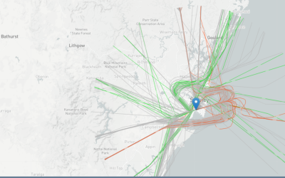
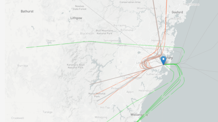
Flight paths for Western Sydney Airport

Last edited:
Not really sure why some of the diagrams in the previous post post show impact to Sydney proper during the day; doubtful any approach to WSI would start over SYD they are no where near each other. SMH seems to indicate all impact is well west of the city.

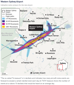
Flight paths Vs noise contours at ground level at various dB. And yes, those ARE the main proposed flight paths, starting/passing over Sydney etc - I guess where they've been put is a function of required aircraft sink rate, other traffic from SYD, Blacktown, Camden, also military and population centres. @AviatorInsight or @jb747 - any observations on their usability/ease of use from a pilot's point of view?

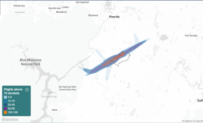
The SMH showed just one of the 4 or more combinations of noise distribution depending on runway direction used, coughulative or one-off events, and night or day operation and of course the contours change as the flight intensity increases over time, and the aircraft used changes (projected).

If people go to the 'Noise tool' at the wsiflightpaths link above, they'll find
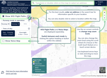
1687849774539.png

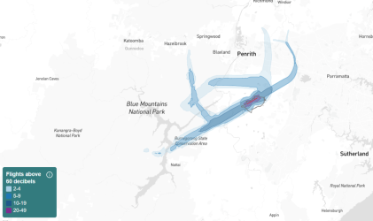
Lots of different perms and coms. This for N60 using runway 05 in 2030
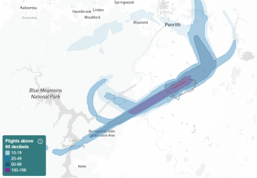
1687849904361.png

Runway 23 N70 in 2033


1687850050235.png

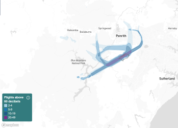
Either runway, overnight, 2033

1687850152793.png

Same, 2040

1687850195325.png
 
But all the noise tools as show above show the noise contained to the very outer western burbs (really lower blue mountains/penrith) again not remotely near the city at all.

I remain unconvinced anyone living near SYD would be hearing any flight path noise for aircraft landing/departing from WSI - simply too far away.
 
The Frequent Flyer Concierge team takes the hard work out of finding reward seat availability. Using their expert knowledge and specialised tools, they'll help you book a great trip that maximises the value for your points.

AFF Supporters can remove this and all advertisements

I remain unconvinced anyone living near SYD would be hearing any flight path noise for aircraft landing/departing from WSI - simply too far away.

Correct - the noise contour distributions show that. But flight paths and noise distributions are different illustrations for different things. If they just showed the flight paths where the noise reaches the surface, people would simply ask - OK, where will the planes fly after that? What are you (air authorities) hiding?

And I guess the tool they have provided provide information for all interested parties - not just residents worried about noise.

They are making a rod for their own back because the more information you put out, the more people will pick it apart, not understanding it, but I guess they know they are in for a hiding from the NIMBYs anyway, so may as well get it out there.

As an aside, here are flight paths for SYD shown under different conditions from here. The spread of paths shown is about the same as for WSI above.

1687863346306.png

1687863399650.png
 
I'm interested in the runway alignment and its position relative to the usual wind patterns.

Also To what extent does wind play a part in sound propagation
 
Last edited:

Enhance your AFF viewing experience!!

From just $6 we'll remove all advertisements so that you can enjoy a cleaner and uninterupted viewing experience.

And you'll be supporting us so that we can continue to provide this valuable resource :)


Sample AFF with no advertisements? More..
Back
Top