




Undersleeping in Uzbekistan

Samarkand, part one

Sergey Yesenin, the brilliant Russian lyric poet, used his trip to Samarkand in 1921 as his main foray to the East to inspire his series of poems called the Persian Songs. It's an ideal vision of the Orient, too idealised to take seriously now, but that was what he escaped to from the turmoil of revolutionary Russia and his own personal life. One of my favourite poems from that cycle begins:

Never have I set eyes on the Bosphorus.
So please do not ask me what it's like.
I have seen the fair sea in your glances.
With a shimmering blue flame alight.

(Translation not mine this time - here is a wonderful lyrical translation by Peter Tempest.)

Yesenin never did set foot in Iran or Turkey. He had four marriages, with one to an American dancer 18 years older than him, before committing suicide at age 30.

One could ask if the blue flame was not just the imagined sea, but directly inspired by the blue of Samarkand.

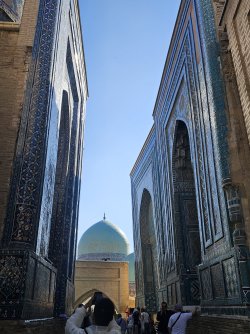
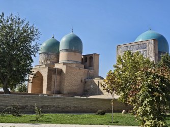
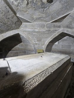
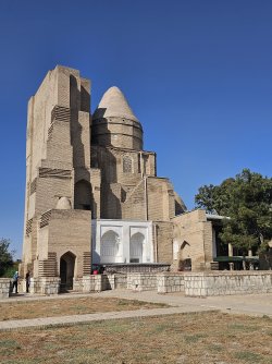
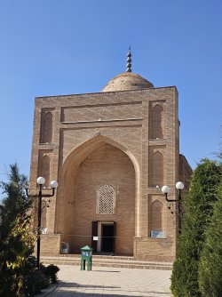
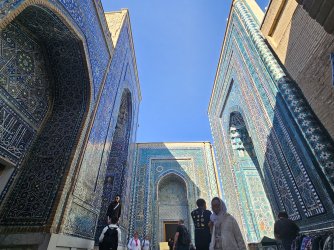
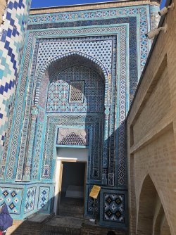
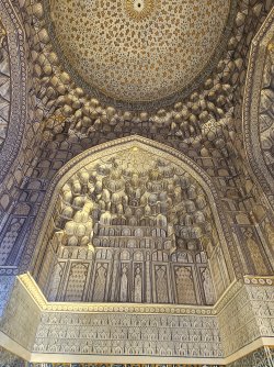
I headed to the Shah-i-zinda necropolis after arriving, sleep-deprived:
1000053669.jpg
The complex is made up of many structures spanning the 11th to 19th centuries, including several mausoleums both from Tamerlane's reign and the following Timurid period.
1000053663.jpg
1000053671.jpg
1000053675.jpg

Then I had to do boring stuff.

Laundry - Samarkand, despite its population of 600,000 and endless tourists, does not have a self-service laundromat. I went to a dry cleaners who does 1 kg of clothes for $5 - and returned them to me folded as well.

SIM card - I had bought an e-sim but the signal was pretty weak even in parts of the city and overall it was just slow. Plus it was quite expensive - about $40 for 5 GB. As my 5 GB has run out I decided to get a local SIM card. The national mobile carrier here is called Uztelekom. There are a lot of stalls unofficially selling SIM cards, but I decided to go to a licensed outlet.

Plugged Uztelekom into Google Maps and got the Samarkand branch. I expected it to look like a Vodafone store, with lots of phones in glass cases and a section for SIM cards, but it looked like a Centrelink office. Take a number and sit down.

Legally, you need to have your passport registered when you activate a SIM card, which is why I didn't go to the unofficial stalls around the city. If you've been in the country longer than 3 days, you are also required to be registered by your accommodation provider with the Ministry of Internal Affairs. Make sure you ask your hotel for the registration slip. You can be asked for it when you leave the country, and in this case they needed it and my passport to give me a SIM card.

It was 15 GB for $8, and it's fast and reliable so I can now Google about the stuff I see when I'm out and about. I imagine it would've been easier if I'd gotten it in Tashkent, but got there in the end.

The last order of business was seeing a dentist. I am not sure if this topic is of interest to anyone, but since I've overshared about my personal life already, I'll go ahead.

My filling chipped off a few days ago and it's starting to cause problems. This is unfortunate timing because I don't want to get dental work done here but don't want to wait until I get back to NZ.

From my research, the biggest concerns with dental tourism is sterilisation of equipment, just like getting a tattoo overseas. Of course the cost of dental work here is orders of magnitude lower than in Aus/NZ but saving a few hundred/thousand dollars just to get hepatitis C is a Very Bad Idea.

The former USSR countries produce many times more dentists per capita than in Australia. This is a holdover from the Soviet medical education system where dentistry is the easiest stream of med school to enter, and there are essentially no caps on graduates the same way our medical student numbers are limited, for example. There are also low regulatory standards for starting a private dental clinic.

Hence you will see the ubiquitous stomatologiya signs on your travels in this region, but they might not be up to the standards we have back home.

I found a clinic that used gold standard sterilisation and the whole thing went well if not a little casual - booked the appointment via Telegram, went there with no reception to register at, just waited until the dentist came to get me, and then at the end I paid him in cash directly. But the actual work seemed very professional, and it was the head dentist himself not his junior staff who saw me. He didn't even charge me a tourist tax - it was $30 for the whole thing, which is actually on the lower end of Uzbek prices.

So, if you do find yourself in need of emergency dental care in the post-USSR countries, just make sure you get in touch with them via Telegram/Whatsapp first and ask about their sterilisation techniques. Have Google Translate ready when you get there, and then sit back, relax, and pretend you enjoy the flight.

I checked into my hotel after. The Western chain hotels are eye-wateringly expensive here, with the Accor ones being at least $400 a night. The local 4-star hotels are in the $100-150 range and I went with the Medina Hotel.

1000053703.jpg
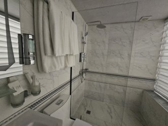
The room was quite spacious

1000053702.jpg
As was the bathroom

1000053704.jpg
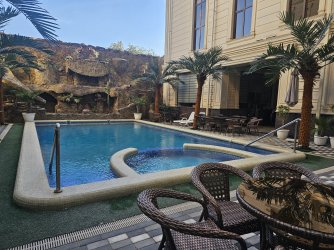
There was a pool, too.

The gym, however, was extremely lacking, and the hotel restaurant wasn't open when I tried to get dinner, so I went to my local shawarma joint instead. Still not bad though given the rate I paid.

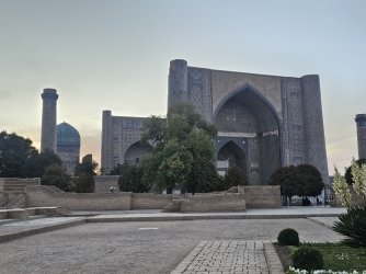
At sunset I went to the Bibi Khanym mosque, built by Tamerlane in 1400 for his favourite wife.
1000053723.jpg

At 40 m tall this eclipses the buildings I saw in Bukkhara, and in general everything in historical Samarkand is taller. I find myself taking more photos from a distance to try to capture everything without warping. If anyone has tips on how to photograph tall buildings, especially wide ones, that would be appreciated. I find trees challenging too - stepping back 50 m would theoretically get the whole building in a shot, but then there's a tree in front of you.

Her mausoleum is directly opposite:
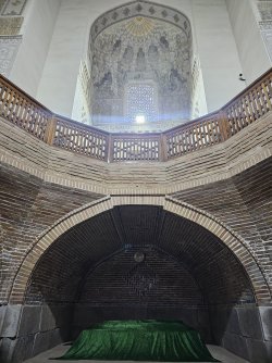
1000053721.jpg
It must be nice being the favourite consort.

When I was still in high school and hadn't seen anything outside of Canada, Australia, and China (where I'd briefly lived as a kid), I remember seeing on my Facebook feed an article about a photographer who turned his back on famous landmarks. I've had this philosophy in my mind ever since, and I try to take photos of the areas surrounding the landmarks I visit. In Bukhara, it was a lot of parking lots or ambiguous empty spaces. For the Bibi Khanym mosque, it was this:
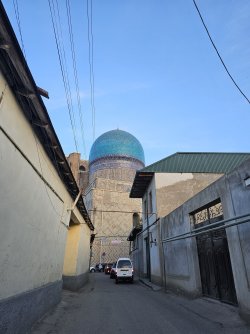
1000053708.jpg

Went back to the hotel after the sun had set and found a mother and her two kids, one of them driving a buggy, going through the bins outside...
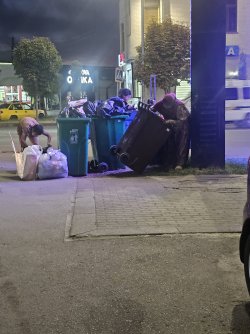
1000053726.jpg
 
Samarkand, part two

The next day I committed a tourist sin.
Having been woken up by the coughatiels in the hotel lounge screaming (my room being next to the lounge), I went up to the breakfast room to see quite a big selection.

Then it was off to the Afrasiab archaeological site. Named after the legendary king who was a thorn in the side of the Persians, Afrasiab represents what first started as a Sogdian town in the 5th C BC. Sogdiana was a state covering modern Samarkand and Bukhara and parts of Tajikistan. They were quite influential in trade along the Silk Road, not as merchants but from being in the middle of the trade route, to the point that the Sogdian language became a lingua franca.

It was destroyed by Genghis Khan in the 1200s. Excavations started in the 1900s. There's a museum next to the site that I went to first. It describes the Sogdian state and exhibits artefacts covering a wide span of time. It also has preserved some of the murals from the royal palace in Afrasiab. The murals depict all kinds of different cultures, attesting to the extent of trade that was done.

1000053646.jpg

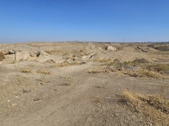
The site itself is mainly just mounds and some exposed clay. The actual remains of the city are underground for the most part. There was a section of the site containing a supposed citadel but I was told by a security guard who was standing there not to go further. Not sure if there's been some changes recently because based on Google pictures other visitors have seen this citadel.

1000053649.jpg

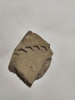
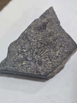
As for the sin: I found a piece of grey material, 2x3x1 cm, with five and a half grooves marked into it like treadmarks. It was lightweight with a Mohs hardness of about 3. I pocketed the fragment, because I do have a collection of interesting looking rocks back home.

Having had a closer look at it now, the grooves are slightly irregular but look deliberate, like they were made manually with a sharp blade. And it's layered at the broken edge.

1000053787.jpg

Afrasiab was built with mudbricks and compacted clay, and supposedly the building material was marked by whichever construction crew was handling it. I don't think this little piece I've picked up appears nearly old enough to be anything significant, and the important stuff is below the ground anyway, but I do feel like I've broken the rule of never take away material from an archaeological site. I've emailed them asking if it's just treadmarks from their diggers or if they want me to return it for examination. In the meantime it's gone into the airplane chuck bag I'm keeping my fossils in.

Onwards, then, to Ulugbek's observatory. After Tamerlane died of pneumonia at age 69 on the campaign trail to China, his empire was ruled by one of his grandsons, Khalil, who was notoriously bad at management, and ceded control to his uncle, one of Tamerlane's sons, who then assigned the region including Samarkand to his son, Ulugbek.

As I said before, Ulugbek had some military successes but his heart was not in territorial expansion. He built an observatory in Samarkand, catalogued over 1,000 stars, and measured the length of time in a solar year to an accuracy of 58 seconds.

1000053640.jpg
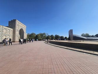
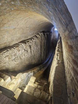
The above-ground observatory has been lost to time. Now the site of where his observatory was is a compound split into two buildings. On the left is a museum and on the right is a tunnel containing the preserved remains of the famed quadrant that Ulugbek used. The tunnel is oriented in a north-south direction, the 'meridian' used in measuring star movements.

1000053639.jpg

His quadrant had a length of 63 m and a radius of 40 m, and it was this he used to measure the movement of the stars each night and thereby calculate the length of the solar year.

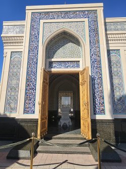
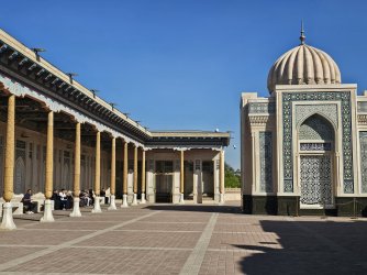
Nearby is the mosque and mausoleum of Uzbekistan's first post-independence president, Islam Karimov. He was from Samarkand.

1000053654.jpg

He ruled from 1991 until his death in 2016 and appears to be perceived positively in Uzbekistan due to the relative political stability the country experienced after, which cannot be said about most other post-USSR states. He also sought to strengthen the conception of an Uzbek identity and use historical narratives to facilitate that.

He was also an authoritarian ruler, though, when it came to civil liberties. In 2005 in Andijan a mass protest erupted in response to some of his economic and social policies; an estimate of over 400 protestors were killed, but the government does not talk about it and does not permit discourse on it. I noticed when I was in Andijan that there were no memorials of the event.

1000053656.jpg

There was a prayer on at the time I was there. If you zoom in you can see the people holding their hands cupped in front of them - this is to catch the blessings/positive thoughts from the prayer, and then they'll move their hands to their face as though washing their face with those blessings.

I took a bus from there to Registan Square. Bus routes are best found on Yandex Maps. You can pay by contactless card (like in every city in the world except Melbourne).

1000053741.jpg

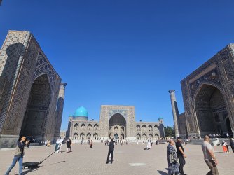
It's made up of three madrasas. The one in the middle is Ulugbek's madrasa, built in the 15th C and where he taught as he lived in Samarkand. The other two are from the 17th C, built a few decades apart from each other.

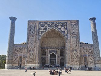
The one on the right is the Sher-Dor Madrasa, its name Persian for 'abode of lions'. If you zoom in you'll see some lion/tiger figures as well as more anthropomorphic suns. Again, not what you should do strictly speaking but if the governor of Samarkand wants lions and human faces on a madrasa, the Muslim clergy are hardly able to say no.

The one on the left is the Tilla-Kori madrasa, commissioned by that same governor. It's remarkable for its use of gold leaf.

1000053747.jpg

Looking at the façades it is apparent that there are inconsistencies in the shades of the colours of the tiles. Restoration efforts, which began in earnest in the 1950s, weren't able to find the exact shade of blue as the recipe has been long for a long time.

1000053745.jpg
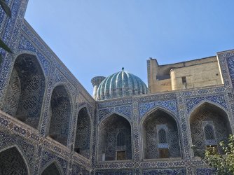
The courtyard of the Sher-Dor, featuring its ribbed domes that look like meringue drops. The domes have two layers. The outer one is ribbed, apparently to help with structural integrity in light of the building's size and the region's earthquake prone-ness.

1000053754.jpg
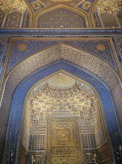
Inside one of the rooms of the Tilla-Kori madrasa. This stalactite recess is called a muqarna. Apparent from its aesthetic function, it also helped amplify a speaker's voice; the priest would turn his back to the congregation and speak into this recess and that would make his voice louder and clearer.

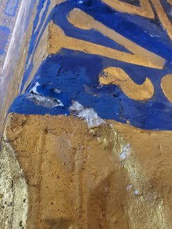
You can see the plentiful gilding in the design. The original builders used gold leaf and the restoration effort in the mid-20th C also used real gold leaf.

1000053756.jpg
Looks quite thin and flaky to me

1000053750.jpg
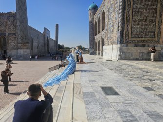
Several tourists rented traditional dresses from the souvenir shops and would take photos of themselves in them or get one of the photographers lingering in the square to do it. To be fair the dresses did look well made and complemented the buildings, and it was nice to see tourists so enthusiastic, but the photographers had an irritating habit of demanding that other tourists clear the space for them to take their photos and videos unobstructed.

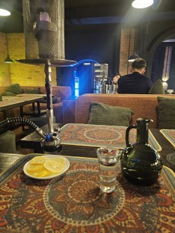
Had to catch up on some work in the afternoon, and then at night went out for dinner and hookah which, though associated with a romanticised version of the Orient, I still felt compelled to try at least once while here.

1000053784.jpg
 
Wonderful stuff. When we visited Bukara the President was going to visit in one or two days time. The Registan was hooked up for a light show and we could see it from viewing platform that night; one of the most amazing sights I can remember. Unfortunately, the next day that meant we had to dodge various installations and lights on the ground when we visited the site but it’s still an amazing one.

I also remember when we walked to dinner there were crews out in the streets trimming every blade of grass and shrub within a millimetre of their lives 😊.
 
Last edited:
Shahrisabz, or, lamentations on unfulfilled dreams

In the Kyzylkum desert there is one of the biggest dinosaur fossil sites in Eurasia: the Bissekty formation. One of its notable species is the Ulughbegsaurus, named after the famed astronomer whom I've mentioned a few times. This dinosaur was a carcharodontid: the apex predator of its time. It's posited that after the Cretaceous Thermal Maximum global temperatures dropped by a cool 7 degrees and many dinosaurs, including the carcharadontids, died out. That left a vacancy at the top of the food chain - and the adaptable tyrannosaurs, much smaller than the carcharadontids at that time, filled it, gorging themselves on the rest of the survivors. They eventually grew restless in their Central Asian homeland and crossed the land bridge of the Bering Strait over to North America, and evolved to be the giants we know of today.

As a child I wanted to become a palaentologist; the growing up process put paid to that. I contacted a company which specialises in private tours around Uzbekistan to organise a driver and guide to take me to the Bissekty formation so that I could see Ulughbegsaurus and azhdarchid fossil sites and live, for a day, the dream of an innocent 6-year-old. It would come out to have a fairly hefty price tag, but what is the price of dreams?

Three weeks before leaving NZ, I found I was denied the permit to visit the site.

So I organised a different trip with the same company. They were very professional in all our interactions and their thoughtfulness in designing custom tours. They're also affiliated with a travel company based in Melbourne. If you want their name and further details PM me.

I asked that they take me to the Zinzilban section of the Kitabskiy geologic park instead, and asked if they could bring a geologist/geology student along who could provide commentary. They got back to me that they could get me the required permits, and that both the rector and the vice-rector of the University of Geological Sciences in Tashkent would come down to accompany me (a very intimidating roster given I have zero background in geology).

With that locked in, I built an itinerary around Kitabskiy park, so stuck to places in the southeast near-ish to Samarkand. We ended up building a 3-night tour, with a driver and guide on top of the geology staff.

The morning of the first day we headed off early from Samarkand through the Takhtakaracha pass to Shahrisabz. On the outskirts of Samarkand we saw a group of women standing in what looked like a market square. My guide said that it was a labour market - women would come here in the morning to find work, usually in domestic duties. You can head over to the market and choose a woman, and could give her a job for a few hours up to months. I didn't get any photos of it because we were driving quickly, but it probably wouldn't have been polite either.

1000053804.jpg
1000053806.jpg

Shahrisabz is Tamerlane's hometown. My guide has told me that the name Tamerlane was actually meant to be derogatory, the -lane suffix referring to his limp after he was wounded in battle. I had learned about him in school as Tamerlane but I suppose while I'm here I should call him Timur.

Timur built a massive palace in Shahrisabz and had dreamed of making his hometown the seat of power, but geography conspired against him to give that title to Samarkand. I guess sometimes the dreams of even world conquerors go unfulfilled.

1000053812.jpg
Looking down on Shahrisabz from the highway. Back then, you could see the palace from this spot. One of the rulers of Bukhara had the palace destroyed in the 16th C so we don't see it now.

1000053820.jpg
This is what remains of the archway to the palace.

Timur had told the architects and builders that he wanted a palace that would last forever. He had two builders at first. They set the foundations and then disappeared. Bewildered, Timur waited for them, hesitant to re-start it. They returned after two years. When he asked them where they'd gone, they said, our emir asked us to build something that would last forever. We needed to make sure the foundations were strong, so we left it for two years.

At its completion it would've been about 70 m tall. Timur's philosophy towards architecture was often inscribed onto the buildings he commissioned: "those who doubt our power, look at our buildings."

1000053824.jpg
Not a lot of restoration has been done on it

1000053833.jpg
Nearby is a mausoleum and mosque complex where he had his tutor buried and where he had intended to bury his family members. There's an empty tomb for Ulugbek, who ended up in Samarkand.

Timur also built a separate crypt for himself as he wished to be buried in Shahrisabz. He died while heading to China, and it was winter and the Takhtakaracha pass to Shahrisabz was impassable at that time, so his body was taken to the capital Samarkand.

1000053836.jpg
His crypt

1000053838.jpg
And this is the mausoleum he built for his beloved eldest son, who unexpectedly died at 20.

I'm nearly caught up, have yesterday afternoon to talk about and am just about to head to Kitab park now.
 
Read our AFF credit card guides and start earning more points now.

AFF Supporters can remove this and all advertisements

Katta Langar

A short drive away from Shahrisabz is the town of Katta Langar, once a popular tourist destination as it held pages of one of the oldest surviving Quran manuscripts in the world. Most of those pages have gone to Russia now for preservation, with a few in Tashkent.

1000053851.jpg
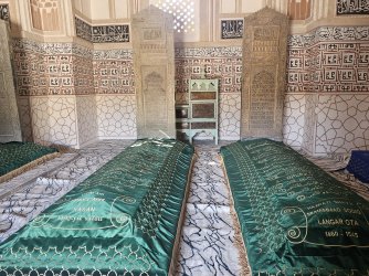
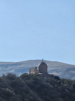
This is the Langar mausoleum, where three Sufi saints are buried

1000053849.jpg
The tombstones are original, from the 15th C.

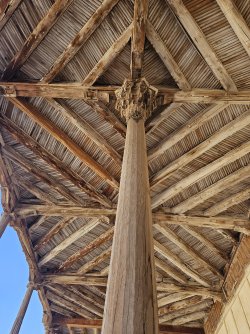
There is also a mosque a few hundred metres away and it was at that mosque that their old Quran was held. There was some kind of service going on so I didn't enter. I also for some reason didn't take any photos of the exterior except for one of the ten wooden pillars. The legend goes that they ran out of trees, but then the last tree continually sprang up again each time it was chopped down, allowing the builders to finish all ten columns.

1000053853.jpg

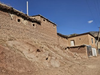
We had an interesting walk through the town. Most of the houses are made of mudbrick.

1000053858.jpg

1000053862.jpg
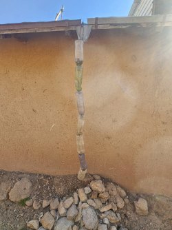
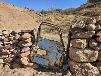
A creative drain-pipe

1000053863.jpg
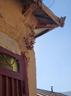
A wreath made of dried chilli peppers, called a kalampir, that is hung outside to ward off evil. It's a pre-Islamic practice, likely stemming from Zoroastrianism. While Islam would consider this superstition it is a practice many Uzbeks still adhere to.

Went up some walking paths on the hill to get a better view of the region, before completing the loop back through town. This was one of the gates for the walk, used to help keep livestock either on the hill or off it I suppose depending on time of day.
1000053864.jpg

As it was afternoon most of the livestock had gone back into their owners' sheds but you could hear the bleats and lowing echoing in the valley.

1000053852.jpg
View of the mausoleum from afar

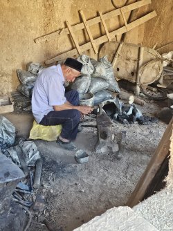
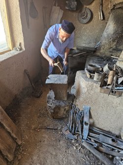
Passed by a small workshop where a man was bent over an anvil.

1000053869.jpg

He introduced himself as Usta Terdak, which means, according to my guide, master of hooks. I've noticed craftsmen in towns like this will introduce themselves/be called usta of their trade rather than by their actual name

His grandfather had started the workshop, in this same place, about 120 years ago. He'd managed it for several years before he was killed by the Red Army at age 35. I didn't ask details, especially since I'd have had to ask him in Russian, but putting the timeline together in my head, that would have made it the late 1910s which does fit in with when the Soviets suppressed the Central Asian revolutionary uprisings and annexed the khanates of Samarkand and Khiva.

His son had left to Tashkent to study business and usually when a child goes to the city they don't really come back. So it'll be one of his 11 grandchildren still in the village who will take over this workshop from him.

1000053871.jpg

He fired up the forge and made a nail in front of us. Then he closed up shop and said he was going to afternoon prayers.

We drove back to Shahrisabz for the night.
 
Kitab National Geological Park

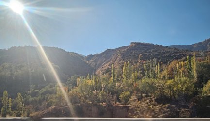
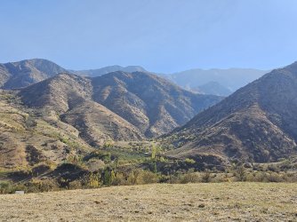
Early morning start with a 1-hr drive to the park. It is a 5,000 ha piece of land snuggled up against the Zarafshan mountain range. The mountain range spans between Uzbekistan and Tajikistan and is fed by the Zarafshan river, which runs through Samarkand. The mountains that we passed through to get to Shahrisabz are part of the range.

1000053896.jpg
Passed on the way there

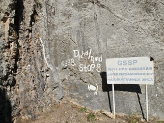
The park is known for its pristine sediment layers covering the Ordovician through to Carboniferous periods. Its key importance to international geology is the GSSP (Global Boundary Stratotype Section and Point) in the Zinzilban section marking the beginning of the Emsian period of the lower Devonian.

What this means in layman terms: a GSSP is a particular point in a layer of rock that acts as a benchmark for the start of a geological period. When determining the age of samples from other parts of the world, for instance, that sample is compared to this benchmark to determine its age. This particular layer of rock is how we decide that the Pragian period of the Devonian has ended and the Emsian starts.

I had done some reading of papers and about stratigraphy to prepare for this visit. Here is a good summary of the principles of stratigraphy. There are seven principles that are followed to determine relative ages of layers/samples. There is also the concept of unconformities, which are essentially disruptions in the layers, like when you're writing a sentence and a word gets smudged or crossed out.

Zinzilban does not have unconformities; its rock layers form a complete sentence. In fact the word Kitab means 'book', as a metaphor for how the rock records can be read like a book.

Along the way to the park we picked up our professor of geology. I'll call him Prof K. He was what I expected a geology professor to look like, dressed in a flannel shirt, khaki pants, and an Arctic Drilling Company cap. I was admittedly a bit less expecting the rugged good looks and easy-going charm.

Prof K explained to me that this park was originally a state geological reserve, but they've opened it up to the public as a park in an attempt to accede to the UNESCO Global Geoparks Network. This requires developing sustainable tourism and promoting the local heritage of the area.

At the park, we met up with the park director, Uktir, his driver, and the lead tourism manager, Alisher, who has been playing an important role in planning that sustainable tourism.

It appears the assembled team was under the assumption that I was a geologist myself. I had told them I was a doctor, which they interpreted as me holding a Ph.D in geology, which might be why I was approved to visit the Zinzilban sector (not usually open to the public) and got the red carpet rolled out on arrival. Sorry to disappoint folks, but if you break a leg falling down a ledge I can splint it until the medevac chopper arrives.

1000053904.jpg

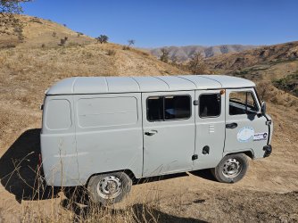
We got into a van that reminded me of Scooby Doo's mystery van for the drive to the trailhead of the Zinzilban section. Along the way we stopped to admire the mountains and look out over to Tajikistan.

1000053902.jpg

It was a 1 km trek from the trailhead. Alisher led the way and he is the closest I've seen to a human mountain goat.

1000053909.jpg
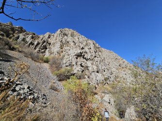
The rock formations here are all sedimentary - carbonate, like limestone and dolomite.

The paleo-Tethys Ocean lay partly in Uzbekistan, and in this particular region it was shallow and warm, with marine wildlife that lived on the ocean floor (benthic) or in the open water (pelagic). The Devonian period (419 to 359 mya), you might remember from high school, is the 'Age of Fishes' due to the abundance of marine life at the time. The Devonian is also the time when plants began to develop vascularisation and colonise land, even becoming forests, and thus supporting the beginning of terrestrial vertebrates.

1000053912.jpg
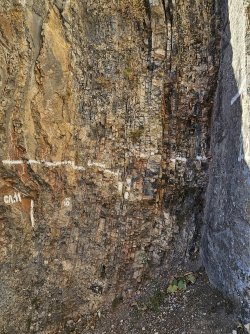
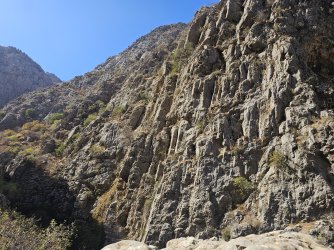
This is what the layers look like. The marker on the side, сл 11, stands for layer 11 in Russian. You'll have to tilt your phone 90* clockwise for it to make sense. I asked Prof K why there were no unconformities at Zinzilban despite the tectonic activity in Uzbekistan and nearby Tajikistan and Kyrgyzstan, and he simply smiled and said geology has its mysteries. Tectonic activity had lifted up the layers that once were the bottom of the paleo-Tethys Ocean and turned them on their side without disrupting the layers.

So everything here is sideways, but the layers are all intact and very visibly distinct. Each layer represents tens of thousands if not millions of years of difference to the ones above and below it.

1000053916.jpg
This is the GSSP - if you look in the left hand quarter of the photo, there's a white dot. That marks the layer where the Emsian period of the Devonian started.

If you are interested, there was a type of marine animal called a conodont whose fossils have been very helpful in demarcating boundaries. I'd never heard of them before this. Here's a 7-minute video on them. Kitab has its own conodont in this Emsian layer named after it.

We aren't allowed to hammer into or disturb the formatioms, but loose rocks on the ground we can have a look at. And there were fossils everywhere.

1000053913.jpg
Corals in the top piece, bivalves in the bottom piece

1000053924.jpg
Several brachiopods and bivalves

1000054089.jpg
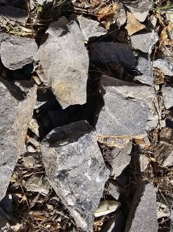
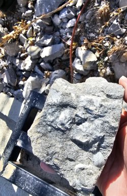
This fragment I kept as you are allowed to keep the loose rock. The pencil-like forms are graptolites, marine organisms that had a tubular shell they lived in. They appeared in the Ordovician and Silurian periods so this fossil could be up to 520 million years old.

It was such a surreal feeling being surrounded by so many fossils from at least 400 mya; every tenth rock on the ground probably contained some kind of fossil. I kept one from Zinzilban and one from the next sector we visited, and put the rest back.

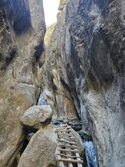
We went back to the mystery van and drove to the trailhead of the Khoja Kurgan sector. The track there was what I'd call a grade 4 hike - usually formed paths but scree-covered, sometimes narrow and on ledges, steep (we probably ascended 700 m), with streams to cross and occasional unformed tracks. We each had our stumbles, except for Alisher the human mountain goat, and I took a big tumble too which has not happened in years of hiking grade 4/5 difficulty tracks. Apparently there are bears and wolves around too though we didn't meet any.

1000053937.jpg
1000053945.jpg
1000053938.jpg
1000053949.jpg
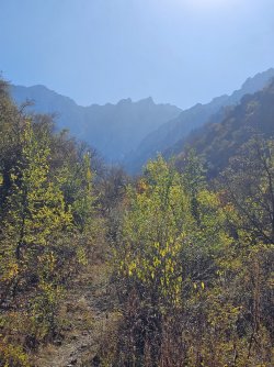
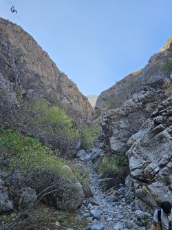
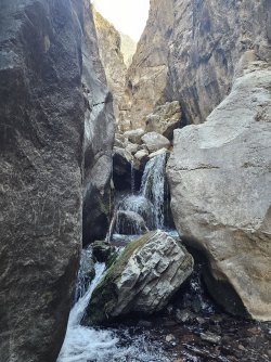
All parts of the track. It was a gorgeous day, and even though there were clear signs of human presence along the track it still felt untouched, like I was an explorer discovering something prehistoric.

The Khoja-Kurgan section also has well preserved Devonian rock layers.

1000053952.jpg

Prof K and Alisher both think this particular formation is where the 'book' name comes from, but they diverged on the application of the metaphor. This either looks like books on a bookshelf or pages of a book, with the fossils as the words.

1000053953.jpg

Alisher and I climbed up a few of them to look for more fossils in the loose rocks. The footholds often felt precarious and I had to stop him going up past 3/4 of the way as a fall from that height seemed to me out of broken bone territory and more into splat-hope-you-had-life-insurance territory.

1000053957.jpg
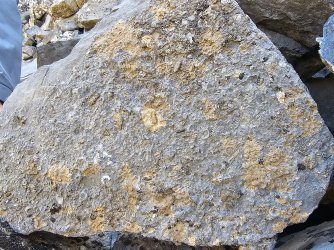
My most significant find of the day: a complex of brachiopods, crinoids, graptolites, tentaculites... Alisher wanted me to keep it but it wouldn't fit in my carry on, and something this large and plentiful I think should be left there for future visitors to see.

We took the same path back. In total we did around 10 km.

1000053959.jpg
1000053967.jpg
1000053946.jpg

Alisher invited us to a late lunch at the park guest-house, which is open to general visitors. There was a Central Asian family there staying as guests, maybe Kyrgyz I'd imagine as they spoke Russian to us. They probably weren't Tajiks visiting from across the border. Up to 70% of people in Samarkand and the neighbouring regions like where we were speak Tajik as their first language even if they are ethnic Uzbeks; my driver and Salvat my guide spoke Tajik to each other, and Prof K who was originally from somewhere further east also speaks it.

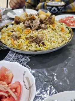
We had Kitab plov, spiced generously with coughin and sunflower seeds (a local variant).

1000053971.jpg
How many plov pictures is too many for a trip report? Achichuk - tomato and onion salad - in the foreground.

After that we parted ways. Alisher was driving Prof K to Samarkand from whence he would return to Tashkent. I wished him a smooth journey, as Marco Rubio has arrived today in Samarkand and a lot of roads will reportedly be closed.

As this was organised mainly through the tour company I'm not sure how one would go about acquiring permission to visit the Zinzilban section. I would highly recommend visiting the park though, especially if you're going to be in Shahrisabz. It might be better to organise a guide in the park to tell you about the rocks and to help with the paths as, where we went at least, there were no trail markers and it would probably be easy to get lost.

It's been about five years since Uzbekistan decided to turn this reserve into a park. The tourism infrastructure is still catching up. The park hasn't been accepted into the UNESCO network yet as far as I can tell but they are still cooperating on how they can facilitate that and hopefully within the next few years it'll be accessible to more tourists without compromising the natural beauty and priceless geological heritage.
 
If you are interested, there was a type of marine animal called a conodont whose fossils have been very helpful in demarcating boundaries. I'd never heard of them before this. Here's a 7-minute video on them.

That's a great video! When I did geology in the late '70s early '80s, conodonts were still a mystery, but one of the most useful fossils around (for reasons given in the video). Also not least because being made of apatite, and being in Devonian limestone in Tas, one of our paleo lecturers used to permanently have dozens of pots of limestone dissolving in acid, which left the apatite conodonts behind and clean, else you'd never get 'em out.

For me, unconformities are much more interesting than pristine sedimentary packages - they show something dramatic has happened. That said, I'd love to be able to put my finger on the K-T boundary.

I'll be less reticent about my own geology posts in future. :)
 

Become an AFF member!

Join Australian Frequent Flyer (AFF) for free and unlock insider tips, exclusive deals, and global meetups with 65,000+ frequent flyers.

AFF members can also access our Frequent Flyer Training courses, and upgrade to Fast-track your way to expert traveller status and unlock even more exclusive discounts!

AFF forum abbreviations

Wondering about Y, J or any of the other abbreviations used on our forum?

Check out our guide to common AFF acronyms & abbreviations.
Back
Top