Goldfields and the Coast

Status
Not open for further replies.

OZDUCK

Established Member
Joined
Aug 1, 2010
Posts
3,658
Our German friends are currently visiting us for 3 weeks. We arranged to take them for quick tour of Kalgoorlie and surrounds plus a quick trip to Esperance. The weather was a bit of a shock for them as they left their village, near Stuttgart, with the temperature at -8C and four days later they were walking on a salt pan in 40C heat.

The trip saw us covering 2,700 km in 8 days with some pretty rough tracks thrown in.

Firstly, a few photos around Kalgoorlie.

The Town Hall
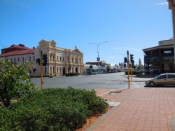
DSCN3970.JPG

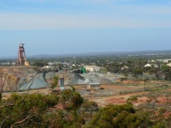
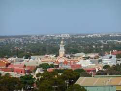
Two views of Kalgoorlie from the lookout at the terminus of the water pipeline at Mt Charlotte. Boulder Town Hall is in the distance in the first photo. The "Gold" dome in the second photo is on the "Government Offices" - Wardens Court, Local Court etc.
DSCN3931.JPG

DSCN3936.JPG

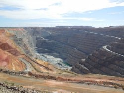
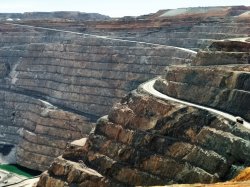
Looking down into the "Super Pit".

DSCN3971.JPG

The famous/infamous Two Up School about 5 km out of Kalgoorlie.
DSCN3975.JPG
 
Last edited:
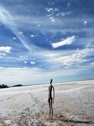
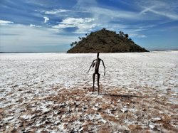
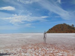
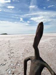
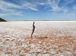
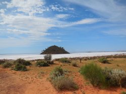
Next, we drove the 133 km to Menzies and then turned left to Lake Ballard. It is about 51 km to Lake Ballard from Menzies and about half is now sealed and the rest is in pretty good condition. It is actually a pretty easy drive to get here. When we arrived the car was showing the outside temperature as 40C . The surface of the lake was slightly "sticky" but pretty easy to walk on.

As was suggested by another AFF member, Daver6(?), a few weeks ago we tried to take old shoes that could be thrown away afterwards with us - but cunningly left half behind. In fact I wore thongs without any problems and tried bare feet for a couple of hundred metres before it got a bit hot. The temperatures were such that half an hour was about all the time we could spend on the salt so we never climbed the hill or visited the more distant statues. I was feeling a bit crook after that time anyway and was happy to get off the salt and wash my head under water.

It was really worthwhile and I would recommend anyone interested to visit. Antony Gormley’s “Inside Australia” - Lake Ballard

I will let the photos tell their own story.

IMG20180323142012 (2).jpg

IMG20180323142808 (2).jpg

DSCN3948.JPG

IMG20180323142518.jpg

IMG20180323142930.jpg

DSCN3951.JPG

DSCN3941.JPG
 
It really is quite an interesting place, having visited only a few weeks ago. Looking forward to reading about the rest of your trip.
 
Some of the hotels (pubs) in Kalgoorlie are amazing buildings. It's quite a main street.
 
It really is quite an interesting place, having visited only a few weeks ago. Looking forward to reading about the rest of your trip.
Thanks - I haven't got a huge number of photos as not only did I leave the "old shoes" behind I also did the same with my better camera. One of our guests is an incredibly enthusiastic photographer and he had an SLR camera, Video camera and a 3D camera. Hopefully, when he gets back from the second part of their trip - they are currently doing the South West including Margaret River - I will get some better quality photos.
 
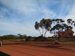
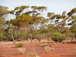
After Lake Ballard we basically we drove a few km west and then turned south along the Riverina - Snake Hill Road for about 40 km. This road was in reasonable condition, we were travelling in a 2005 WL Statesman, and our friends got to see a couple of Emus & a large Goanna so they were happy. We passed Riverina & the Riverina Homestead and then came to Mulline where my father lived for a while around WW1. He was born in 1904 and had me when he was 50.

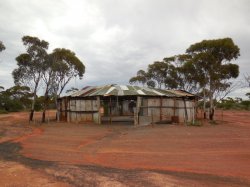
The townsite of Mulline - the old wall on the left was the biggest structure left in any of these townsites.

DSCN3952.JPG

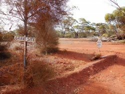
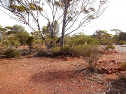
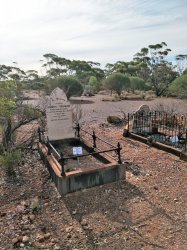
We then stopped at the Mulline Cemetery where my grandmother, who had died in childbirth far from any medical help in 1918, and her 5 year old daughter are buried in unmarked graves. All these towns and cemeteries have been abandoned for close to 100 years. The track has been moved a little bit since the previous time we had been here but luckily someone had put up these basic, but useful signs to show the way. Also someone, probably the same people, have also cleaned up the site and made an effort to mark some of the "lost" graves - so thank you whoever you are. The car showed the outside temperature as 50C when we got into it to leave.

DSCN3959 (2).JPG

The cemetery from a distance.

IMG20180323160857 (2).jpg

DSCN3957 (2).JPG


DSCN3962.JPG

IMG20180323155511 (2).jpg
 
Next, we drove the 133 km to Menzies and then turned left to Lake Ballard. It is about 51 km to Lake Ballard from Menzies and about half is now sealed and the rest is in pretty good condition. It is actually a pretty easy drive to get here. When we arrived the car was showing the outside temperature as 40C . The surface of the lake was slightly "sticky" but pretty easy to walk on.

As was suggested by another AFF member, Daver6(?), a few weeks ago we tried to take old shoes that could be thrown away afterwards with us - but cunningly left half behind. In fact I wore thongs without any problems and tried bare feet for a couple of hundred metres before it got a bit hot. The temperatures were such that half an hour was about all the time we could spend on the salt so we never climbed the hill or visited the more distant statues. I was feeling a bit crook after that time anyway and was happy to get off the salt and wash my head under water.

It was really worthwhile and I would recommend anyone interested to visit. Antony Gormley’s “Inside Australia” - Lake Ballard

I will let the photos tell their own story.

View attachment 121942

View attachment 121943

View attachment 121944

View attachment 121945

View attachment 121947

View attachment 121948

View attachment 121946

Wow ! That is something different. I can only imagine what your German friends must have thought.
 
Some great photos already-love the distinct colours of Aust
 
Wow ! That is something different. I can only imagine what your German friends must have thought.

They have been to Oz four or five times before, including Cairns, Darwin, Uluru and driving to Broome and back from Perth. But they did seem to really (mostly) enjoy being on the bush tracks as they had hire cars before so were restricted as to where they could go.
 
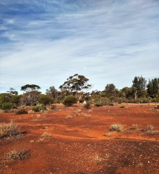
After having a good look around the cemetery we moved down the track to Davyhurst where my father was born. The track was getting rougher the more we moved south

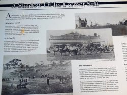
Part of a roadside sign at Davyhurst.

DSCN3963 (2).JPG

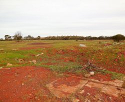
What is left of Davyhurst today. I agree with the sign, that the scattered bricks around here, and what looked like the remains of a cellar, means that this was the site of the above mentioned Grand Hotel. (Ozymadias comes to mind.)


DSCN3964 (2).JPG

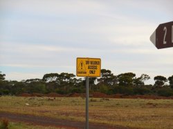
Considering the number of washaways and small gulleys we encountered after this sign it is good advice.

DSCN3967 (2).JPG

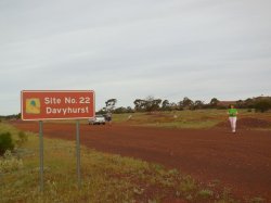
A broader view of Davyhurst, with my trusty Statesman at temporary rest. The Golden symbol on the sign means that you are on the Golden Quest Discovery Trail Home - Golden Quest Discovery Trail . This is fairly well signposted and you can get an accompanying book and CD's for the drive - we got the CD's for free from the Kalgoorlie Tourist Office and they contain stories about the region.

DSCN3968.JPG

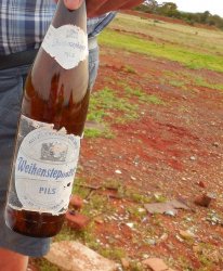
Our friends were amused when I found a German Beer bottle (empty unfortunately) on the ground.

DSCN3965 (2).JPG
 
Last edited:
WE had a bit of fun getting back to Kalgoorlie. I did not want to backtrack the hundred or so km top Menzies so I tried to take the Davyhurst - Ora Banda Road but after 12 or so km of very rough track it was blocked by mine tailings dumped across the road. This required us to take the Coolgardie North Road which was just as rough. Because of the delays we had to drive about 80 km of poor road at night. Luckily, only one kangaroo jumped in front of us, far enough away not to be a danger.

Eventually we connected with the Ora Banda Road and returned to the highway via Ora Banda and Broad Arrow. There is a bit of a lesson in this in that a few of the roads I tried to use were either blocked or moved significantly, even though they were still marked on maps, The mining operations often change the landscape significantly and a lot of roads are marked as mining access roads only.

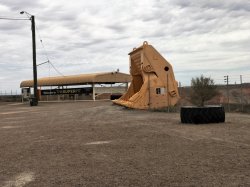
A couple more photos to finish off the Goldfields section.

An old digger bucket at the lookout.

IMG20180324105514 (2).jpg

The small black squares in the upper level of the pit are mainly old horizontal shafts left over from
100 years of deep shaft mining.

IMG20180324101454 (2).jpg


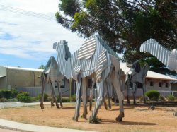
Iron "camels" on the roundabout at Norseman. My father could remember seeing "Afghan" camel trains in his childhood.

DSCN3995 (2).JPG
 
My father was born in Norseman and my grandmother (widowed before I was born) lived there until very late in life. She was a young girl when her family came over from South Australia in the Norseman gold rush. She often told me about the Afghans and their camel trains.

Staying with her was my home-away-from-home during summer school holidays as a young kid, days spent roaming around the old diggings and over the salt lakes. Hence my affinity for the bush in general and the WA Goldfields in particular.

Too bad you struck it so hot at Lake Ballard. With it drying out and the salt layer forming, the reflected heat would have been brutal.

IT would have been an interesting place to spend your holidays. My father moved to Perth in the 1950's before I was born and this was only the third time I have been to Kalgoorlie.

It was really hot but that is part of the experience. We arrived there a lot later in the day than I had intended as the tour times for the Super Pit were different than we thought and required a re-arrangement.
 
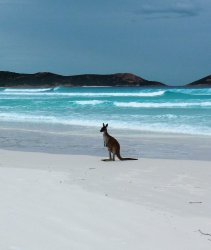
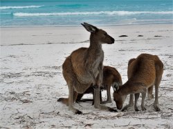
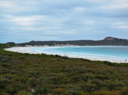
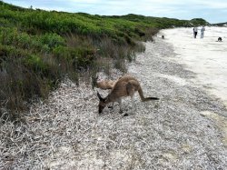
We then moved down to Esperance and went out Cape Le Grand National Park to visit Lucky Bay. The sand squeaks under bare feet like being on a highly polished wood floor - due to the high quartz content.

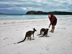
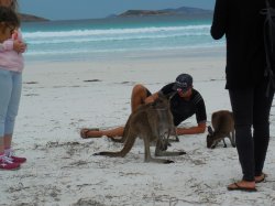
We also saw 6 or 7 of the local kangaroos browsing on the beach. Despite being wild they have no fear of humans and will approach you to have their heads scratched.

Kangarooz and the beach - two Australian Icons together

DSCN4041 - Copy (3).JPG

DSCN4055.JPG

IMG20180326125719 (2).jpg

DSCN4057 (2).JPG

DSCN4028 (2).JPG

Luckily for the kangaroos it was a cloudy day so they weren't blinded by the sun reflecting off my shiny head

IMG20180326124439 (2).jpg
 
Lucky Bay, like many of the bays down that way, is a magic spot - but made all the more so by the 'roos on the beach.
 
Some photos around Esperance.

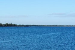
Looking out across the foreshore - with the - much recently discussed on AFF - old tanker jetty on display.

DSCN4102 (2).JPG

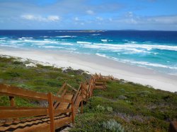
On a sunny day the beaches are beautiful

DSCN4089 (2).JPG

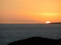
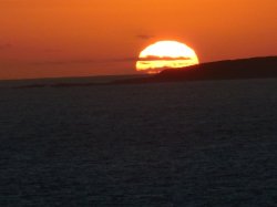
Sunset - taken just west of the town

DSCN4113 (2).JPG

DSCN4112 (2).JPG

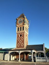
A relatively new Clock Tower on the foreshore

IMG20180327170707 (2).jpg
 
Nature around Esperance

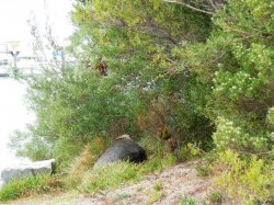
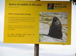
A sleepy sea-lion at Bandy Creek Harbour. I had a bit of trouble convincing my friend that they are dangerous and not to get too close

DSCN4020 (2).JPG

We went a few hundred metres further and I was able to show him that I was not lying

DSCN4021 (2).JPG

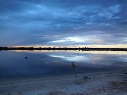
We went for an evening and morning walk in the Woody Lake Nature Reserve just north of Esperance

DSCN4071 (2).JPG

DSCN4073 (2).JPG

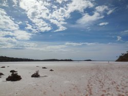
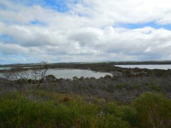
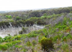
As always in much of W.A. salinity is causing problems

DSCN4076 (2).JPG

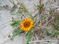
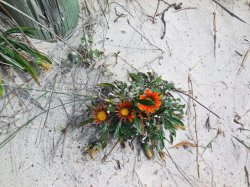
Finally, a couple of floral shots in the sanddunes

DSCN4094 (2).JPG

DSCN4095 (2).JPG
 
The Frequent Flyer Concierge team takes the hard work out of finding reward seat availability. Using their expert knowledge and specialised tools, they'll help you book a great trip that maximises the value for your points.

AFF Supporters can remove this and all advertisements

Status
Not open for further replies.
Back
Top