Canyons & Covid-19

Status
Not open for further replies.

irv

Active Member
Joined
Apr 11, 2012
Posts
852
I had previously started a thread called USA Canyons, however now that I am home and in self isolation I thought it a good idea to start a new thread from the outset, so here I go.

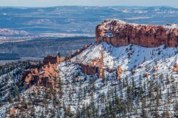
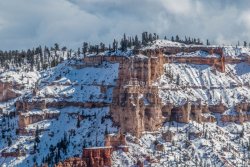
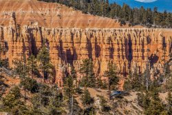
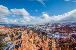
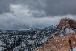
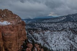
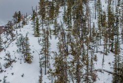
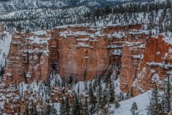
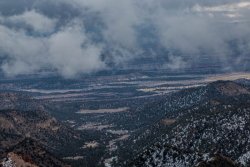
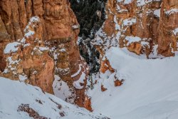
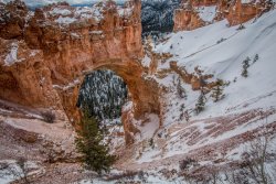
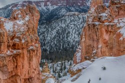
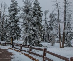
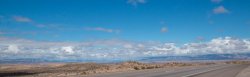
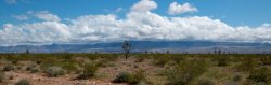
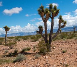
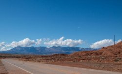
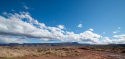
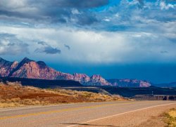
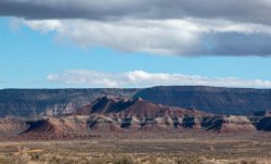
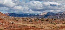
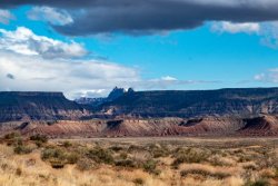
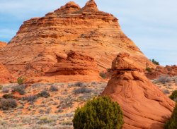
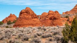
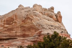
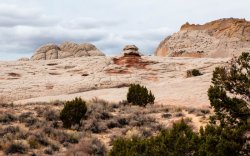
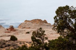
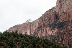
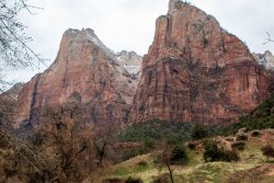
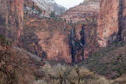
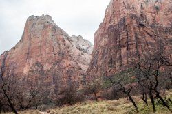
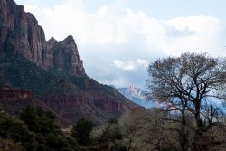
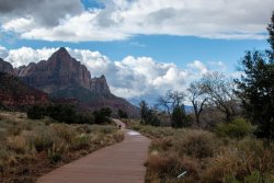
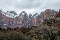
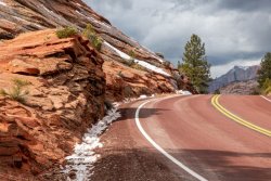
My trip began on 9 March 2020, under the increasing spectre of COVID19 and the uncertainty of what was really at that time an emerging problem. My destination was the southwest of the USA, where I had planned to start from Los Angeles and travel to Utah, Arizona, Nevada and then back to California before heading home after 3 weeks of travel.

My travelling companion was my Camera and associated equipment, this was to be my first solo journey in many years, leaving behind at home my wife and grandson.

I said my goodbyes to the latter at PQQ airport before boarding a plane to Sydney for an overnight stay, before taking off the next day on QF11, LAX bound.


That night was spent at the IBIS near Sydney Airport, it is within walking distance of the Domestic Terminal and alright if you just want a bed for the night. I booked the shuttle to the International Terminal for 6:00 am the next morning which would allow plenty of time to book in before sojourning to the QP for breakfast.
 
Up early the next morning, reorganised my bags before heading downstairs to hop on board the shuttle. I was expecting a minivan towing a trailer, however the shuttle this morning was a 49 seater coach. I hopped on board with the driver and we were it, rest of the bus was empty, a bit surreal. Hopped out at the departure area about 6:15 am, place was just about empty. Had to answer a few questions like have you been to China in the last 14 days etc, before checking in the luggage and then off to the Qantas Club. Plenty of empty seats at that time of the morning, maybe a sign of things to come.

I had booked my seat in economy in the upstairs section of the A380, I was in the middle aisle and had the seat next to me vacant, two armrests to myself 😊 Plane left on time, next stop LAX.
 
Quick flight, just a tad over 12 hours to fly into LAX, in fact we arrived that early we had to wait about 25 minutes before they would allow us to disembark. It was the usual LAX scrum at that time of the morning, no social distancing as they fed us through the American version of Smartgate. Although crowded, the line moved steadily up to the smiling customs official (a bit of sarcasm here) before being released into the general population within about 45 minutes. I had a bit of time to kill before I could pick up the hire car, so I sat down with the American version of a flat white, I really don’t know how they can’t get this right, and a read online of what was happening in Australia as well as here.

Hopped on the shuttle out to the car rental terminal, I had ordered an SUV and they actually had a number to choose from. I was staying in Ontario that night which is about 35 miles west of LA on which meant I could avoid the madness of trying to get out of LA in the morning. Parked the car at the hotel and went for a ten klm walk to shake off the plane flight before checking in. Had dinner that night at a local Tex Mex restaurant, the starter was good, the main was dry and tasteless. Back to the hotel to hit the sack for the drive to Zion Canyon the next morning.
 
As part of my trip planning I had tossed up between trying to get a permit to visit The Wave, or whether to go on a guided tour. Given that there are only 20 people allowed to visit the Wave each day, 10 of which were drawn by way of lottery on the day before, I figured my chances of this were not particularly high. I had done fair bit of research and had booked a guided tour to White Pocket with Dreamlands Safari Tours. They have a policy of a minimum of two people and asked if I was happy to share with another party if a vacancy arose, which I was happy to do. Whilst driving on my way to Zion I received a call advising they had a vacancy tomorrow and the next day, I grabbed the tomorrow vacancy with the tour to leave at 9:00 from Kanab, which was about a 45 minute drive from Zion.

So that sorted, it was time to enjoy the drive, I avoided stopping in Vegas this part of the world looks so fresh and clean and is visually so different to where I live. Here are a few photos of the journey to Zion.
 

Attachments

  • Road Trip to Zion Valley (2 of 35).jpg
    Road Trip to Zion Valley (2 of 35).jpg
    53.5 KB · Views: 16
  • Road Trip to Zion Valley (6 of 35).jpg
    Road Trip to Zion Valley (6 of 35).jpg
    40.1 KB · Views: 15
  • Road Trip to Zion Valley (11 of 35).jpg
    Road Trip to Zion Valley (11 of 35).jpg
    53.2 KB · Views: 14
  • Road Trip to Zion Valley (13 of 35).jpg
    Road Trip to Zion Valley (13 of 35).jpg
    149.4 KB · Views: 14
  • Road Trip to Zion Valley (18 of 35).jpg
    Road Trip to Zion Valley (18 of 35).jpg
    59 KB · Views: 14
  • Road Trip to Zion Valley (20 of 35).jpg
    Road Trip to Zion Valley (20 of 35).jpg
    60.3 KB · Views: 15
  • Road Trip to Zion Valley (25 of 35).jpg
    Road Trip to Zion Valley (25 of 35).jpg
    96.9 KB · Views: 16
  • Road Trip to Zion Valley (28 of 35).jpg
    Road Trip to Zion Valley (28 of 35).jpg
    75.7 KB · Views: 14
  • Road Trip to Zion Valley (33 of 35).jpg
    Road Trip to Zion Valley (33 of 35).jpg
    72.2 KB · Views: 14
  • Road Trip to Zion Valley (34 of 35).jpg
    Road Trip to Zion Valley (34 of 35).jpg
    99.4 KB · Views: 15
The next morning saw me on my way to Kanab for a 4 wheel drive safari to Whitepocket Arizona. My travelling companions were our guide Steve, with a broad Manchester accent, even though he said he had lived in the USA for over 20 years, and a mother and daughter from Vancouver, all of us with a love of the outdoors and photo opportunities.

The journey took over 2 hours through some pretty rough roads and deep sand pockets, in fact the track into Whitepocket runs along the San Andreas fault, hopefully no surprises today. To describe the topography of Whitepocket is difficult, so I have taken this opportunity to copy from an article I found

“ Retired petroleum geologist Marc Deshowitz has poked around White Pocket as much as anyone I know. He envisions a huge sand-slide mass, triggered by an earthquake, detaching from a tall dune and traveling rapidly downslope. As the mass slid and tumbled downslope, it ripped up chunks of laminated sand beneath that intermixed with the basal part of the slide. The sand mass eventually filled a large pond or oasis. This large sand mass is the featureless bleached-white sandstone or "cauliflower rock" seen today. The instantaneous loading from the sand mass caused pressure adjustments within the underlying saturated sand resulting in contortions and fluid escape structures such as sand volcanoes. Marc has identified at least 25 of these features.

Questions remain. The fine laminae and cross-beds beneath the slide mass are remarkably well-preserved. This may indicate all of the sand involved was buried under a fairly thick column of additional sediment. In other words, the slide plane may have been several 100 feet below the surface. This overburden pressure would have allowed the plastic-like contortions but still keep things somewhat in order.”

It is certainly an interesting place, you can easily imagine you have been transported to another world, any way I will let the photos do the talking.
 

Attachments

  • White Pocket Arizona (1 of 248).jpg
    White Pocket Arizona (1 of 248).jpg
    156.6 KB · Views: 12
  • White Pocket Arizona (2 of 248).jpg
    White Pocket Arizona (2 of 248).jpg
    135.3 KB · Views: 11
  • White Pocket Arizona (10 of 248).jpg
    White Pocket Arizona (10 of 248).jpg
    135 KB · Views: 12
  • White Pocket Arizona (15 of 248).jpg
    White Pocket Arizona (15 of 248).jpg
    138.1 KB · Views: 11
  • White Pocket Arizona (16 of 248).jpg
    White Pocket Arizona (16 of 248).jpg
    138 KB · Views: 12
  • White Pocket Arizona (19 of 248).jpg
    White Pocket Arizona (19 of 248).jpg
    179 KB · Views: 11
  • White Pocket Arizona (26 of 248).jpg
    White Pocket Arizona (26 of 248).jpg
    178 KB · Views: 13
A few more
 

Attachments

  • White Pocket Arizona (27 of 248).jpg
    White Pocket Arizona (27 of 248).jpg
    120.1 KB · Views: 10
  • White Pocket Arizona (34 of 248).jpg
    White Pocket Arizona (34 of 248).jpg
    130.3 KB · Views: 12
  • White Pocket Arizona (37 of 248).jpg
    White Pocket Arizona (37 of 248).jpg
    140.1 KB · Views: 11
  • White Pocket Arizona (38 of 248).jpg
    White Pocket Arizona (38 of 248).jpg
    98.3 KB · Views: 11
  • White Pocket Arizona (43 of 248).jpg
    White Pocket Arizona (43 of 248).jpg
    145.1 KB · Views: 11
  • White Pocket Arizona (44 of 248).jpg
    White Pocket Arizona (44 of 248).jpg
    155.3 KB · Views: 10
  • White Pocket Arizona (48 of 248).jpg
    White Pocket Arizona (48 of 248).jpg
    137.3 KB · Views: 10
  • White Pocket Arizona (51 of 248).jpg
    White Pocket Arizona (51 of 248).jpg
    168.7 KB · Views: 10
  • White Pocket Arizona (58 of 248).jpg
    White Pocket Arizona (58 of 248).jpg
    115 KB · Views: 10
  • White Pocket Arizona (105 of 248).jpg
    White Pocket Arizona (105 of 248).jpg
    161.8 KB · Views: 11
And to finish....
 

Attachments

  • White Pocket Arizona (121 of 248).jpg
    White Pocket Arizona (121 of 248).jpg
    126.7 KB · Views: 7
  • White Pocket Arizona (133 of 248).jpg
    White Pocket Arizona (133 of 248).jpg
    164.8 KB · Views: 7
  • White Pocket Arizona (163 of 248).jpg
    White Pocket Arizona (163 of 248).jpg
    184.8 KB · Views: 10
  • White Pocket Arizona (193 of 248).jpg
    White Pocket Arizona (193 of 248).jpg
    86.3 KB · Views: 10
  • White Pocket Arizona (196 of 248).jpg
    White Pocket Arizona (196 of 248).jpg
    160.4 KB · Views: 10
  • White Pocket Arizona (221 of 248).jpg
    White Pocket Arizona (221 of 248).jpg
    125.7 KB · Views: 9
  • White Pocket Arizona (230 of 248).jpg
    White Pocket Arizona (230 of 248).jpg
    133.2 KB · Views: 11
  • White Pocket Arizona (234 of 248).jpg
    White Pocket Arizona (234 of 248).jpg
    160.9 KB · Views: 14
  • White Pocket Arizona (239 of 248).jpg
    White Pocket Arizona (239 of 248).jpg
    130.5 KB · Views: 9
  • White Pocket Arizona (240 of 248).jpg
    White Pocket Arizona (240 of 248).jpg
    136 KB · Views: 8
The Frequent Flyer Concierge team takes the hard work out of finding reward seat availability. Using their expert knowledge and specialised tools, they'll help you book a great trip that maximises the value for your points.

AFF Supporters can remove this and all advertisements

The next morning saw me wake up to a wet and cold day. Heavy rain falling and a light snowfall higher up, a good day to start sorting photographs. Later that day I drove down to the local supermarket to pick up a few items, whilst walking around I noticed the huge empty spaces in the cleaning products section and personal hygiene section, obviously what was happening back home in supermarkets was being repeated around the globe, welcome to the new world of Covid-19.
 

Attachments

  • 20200313_105711.jpg
    20200313_105711.jpg
    100.9 KB · Views: 11
  • 20200313_105740.jpg
    20200313_105740.jpg
    141.3 KB · Views: 11
  • 20200313_142050.jpg
    20200313_142050.jpg
    72.7 KB · Views: 11
Awoke the next morning rain having cleared overnight, with some minor flash flooding in the National Park due to over 100mm falling in the last 24 hours. It was my last day in Zion before heading to Bryce Canyon, so it was down to the National Park right on opening time. Very quiet at 8:00 am as I hopped on one of the Park Shuttles, only myself and the driver. Zion is one of places where you feel insignificant, the cliffs tower above you and the landscape bursts with colour. The Virgin River was in full flow and a number of the trails were temporarily closed due to the wet and slippery conditions. I spent until lunchtime just wandering enjoying the spectacular views, next destination Bryce Canyon.
 

Attachments

  • Zion National Park Utah (2 of 118).jpg
    Zion National Park Utah (2 of 118).jpg
    130.9 KB · Views: 12
  • Zion National Park Utah (14 of 118).jpg
    Zion National Park Utah (14 of 118).jpg
    121.6 KB · Views: 13
  • Zion National Park Utah (19 of 118).jpg
    Zion National Park Utah (19 of 118).jpg
    139.9 KB · Views: 13
  • Zion National Park Utah (20 of 118).jpg
    Zion National Park Utah (20 of 118).jpg
    136.7 KB · Views: 13
  • Zion National Park Utah (26 of 118).jpg
    Zion National Park Utah (26 of 118).jpg
    167.7 KB · Views: 13
  • Zion National Park Utah (36 of 118).jpg
    Zion National Park Utah (36 of 118).jpg
    150.7 KB · Views: 14
  • Zion National Park Utah (50 of 118).jpg
    Zion National Park Utah (50 of 118).jpg
    124.3 KB · Views: 13
  • Zion National Park Utah (59 of 118).jpg
    Zion National Park Utah (59 of 118).jpg
    121.5 KB · Views: 12
  • Zion National Park Utah (68 of 118).jpg
    Zion National Park Utah (68 of 118).jpg
    143.6 KB · Views: 12
The road to Bryce Canyon winds through Zion National Park and through the Mt Carmel Tunnel. Constructed between 1927 and 1930, the tunnel is 1.8 k in length with a number of “windows” set within the tunnel. At the time of its completion it was the longest non-urban road tunnel in the United States. The tunnel's restricted dimensions require that vehicles over 3.45 m in height or 2.39 m in width give advance notice so that two-way traffic can be shut down in the tunnel, allowing oversize vehicles to proceed down the centre of the tunnel. Vehicles over 3.99 m tall and semi-trailers as well as bicycles and pedestrians are prohibited in the tunnel.

The view leaving the park is almost spectacular as within, heaps of pull offs to allow people to continue to enjoy this spectacular vista.
 

Attachments

  • Zion National Park Utah (89 of 118).jpg
    Zion National Park Utah (89 of 118).jpg
    131.7 KB · Views: 13
  • Zion National Park Utah (90 of 118).jpg
    Zion National Park Utah (90 of 118).jpg
    204.5 KB · Views: 14
  • Zion National Park Utah (95 of 118).jpg
    Zion National Park Utah (95 of 118).jpg
    143.5 KB · Views: 14
  • Zion National Park Utah (101 of 118).jpg
    Zion National Park Utah (101 of 118).jpg
    137.5 KB · Views: 14
  • Zion National Park Utah (106 of 118).jpg
    Zion National Park Utah (106 of 118).jpg
    180.6 KB · Views: 13
  • Zion National Park Utah (108 of 118).jpg
    Zion National Park Utah (108 of 118).jpg
    169 KB · Views: 12
  • Zion National Park Utah (110 of 118).jpg
    Zion National Park Utah (110 of 118).jpg
    179.9 KB · Views: 13
  • Zion National Park Utah (115 of 118).jpg
    Zion National Park Utah (115 of 118).jpg
    195.7 KB · Views: 12
  • Zion National Park Utah (116 of 118).jpg
    Zion National Park Utah (116 of 118).jpg
    155.1 KB · Views: 17
  • OIP[7].jpg
    OIP[7].jpg
    41.8 KB · Views: 16
Plenty of snow and scenery on the way to Bryce Canyon.
 

Attachments

  • Day Trip to bryce (1).jpg
    Day Trip to bryce (1).jpg
    130.8 KB · Views: 7
  • Day Trip to bryce (3).jpg
    Day Trip to bryce (3).jpg
    193.1 KB · Views: 6
  • Day Trip to bryce (7).jpg
    Day Trip to bryce (7).jpg
    44 KB · Views: 5
  • Day Trip to bryce (12).jpg
    Day Trip to bryce (12).jpg
    91.7 KB · Views: 5
  • Day Trip to Bryce Canyon Utah (5 of 14).jpg
    Day Trip to Bryce Canyon Utah (5 of 14).jpg
    53.7 KB · Views: 6
  • Day Trip to Bryce Canyon Utah (8 of 14).jpg
    Day Trip to Bryce Canyon Utah (8 of 14).jpg
    111.3 KB · Views: 5
  • Day Trip to Bryce.jpg
    Day Trip to Bryce.jpg
    178.5 KB · Views: 6
It had been 5 years since I was last at Bryce Canyon and that was at the height of summer, so I was keen to see what difference snow made on this incredible place, all I can say I was stunned the first time I visited here, and I thought it was magical the second time round. I had the opportunity of taking a few photographs, not withstanding the chill in the air. This is a place you must visit if ever you get to be in this part of the world.
 

Attachments

  • Bryce Canyon Utah (1 of 454).jpg
    Bryce Canyon Utah (1 of 454).jpg
    196.3 KB · Views: 11
  • Bryce Canyon Utah (5 of 454).jpg
    Bryce Canyon Utah (5 of 454).jpg
    221.2 KB · Views: 12
  • Bryce Canyon Utah (9 of 454).jpg
    Bryce Canyon Utah (9 of 454).jpg
    170.8 KB · Views: 11
  • Bryce Canyon Utah (11 of 454).jpg
    Bryce Canyon Utah (11 of 454).jpg
    214.7 KB · Views: 12
  • Bryce Canyon Utah (13 of 454).jpg
    Bryce Canyon Utah (13 of 454).jpg
    186.6 KB · Views: 11
  • Bryce Canyon Utah (15 of 454).jpg
    Bryce Canyon Utah (15 of 454).jpg
    188.9 KB · Views: 10
  • Bryce Canyon Utah (16 of 454).jpg
    Bryce Canyon Utah (16 of 454).jpg
    195 KB · Views: 11
  • Bryce Canyon Utah (18 of 454).jpg
    Bryce Canyon Utah (18 of 454).jpg
    173.9 KB · Views: 11
  • Bryce Canyon Utah (23 of 454).jpg
    Bryce Canyon Utah (23 of 454).jpg
    213.6 KB · Views: 12
  • Bryce Canyon Utah (36 of 454).jpg
    Bryce Canyon Utah (36 of 454).jpg
    155.8 KB · Views: 11
At this point precautions in this post Covid-19 world were ramping up. The receptionist at Bryce Lodge was disinfecting the pens after you signed in plus there were lines on the floor 1.5 metres separating waiting guests. Room service was non existent, with the only tidy up once you had checked out, all this starting to ramp up for what would be peak season, and one had the feeling it was not going to improve in the short term.
 
Day 2 at Bryce Canyon, all trails closed due too heavy snowfall. There had been further snowfall overnight which led to some more great photo opportunities. I also made the decision to drive up to Rainbow Point provided the road was clear and open. Here are a few early morning shots.
 

Attachments

  • Bryce Canyon Utah (72 of 454).jpg
    Bryce Canyon Utah (72 of 454).jpg
    130.1 KB · Views: 9
  • Bryce Canyon Utah (76 of 454).jpg
    Bryce Canyon Utah (76 of 454).jpg
    143.1 KB · Views: 9
  • Bryce Canyon Utah (82 of 454).jpg
    Bryce Canyon Utah (82 of 454).jpg
    213.8 KB · Views: 9
  • Bryce Canyon Utah (84 of 454).jpg
    Bryce Canyon Utah (84 of 454).jpg
    212.5 KB · Views: 9
  • Bryce Canyon Utah (91 of 454).jpg
    Bryce Canyon Utah (91 of 454).jpg
    115.5 KB · Views: 9
  • Bryce Canyon Utah (92 of 454).jpg
    Bryce Canyon Utah (92 of 454).jpg
    124 KB · Views: 8
  • Bryce Canyon Utah (97 of 454).jpg
    Bryce Canyon Utah (97 of 454).jpg
    166.4 KB · Views: 8
  • Bryce Canyon Utah (101 of 454).jpg
    Bryce Canyon Utah (101 of 454).jpg
    85.9 KB · Views: 9
  • Bryce Canyon Utah (102 of 454).jpg
    Bryce Canyon Utah (102 of 454).jpg
    120.1 KB · Views: 9
Covid-19 was beginning to bite on the travel plans. I received an email saying all trips to Antelope Canyon had been cancelled and would be refunded, disappointing but understandable. I then received an email advising that if I wished, I could cancel my Air BnB bookings with no penalty. I had bookings in LV & LA which had been paid for, however at this stage it was play it by ear. Another email, the David Copperfield show I had booked was also cancelled, things were beginning to escalate quite rapidly.

At that stage I was undecided as to the best strategy to engage. Logic told me that I was reasonably safe at that time due to the fact I was travelling alone, I was not mixing in large crowds and I was in a reasonably remote area population wise, however I knew I would have to formulate a Plan B just in case, however for now the great outdoors beckoned.
 
Today’s trip was along the road which takes you to the southern end of the canyon, up to an elevation of just over 9000 feet. The viewing points included The Natural Bridge, beautiful Archway framing the valley below, Agua Canyon, Ponderosa Point, Rainbow Point, Yavimpa Point and Black Birch Canyon. The roads were clear with a number of light snow showers on the way, to me this was magic, not much snow on the mid-north coast of NSW. Rainbow Point was a winter wonderland, the trees covered in snow looked like just out of a postcard, certainly a memorable sight and day trip, a few photos attached.
 

Attachments

  • Bryce Canyon Utah (132 of 454).jpg
    Bryce Canyon Utah (132 of 454).jpg
    164.1 KB · Views: 10
  • Bryce Canyon Utah (133 of 454).jpg
    Bryce Canyon Utah (133 of 454).jpg
    154.3 KB · Views: 10
  • Bryce Canyon Utah (146 of 454).jpg
    Bryce Canyon Utah (146 of 454).jpg
    196.7 KB · Views: 9
  • Bryce Canyon Utah (162 of 454).jpg
    Bryce Canyon Utah (162 of 454).jpg
    157 KB · Views: 10
  • Bryce Canyon Utah (113 of 454).jpg
    Bryce Canyon Utah (113 of 454).jpg
    190.2 KB · Views: 11
  • Bryce Canyon Utah (127 of 454).jpg
    Bryce Canyon Utah (127 of 454).jpg
    174.9 KB · Views: 12
  • Bryce Canyon Utah (168 of 454).jpg
    Bryce Canyon Utah (168 of 454).jpg
    195.3 KB · Views: 8
  • Bryce Canyon Utah (175 of 454).jpg
    Bryce Canyon Utah (175 of 454).jpg
    132.7 KB · Views: 9
  • Bryce Canyon Utah (179 of 454).jpg
    Bryce Canyon Utah (179 of 454).jpg
    141.6 KB · Views: 7
  • Bryce Canyon Utah (192 of 454).jpg
    Bryce Canyon Utah (192 of 454).jpg
    153.4 KB · Views: 8
Heaps of messages that afternoon from family and friends. DFAT had just published its recommendation that Australians who wished to return home should do so as soon as possible via commercial flights. One didn’t need to be a fortune teller to read the tea leaves, plan B was becoming more of an option than continuing with plan A, unabated. I had one day left in Bryce, decided I would sit down and seriously consider my options by the end of the next day.
 
Status
Not open for further replies.
Back
Top